Texarkana elevation
Texarkana (Arkansas, Miller County), United States elevation is 118 meters and Texarkana elevation in feet is 387 ft above sea level [src 1]. Texarkana is a seat of a second-order administrative division (feature code) with elevation that is 161 meters (528 ft) smaller than average city elevation in United States.
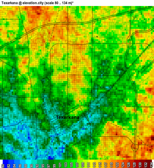
Below is the Elevation map of Texarkana, which displays elevation range with different colors. Scale of the first map is from 80 to 134 m (262 to 440 ft) with average elevation of 105.8 meters (=347 ft) [note 1]
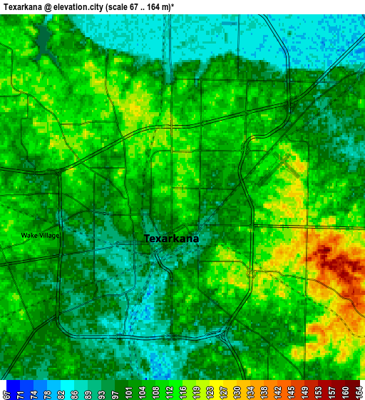
These maps also provides idea of topography and contour of this city, they are displayed at different zoom levels. More info about maps, scale and edge coordinates you can find below images.
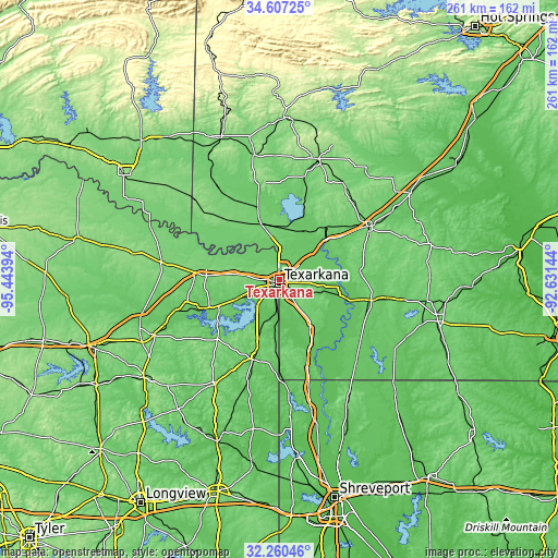
| \ | Map #1 | Map #2 | Topo.Map |
| Scale [m] | 80..134 m | 67..164 m | × |
| Scale [ft] | 262..440 ft | 220..538 ft | × |
| Average | 105.8 m = 347 ft | 104.1 m = 342 ft | × |
| Width | 8.15 km = 5.1 mi | 16.31 km = 10.1 mi | 260.9 km = 162.1 mi |
| Height | 8.15 km = 5.1 mi | 16.31 km = 10.1 mi | 260.9 km = 162.1 mi |
| ↑Max Latitude | 33.478452° | 33.515099° | 34.60725° |
| Latitude at center | 33.44179° | 33.44179° | 33.44179° |
| ↓Min Latitude | 33.405112° | 33.368419° | 32.26046° |
| ← Min Longitude | -94.081635° | -94.125581° | -95.44394° |
| Longitude center | -94.03769° | -94.03769° | -94.03769° |
| →Max Longitude | -93.993745° | -93.949799° | -92.63144° |
Nearby cities:
Cities around Texarkana sort by population:
• Texarkana elevation 95 m
2.1 km,  206°
206°
• Atlanta 83 m
38.3 km,  197°
197°
• Wake Village 106 m
6.6 km,  255°
255°
• New Boston 111 m
35.1 km,  273°
273°
• Ashdown 103 m
27.3 km,  341°
341°
• Nash 112 m
8.6 km, 270°
• Hooks 116 m
23.4 km,  276°
276°
• Queen City 112 m
34.2 km, 197°
• Lewisville 95 m
43.7 km,  102°
102°
• Maud 93 m
30.8 km,  246°
246°
• Redwater 94 m
22.2 km, 245°
• Red Lick 113 m
12.6 km, 281°
Multilingual:
 En español:
Texarkana elevación 118 m.
 En France:
Texarkana élévation 118 m.
 Auf Deutsch:
Texarkana höhe über dem Meeresspiegel ist 118 m.

Sources and notes:
- [note 1] Map square and city borders are not equal. Map elevation data is calculated only from area inside that square.
- [src 1] Elevation data from geonames database provided with same terms of usage.
- [src 2] The elevation map of Texarkana is generated using elevation data from NASA's 3 arcsec (90m) resolution SRTM data.
- [src 3] Base (background) map © OpenStreetMap contributors tiles are generated by Geofabrik and OpenTopoMap.
Copyright & License:
This Texarkana Elevation Map is licensed under CC BY-SA. You may reuse any part from this page, if you give a proper credit by linking to this URL:
 More info on terms of use page.