Etowah elevation
Etowah (Tennessee, McMinn County), United States elevation is 244 meters and Etowah elevation in feet is 801 ft above sea level [src 1]. Etowah is a populated place (feature code) with elevation that is 35 meters (115 ft) smaller than average city elevation in United States.
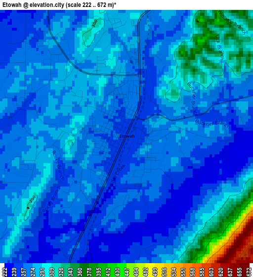
Below is the Elevation map of Etowah, which displays elevation range with different colors. Scale of the first map is from 222 to 672 m (728 to 2205 ft) with average elevation of 279 meters (=915 ft) [note 1]
These maps also provides idea of topography and contour of this city, they are displayed at different zoom levels. More info about maps, scale and edge coordinates you can find below images.
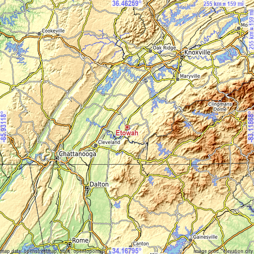
| \ | Map #1 | Topo.Map |
| Scale [m] | 222..672 m | × |
| Scale [ft] | 728..2205 ft | × |
| Average | 279 m = 915 ft | × |
| Width | 7.97 km = 5 mi | 255.1 km = 158.5 mi |
| Height | 7.97 km = 5 mi | 255.1 km = 158.5 mi |
| ↑Max Latitude | 35.359257° | 36.46259° |
| Latitude at center | 35.32341° | 35.32341° |
| ↓Min Latitude | 35.287547° | 34.16795° |
| ← Min Longitude | -84.568875° | -85.93118° |
| Longitude center | -84.52493° | -84.52493° |
| →Max Longitude | -84.480985° | -83.11868° |
Nearby cities:
Cities around Etowah sort by population:
• Cleveland elevation 261 m
36.8 km,  240°
240°
• Athens 267 m
14.6 km,  335°
335°
• South Cleveland 284 m
37.5 km, 237°
• Sweetwater 277 m
31.5 km,  10°
10°
• Madisonville 304 m
26.3 km,  33°
33°
• Wildwood Lake 254 m
39.5 km,  229°
229°
• Hopewell 222 m
34.4 km,  253°
253°
• East Cleveland 295 m
35.2 km, 239°
• Decatur 238 m
32.1 km,  311°
311°
• Englewood 258 m
11.7 km,  16°
16°
• Vonore 261 m
39.2 km,  40°
40°
• Benton 225 m
20.3 km,  215°
215°
Multilingual:
 En español:
Etowah elevación 244 m.
 En France:
Etowah élévation 244 m.


Sources and notes:
- [note 1] Map square and city borders are not equal. Map elevation data is calculated only from area inside that square.
- [src 1] Elevation data from geonames database provided with same terms of usage.
- [src 2] The elevation map of Etowah is generated using elevation data from NASA's 3 arcsec (90m) resolution SRTM data.
- [src 3] Base (background) map © OpenStreetMap contributors tiles are generated by Geofabrik and OpenTopoMap.
Copyright & License:
This Etowah Elevation Map is licensed under CC BY-SA. You may reuse any part from this page, if you give a proper credit by linking to this URL:
 More info on terms of use page.