Tigerville elevation
Tigerville (South Carolina, Greenville County), United States elevation is 308 meters and Tigerville elevation in feet is 1010 ft above sea level [src 1]. Tigerville is a populated place (feature code) with elevation that is 29 meters (95 ft) bigger than average city elevation in United States.
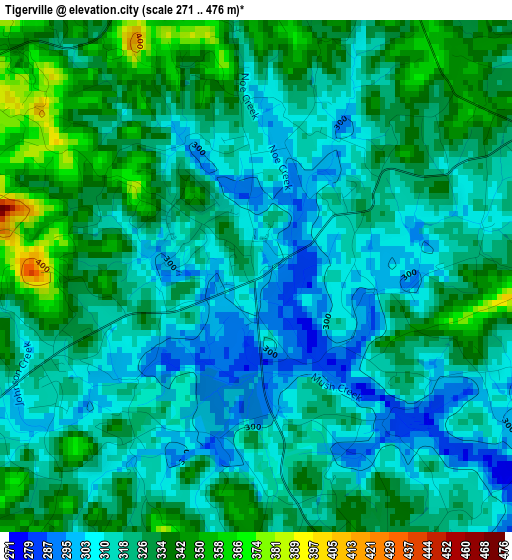
Below is the Elevation map of Tigerville, which displays elevation range with different colors. Scale of the first map is from 271 to 476 m (889 to 1562 ft) with average elevation of 322.9 meters (=1059 ft) [note 1]
These maps also provides idea of topography and contour of this city, they are displayed at different zoom levels. More info about maps, scale and edge coordinates you can find below images.
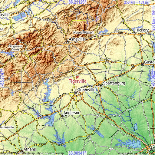
| \ | Map #1 | Topo.Map |
| Scale [m] | 271..476 m | × |
| Scale [ft] | 889..1562 ft | × |
| Average | 322.9 m = 1059 ft | × |
| Width | 8 km = 5 mi | 255.9 km = 159 mi |
| Height | 8 km = 5 mi | 255.9 km = 159 mi |
| ↑Max Latitude | 35.10441° | 36.21126° |
| Latitude at center | 35.06845° | 35.06845° |
| ↓Min Latitude | 35.032474° | 33.90941° |
| ← Min Longitude | -82.412395° | -83.7747° |
| Longitude center | -82.36845° | -82.36845° |
| →Max Longitude | -82.324505° | -80.9622° |
Nearby cities:
Cities around Tigerville sort by population:
• Greer elevation 312 m
19.3 km,  138°
138°
• Taylors 284 m
17.7 km,  158°
158°
• Wade Hampton 313 m
18.6 km,  170°
170°
• Berea 318 m
21.9 km,  201°
201°
• Sans Souci 310 m
21.8 km,  193°
193°
• East Flat Rock 675 m
24 km,  348°
348°
• Travelers Rest 336 m
13.1 km,  211°
211°
• Flat Rock 677 m
23.5 km,  343°
343°
• Landrum 320 m
20.2 km,  53°
53°
• Slater-Marietta 331 m
11.9 km,  251°
251°
• Tryon 337 m
19.5 km,  37°
37°
• City View 301 m
23.7 km, 194°
Multilingual:
 En español:
Tigerville elevación 308 m.
 En France:
Tigerville élévation 308 m.
 Auf Deutsch:
Tigerville höhe über dem Meeresspiegel ist 308 m.

Sources and notes:
- [note 1] Map square and city borders are not equal. Map elevation data is calculated only from area inside that square.
- [src 1] Elevation data from geonames database provided with same terms of usage.
- [src 2] The elevation map of Tigerville is generated using elevation data from NASA's 3 arcsec (90m) resolution SRTM data.
- [src 3] Base (background) map © OpenStreetMap contributors tiles are generated by Geofabrik and OpenTopoMap.
Copyright & License:
This Tigerville Elevation Map is licensed under CC BY-SA. You may reuse any part from this page, if you give a proper credit by linking to this URL:
 More info on terms of use page.