Tryon elevation
Tryon (North Carolina, Polk County), United States elevation is 337 meters and Tryon elevation in feet is 1106 ft above sea level [src 1]. Tryon is a populated place (feature code) with elevation that is 58 meters (190 ft) bigger than average city elevation in United States.
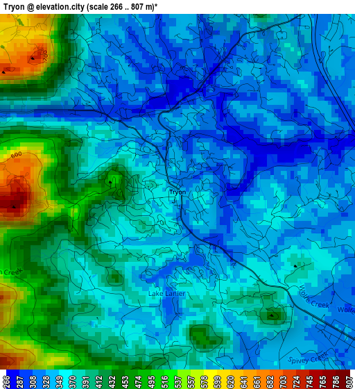
Below is the Elevation map of Tryon, which displays elevation range with different colors. Scale of the first map is from 266 to 807 m (873 to 2648 ft) with average elevation of 378 meters (=1240 ft) [note 1]
These maps also provides idea of topography and contour of this city, they are displayed at different zoom levels. More info about maps, scale and edge coordinates you can find below images.
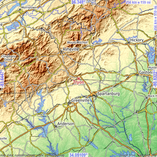
| \ | Map #1 | Topo.Map |
| Scale [m] | 266..807 m | × |
| Scale [ft] | 873..2648 ft | × |
| Average | 378 m = 1240 ft | × |
| Width | 7.98 km = 5 mi | 255.5 km = 158.8 mi |
| Height | 7.98 km = 5 mi | 255.5 km = 158.8 mi |
| ↑Max Latitude | 35.244068° | 36.349° |
| Latitude at center | 35.20817° | 35.20817° |
| ↓Min Latitude | 35.172256° | 34.05109° |
| ← Min Longitude | -82.282395° | -83.6447° |
| Longitude center | -82.23845° | -82.23845° |
| →Max Longitude | -82.194505° | -80.8322° |
Nearby cities:
Cities around Tryon sort by population:
• Hendersonville elevation 664 m
23.6 km,  301°
301°
• East Flat Rock 675 m
18.5 km, 295°
• Dana 689 m
18.3 km,  317°
317°
• Flat Rock 677 m
19.7 km,  290°
290°
• Landrum 320 m
5.8 km,  129°
129°
• Edneyville 684 m
22.7 km,  335°
335°
• Inman 301 m
22.4 km,  143°
143°
• Valley Hill 667 m
24.4 km, 294°
• Tigerville 308 m
19.5 km,  217°
217°
• Barker Heights 652 m
21.9 km, 301°
• Inman Mills 282 m
22.2 km,  146°
146°
• Columbus 339 m
6.3 km,  36°
36°
Multilingual:
 En español:
Tryon elevación 337 m.
 En France:
Tryon élévation 337 m.


Sources and notes:
- [note 1] Map square and city borders are not equal. Map elevation data is calculated only from area inside that square.
- [src 1] Elevation data from geonames database provided with same terms of usage.
- [src 2] The elevation map of Tryon is generated using elevation data from NASA's 3 arcsec (90m) resolution SRTM data.
- [src 3] Base (background) map © OpenStreetMap contributors tiles are generated by Geofabrik and OpenTopoMap.
Copyright & License:
This Tryon Elevation Map is licensed under CC BY-SA. You may reuse any part from this page, if you give a proper credit by linking to this URL:
 More info on terms of use page.