Hendersonville elevation
Hendersonville (North Carolina, Henderson County), United States elevation is 664 meters and Hendersonville elevation in feet is 2178 ft above sea level [src 1]. Hendersonville is a seat of a second-order administrative division (feature code) with elevation that is 385 meters (1263 ft) bigger than average city elevation in United States.
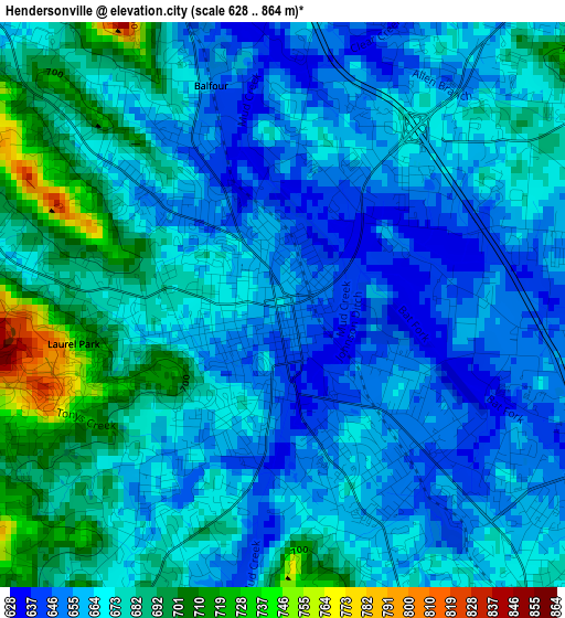
Below is the Elevation map of Hendersonville, which displays elevation range with different colors. Scale of the first map is from 628 to 864 m (2060 to 2835 ft) with average elevation of 670.5 meters (=2200 ft) [note 1]
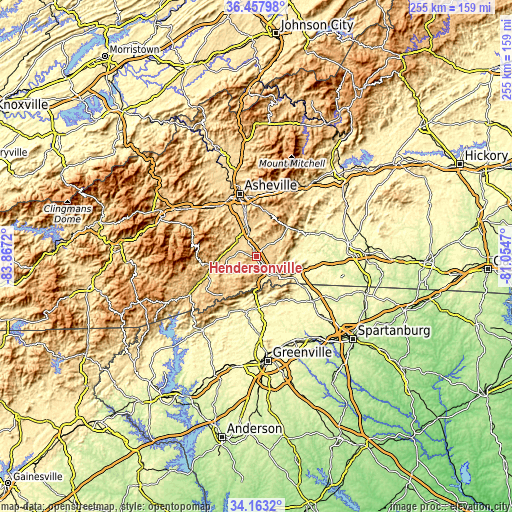
These maps also provides idea of topography and contour of this city, they are displayed at different zoom levels. More info about maps, scale and edge coordinates you can find below images.
| \ | Map #1 | Map #2 | Topo.Map |
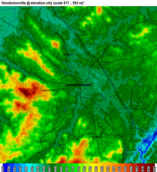
| Scale [m] | 628..864 m | 517..953 m | × |
| Scale [ft] | 2060..2835 ft | 1696..3127 ft | × |
| Average | 670.5 m = 2200 ft | 685.4 m = 2249 ft | × |
| Width | 7.97 km = 5 mi | 15.95 km = 9.9 mi | 255.2 km = 158.6 mi |
| Height | 7.97 km = 5 mi | 15.95 km = 9.9 mi | 255.2 km = 158.6 mi |
| ↑Max Latitude | 35.354579° | 35.390412° | 36.45798° |
| Latitude at center | 35.31873° | 35.31873° | 35.31873° |
| ↓Min Latitude | 35.282865° | 35.246984° | 34.1632° |
| ← Min Longitude | -82.504895° | -82.548841° | -83.8672° |
| Longitude center | -82.46095° | -82.46095° | -82.46095° |
| →Max Longitude | -82.417005° | -82.373059° | -81.0547° |
Nearby cities:
Cities around Hendersonville sort by population:
• Mills River elevation 643 m
12.3 km,  308°
308°
• Etowah 643 m
12.1 km,  269°
269°
• East Flat Rock 675 m
5.6 km,  140°
140°
• Mountain Home 657 m
6.4 km,  332°
332°
• Dana 689 m
7.8 km,  81°
81°
• Flat Rock 677 m
5.6 km,  161°
161°
• Horse Shoe 644 m
9.1 km,  287°
287°
• Laurel Park 732 m
3 km,  259°
259°
• Valley Hill 667 m
3 km,  221°
221°
• Fruitland 678 m
10.6 km,  35°
35°
• Barker Heights 652 m
1.7 km,  118°
118°
• Balfour 647 m
3.2 km,  341°
341°
Multilingual:
 En español:
Hendersonville elevación 664 m.
 En France:
Hendersonville élévation 664 m.
 Auf Deutsch:
Hendersonville höhe über dem Meeresspiegel ist 664 m.

Sources and notes:
- [note 1] Map square and city borders are not equal. Map elevation data is calculated only from area inside that square.
- [src 1] Elevation data from geonames database provided with same terms of usage.
- [src 2] The elevation map of Hendersonville is generated using elevation data from NASA's 3 arcsec (90m) resolution SRTM data.
- [src 3] Base (background) map © OpenStreetMap contributors tiles are generated by Geofabrik and OpenTopoMap.
Copyright & License:
This Hendersonville Elevation Map is licensed under CC BY-SA. You may reuse any part from this page, if you give a proper credit by linking to this URL:
 More info on terms of use page.