Mountain Home elevation
Mountain Home (North Carolina, Henderson County), United States elevation is 657 meters and Mountain Home elevation in feet is 2156 ft above sea level [src 1]. Mountain Home is a populated place (feature code) with elevation that is 378 meters (1240 ft) bigger than average city elevation in United States.
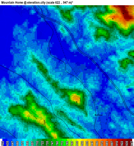
Below is the Elevation map of Mountain Home, which displays elevation range with different colors. Scale of the first map is from 622 to 947 m (2041 to 3107 ft) with average elevation of 676.2 meters (=2219 ft) [note 1]
These maps also provides idea of topography and contour of this city, they are displayed at different zoom levels. More info about maps, scale and edge coordinates you can find below images.
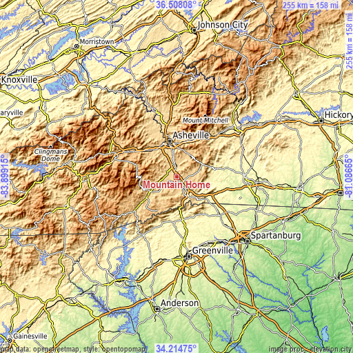
| \ | Map #1 | Map #2 | Topo.Map |
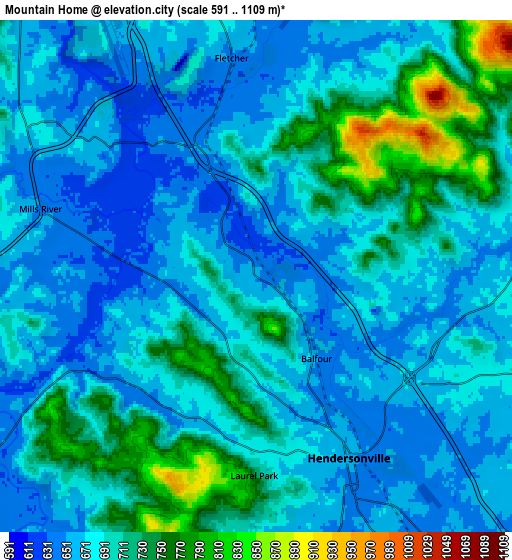
| Scale [m] | 622..947 m | 591..1109 m | × |
| Scale [ft] | 2041..3107 ft | 1939..3638 ft | × |
| Average | 676.2 m = 2219 ft | 688.1 m = 2258 ft | × |
| Width | 7.97 km = 5 mi | 15.94 km = 9.9 mi | 255 km = 158.4 mi |
| Height | 7.97 km = 5 mi | 15.94 km = 9.9 mi | 255 km = 158.4 mi |
| ↑Max Latitude | 35.405387° | 35.441197° | 36.50808° |
| Latitude at center | 35.36956° | 35.36956° | 35.36956° |
| ↓Min Latitude | 35.333717° | 35.297859° | 34.21475° |
| ← Min Longitude | -82.536845° | -82.580791° | -83.89915° |
| Longitude center | -82.4929° | -82.4929° | -82.4929° |
| →Max Longitude | -82.448955° | -82.405009° | -81.08665° |
Nearby cities:
Cities around Mountain Home sort by population:
• Hendersonville elevation 664 m
6.4 km,  152°
152°
• Fletcher 649 m
6.8 km,  353°
353°
• Mills River 643 m
7 km,  287°
287°
• Etowah 643 m
10.9 km,  237°
237°
• Dana 689 m
11.6 km,  112°
112°
• Horse Shoe 644 m
6.5 km, 243°
• Laurel Park 732 m
6.2 km,  180°
180°
• Valley Hill 667 m
8 km,  173°
173°
• Fruitland 678 m
9.5 km,  71°
71°
• Barker Heights 652 m
7.9 km, 145°
• Balfour 647 m
3.2 km,  143°
143°
• Hoopers Creek 663 m
8.1 km,  17°
17°
Multilingual:
 En español:
Mountain Home elevación 657 m.
 En France:
Mountain Home élévation 657 m.
 Auf Deutsch:
Mountain Home höhe über dem Meeresspiegel ist 657 m.

Sources and notes:
- [note 1] Map square and city borders are not equal. Map elevation data is calculated only from area inside that square.
- [src 1] Elevation data from geonames database provided with same terms of usage.
- [src 2] The elevation map of Mountain Home is generated using elevation data from NASA's 3 arcsec (90m) resolution SRTM data.
- [src 3] Base (background) map © OpenStreetMap contributors tiles are generated by Geofabrik and OpenTopoMap.
Copyright & License:
This Mountain Home Elevation Map is licensed under CC BY-SA. You may reuse any part from this page, if you give a proper credit by linking to this URL:
 More info on terms of use page.