Saluda elevation
Saluda (South Carolina, Saluda County), United States elevation is 147 meters and Saluda elevation in feet is 482 ft above sea level [src 1]. Saluda is a seat of a second-order administrative division (feature code) with elevation that is 132 meters (433 ft) smaller than average city elevation in United States.
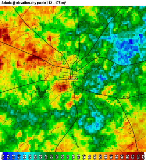
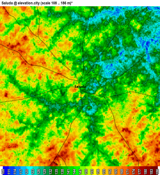
Below is the Elevation map of Saluda, which displays elevation range with different colors. Scale of the first map is from 112 to 175 m (367 to 574 ft) with average elevation of 141.7 meters (=465 ft) [note 1]
These maps also provides idea of topography and contour of this city, they are displayed at different zoom levels. More info about maps, scale and edge coordinates you can find below images.
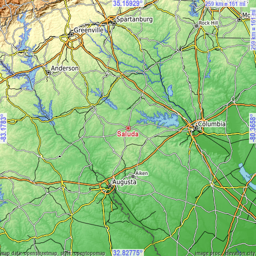
| \ | Map #1 | Map #2 | Topo.Map |
| Scale [m] | 112..175 m | 108..186 m | × |
| Scale [ft] | 367..574 ft | 354..610 ft | × |
| Average | 141.7 m = 465 ft | 146.1 m = 479 ft | × |
| Width | 8.1 km = 5 mi | 16.2 km = 10.1 mi | 259.2 km = 161.1 mi |
| Height | 8.1 km = 5 mi | 16.2 km = 10.1 mi | 259.2 km = 161.1 mi |
| ↑Max Latitude | 34.037944° | 34.074352° | 35.15929° |
| Latitude at center | 34.00152° | 34.00152° | 34.00152° |
| ↓Min Latitude | 33.965081° | 33.928625° | 32.82775° |
| ← Min Longitude | -81.815995° | -81.859941° | -83.1783° |
| Longitude center | -81.77205° | -81.77205° | -81.77205° |
| →Max Longitude | -81.728105° | -81.684159° | -80.3658° |
Nearby cities:
Cities around Saluda sort by population:
• Greenwood elevation 205 m
41.9 km,  300°
300°
• Newberry 152 m
33.5 km,  24°
24°
• Batesburg-Leesville 198 m
23.9 km,  115°
115°
• Edgefield 162 m
27.7 km,  211°
211°
• Batesburg 201 m
23.2 km, 116°
• Johnston 202 m
19 km,  188°
188°
• Leesville 199 m
25.7 km,  111°
111°
• Ninety Six 167 m
30.2 km,  309°
309°
• Chapin 139 m
43 km,  64°
64°
• Joanna 183 m
46.1 km,  355°
355°
• Murphys Estates 177 m
47.3 km,  199°
199°
• Prosperity 166 m
31.9 km,  43°
43°
Multilingual:
 En español:
Saluda elevación 147 m.
 En France:
Saluda élévation 147 m.


Sources and notes:
- [note 1] Map square and city borders are not equal. Map elevation data is calculated only from area inside that square.
- [src 1] Elevation data from geonames database provided with same terms of usage.
- [src 2] The elevation map of Saluda is generated using elevation data from NASA's 3 arcsec (90m) resolution SRTM data.
- [src 3] Base (background) map © OpenStreetMap contributors tiles are generated by Geofabrik and OpenTopoMap.
Copyright & License:
This Saluda Elevation Map is licensed under CC BY-SA. You may reuse any part from this page, if you give a proper credit by linking to this URL:
 More info on terms of use page.