Rock Hill elevation
Rock Hill (South Carolina, York County), United States elevation is 209 meters and Rock Hill elevation in feet is 686 ft above sea level [src 1]. Rock Hill is a populated place (feature code) with elevation that is 70 meters (230 ft) smaller than average city elevation in United States.
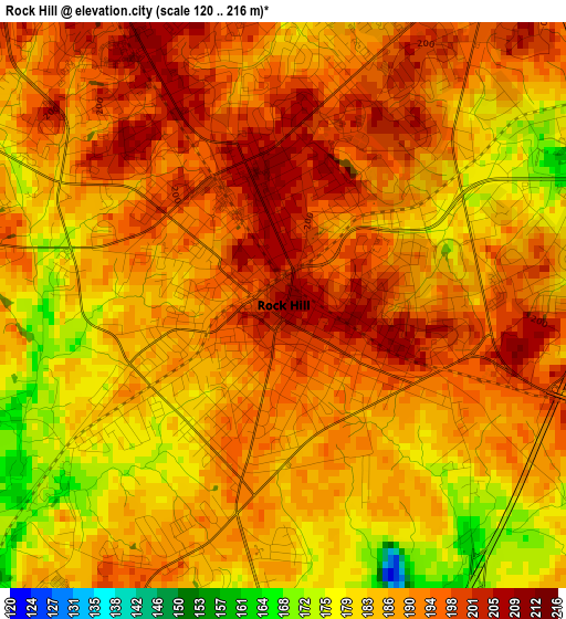
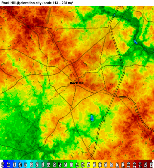
Below is the Elevation map of Rock Hill, which displays elevation range with different colors. Scale of the first map is from 120 to 216 m (394 to 709 ft) with average elevation of 188.9 meters (=620 ft) [note 1]
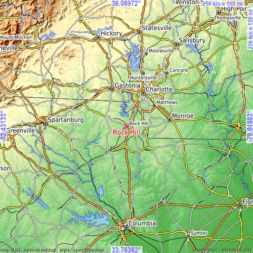
These maps also provides idea of topography and contour of this city, they are displayed at different zoom levels. More info about maps, scale and edge coordinates you can find below images.
| \ | Map #1 | Map #2 | Topo.Map |
| Scale [m] | 120..216 m | 113..228 m | × |
| Scale [ft] | 394..709 ft | 371..748 ft | × |
| Average | 188.9 m = 620 ft | 185.7 m = 609 ft | × |
| Width | 8.01 km = 5 mi | 16.03 km = 10 mi | 256.4 km = 159.3 mi |
| Height | 8.01 km = 5 mi | 16.02 km = 10 mi | 256.4 km = 159.3 mi |
| ↑Max Latitude | 34.960893° | 34.9969° | 36.06972° |
| Latitude at center | 34.92487° | 34.92487° | 34.92487° |
| ↓Min Latitude | 34.888831° | 34.852777° | 33.76382° |
| ← Min Longitude | -81.069025° | -81.112971° | -82.43133° |
| Longitude center | -81.02508° | -81.02508° | -81.02508° |
| →Max Longitude | -80.981135° | -80.937189° | -79.61883° |
Nearby cities:
Cities around Rock Hill sort by population:
• Fort Mill elevation 193 m
11.7 km,  38°
38°
• Waxhaw 203 m
25.7 km,  90°
90°
• Weddington 222 m
26.4 km,  65°
65°
• Tega Cay 194 m
11.1 km,  358°
358°
• Lake Wylie 181 m
20.5 km, 355°
• Pineville 176 m
21.4 km,  34°
34°
• York 233 m
21.2 km,  291°
291°
• Marvin 212 m
20.6 km, 68°
• Newport 217 m
10 km,  316°
316°
• India Hook 196 m
9.2 km,  1°
1°
• Lesslie 212 m
7.3 km,  121°
121°
• Catawba 170 m
13.1 km,  127°
127°
Multilingual:
 En español:
Rock Hill elevación 209 m.
 En France:
Rock Hill élévation 209 m.
 Auf Deutsch:
Rock Hill höhe über dem Meeresspiegel ist 209 m.

Sources and notes:
- [note 1] Map square and city borders are not equal. Map elevation data is calculated only from area inside that square.
- [src 1] Elevation data from geonames database provided with same terms of usage.
- [src 2] The elevation map of Rock Hill is generated using elevation data from NASA's 3 arcsec (90m) resolution SRTM data.
- [src 3] Base (background) map © OpenStreetMap contributors tiles are generated by Geofabrik and OpenTopoMap.
Copyright & License:
This Rock Hill Elevation Map is licensed under CC BY-SA. You may reuse any part from this page, if you give a proper credit by linking to this URL:
 More info on terms of use page.