Marvin elevation
Marvin (North Carolina, Union County), United States elevation is 212 meters and Marvin elevation in feet is 696 ft above sea level [src 1]. Marvin is a populated place (feature code) with elevation that is 67 meters (220 ft) smaller than average city elevation in United States.
Below is the Elevation map of Marvin, which displays elevation range with different colors. Scale of the first map is from 160 to 224 m (525 to 735 ft) with average elevation of 192.8 meters (=633 ft) [note 1]
These maps also provides idea of topography and contour of this city, they are displayed at different zoom levels. More info about maps, scale and edge coordinates you can find below images.
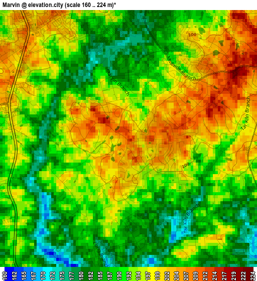
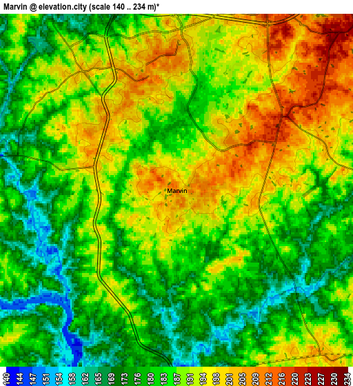
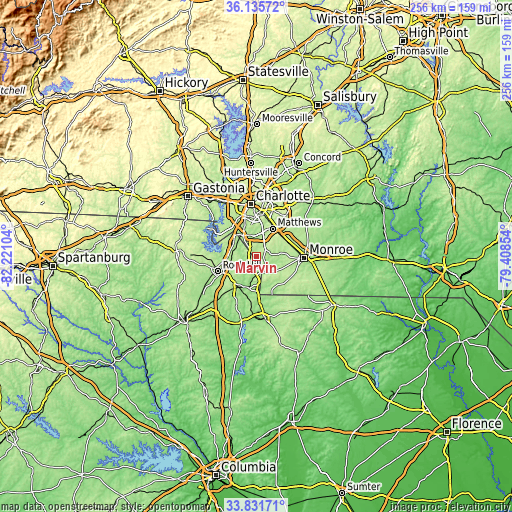
| \ | Map #1 | Map #2 | Topo.Map |
| Scale [m] | 160..224 m | 140..234 m | × |
| Scale [ft] | 525..735 ft | 459..768 ft | × |
| Average | 192.8 m = 633 ft | 186.4 m = 612 ft | × |
| Width | 8.01 km = 5 mi | 16.01 km = 9.9 mi | 256.2 km = 159.2 mi |
| Height | 8.01 km = 5 mi | 16.01 km = 9.9 mi | 256.2 km = 159.2 mi |
| ↑Max Latitude | 35.027814° | 35.063791° | 36.13572° |
| Latitude at center | 34.99182° | 34.99182° | 34.99182° |
| ↓Min Latitude | 34.955811° | 34.919785° | 33.83171° |
| ← Min Longitude | -80.858735° | -80.902681° | -82.22104° |
| Longitude center | -80.81479° | -80.81479° | -80.81479° |
| →Max Longitude | -80.770845° | -80.726899° | -79.40854° |
Nearby cities:
Cities around Marvin sort by population:
• Indian Trail elevation 211 m
16.3 km,  54°
54°
• Matthews 226 m
16.2 km,  30°
30°
• Stallings 229 m
16.1 km, 46°
• Fort Mill 193 m
12 km,  278°
278°
• Waxhaw 203 m
9.9 km,  138°
138°
• Weddington 222 m
6 km,  55°
55°
• Pineville 176 m
12.4 km,  325°
325°
• Wesley Chapel 186 m
12.9 km,  82°
82°
• India Hook 196 m
18.9 km, 275°
• Lesslie 212 m
17.1 km,  228°
228°
• Mineral Springs 193 m
14.6 km,  114°
114°
• Catawba 170 m
17.8 km,  209°
209°
Multilingual:
 En español:
Marvin elevación 212 m.
 En France:
Marvin élévation 212 m.


Sources and notes:
- [note 1] Map square and city borders are not equal. Map elevation data is calculated only from area inside that square.
- [src 1] Elevation data from geonames database provided with same terms of usage.
- [src 2] The elevation map of Marvin is generated using elevation data from NASA's 3 arcsec (90m) resolution SRTM data.
- [src 3] Base (background) map © OpenStreetMap contributors tiles are generated by Geofabrik and OpenTopoMap.
Copyright & License:
This Marvin Elevation Map is licensed under CC BY-SA. You may reuse any part from this page, if you give a proper credit by linking to this URL:
 More info on terms of use page.