Carroll Valley elevation
Carroll Valley (Pennsylvania, Adams County), United States elevation is 197 meters and Carroll Valley elevation in feet is 646 ft above sea level [src 1]. Carroll Valley is a populated place (feature code) with elevation that is 82 meters (269 ft) smaller than average city elevation in United States.
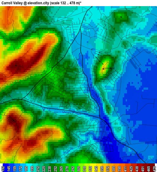
Below is the Elevation map of Carroll Valley, which displays elevation range with different colors. Scale of the first map is from 132 to 478 m (433 to 1568 ft) with average elevation of 240 meters (=787 ft) [note 1]
These maps also provides idea of topography and contour of this city, they are displayed at different zoom levels. More info about maps, scale and edge coordinates you can find below images.
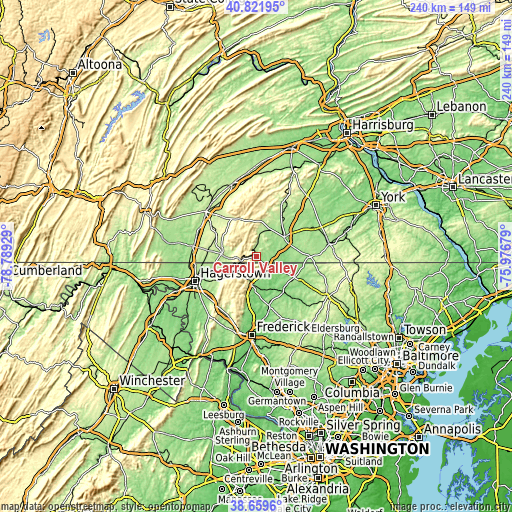
| \ | Map #1 | Map #2 | Topo.Map |
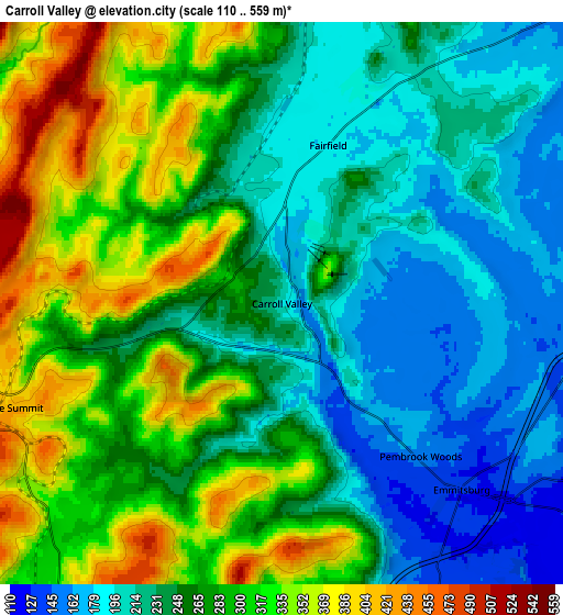
| Scale [m] | 132..478 m | 110..559 m | × |
| Scale [ft] | 433..1568 ft | 361..1834 ft | × |
| Average | 240 m = 787 ft | 264.6 m = 868 ft | × |
| Width | 7.51 km = 4.7 mi | 15.03 km = 9.3 mi | 240.4 km = 149.4 mi |
| Height | 7.51 km = 4.7 mi | 15.03 km = 9.3 mi | 240.4 km = 149.4 mi |
| ↑Max Latitude | 39.783039° | 39.816802° | 40.82195° |
| Latitude at center | 39.74926° | 39.74926° | 39.74926° |
| ↓Min Latitude | 39.715464° | 39.681652° | 38.6596° |
| ← Min Longitude | -77.426985° | -77.470931° | -78.78929° |
| Longitude center | -77.38304° | -77.38304° | -77.38304° |
| →Max Longitude | -77.339095° | -77.295149° | -75.97679° |
Nearby cities:
Cities around Carroll Valley sort by population:
• Waynesboro elevation 218 m
16.7 km,  272°
272°
• Gettysburg 166 m
15.8 km,  55°
55°
• Taneytown 155 m
20.5 km,  119°
119°
• Thurmont 157 m
14.2 km,  189°
189°
• Emmitsburg 132 m
6.9 km,  136°
136°
• Smithsburg 234 m
19.3 km,  237°
237°
• Wayne Heights 194 m
14.6 km, 267°
• Bonneauville 173 m
22.1 km,  71°
71°
• Mont Alto 260 m
18.3 km,  305°
305°
• Cavetown 220 m
20.9 km, 236°
• Lake Heritage 147 m
18.3 km, 68°
• Highfield-Cascade 426 m
9.3 km,  246°
246°
Multilingual:
 En español:
Carroll Valley elevación 197 m.
 En France:
Carroll Valley élévation 197 m.
 Auf Deutsch:
Carroll Valley höhe über dem Meeresspiegel ist 197 m.

Sources and notes:
- [note 1] Map square and city borders are not equal. Map elevation data is calculated only from area inside that square.
- [src 1] Elevation data from geonames database provided with same terms of usage.
- [src 2] The elevation map of Carroll Valley is generated using elevation data from NASA's 3 arcsec (90m) resolution SRTM data.
- [src 3] Base (background) map © OpenStreetMap contributors tiles are generated by Geofabrik and OpenTopoMap.
Copyright & License:
This Carroll Valley Elevation Map is licensed under CC BY-SA. You may reuse any part from this page, if you give a proper credit by linking to this URL:
 More info on terms of use page.