Perkins elevation
Perkins (Oklahoma, Payne County), United States elevation is 278 meters and Perkins elevation in feet is 912 ft above sea level [src 1]. Perkins is a populated place (feature code) with elevation that is 1 meters (3 ft) smaller than average city elevation in United States.
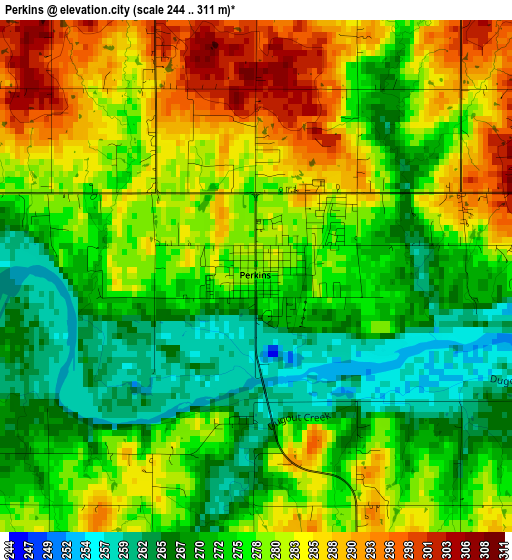
Below is the Elevation map of Perkins, which displays elevation range with different colors. Scale of the first map is from 244 to 311 m (801 to 1020 ft) with average elevation of 277.1 meters (=909 ft) [note 1]
These maps also provides idea of topography and contour of this city, they are displayed at different zoom levels. More info about maps, scale and edge coordinates you can find below images.
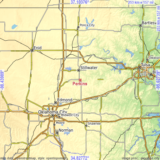
| \ | Map #1 | Topo.Map |
| Scale [m] | 244..311 m | × |
| Scale [ft] | 801..1020 ft | × |
| Average | 277.1 m = 909 ft | × |
| Width | 7.91 km = 4.9 mi | 253.1 km = 157.3 mi |
| Height | 7.91 km = 4.9 mi | 253.1 km = 157.3 mi |
| ↑Max Latitude | 36.009496° | 37.10376° |
| Latitude at center | 35.97394° | 35.97394° |
| ↓Min Latitude | 35.938368° | 34.82772° |
| ← Min Longitude | -97.077585° | -98.43989° |
| Longitude center | -97.03364° | -97.03364° |
| →Max Longitude | -96.989695° | -95.62739° |
Nearby cities:
Cities around Perkins sort by population:
• Stillwater elevation 277 m
15.9 km,  351°
351°
• Guthrie 307 m
36.8 km,  253°
253°
• Cushing 289 m
24 km,  87°
87°
• Perry 312 m
41.9 km,  326°
326°
• Chandler 289 m
33.3 km,  155°
155°
• Drumright 263 m
38.9 km, 87°
• Stroud 270 m
42.1 km,  126°
126°
• Pawnee 270 m
45.4 km,  27°
27°
• Langston 297 m
20.2 km,  260°
260°
• Luther 286 m
37.7 km,  202°
202°
• Yale 250 m
33.9 km,  62°
62°
• Oilton 249 m
42.3 km,  73°
73°
Multilingual:
 En español:
Perkins elevación 278 m.
 En France:
Perkins élévation 278 m.


Sources and notes:
- [note 1] Map square and city borders are not equal. Map elevation data is calculated only from area inside that square.
- [src 1] Elevation data from geonames database provided with same terms of usage.
- [src 2] The elevation map of Perkins is generated using elevation data from NASA's 3 arcsec (90m) resolution SRTM data.
- [src 3] Base (background) map © OpenStreetMap contributors tiles are generated by Geofabrik and OpenTopoMap.
Copyright & License:
This Perkins Elevation Map is licensed under CC BY-SA. You may reuse any part from this page, if you give a proper credit by linking to this URL:
 More info on terms of use page.