Chandler elevation
Chandler (Oklahoma, Lincoln County), United States elevation is 289 meters and Chandler elevation in feet is 948 ft above sea level [src 1]. Chandler is a seat of a second-order administrative division (feature code) with elevation that is 10 meters (33 ft) bigger than average city elevation in United States.
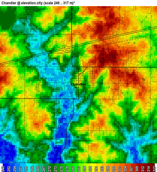
Below is the Elevation map of Chandler, which displays elevation range with different colors. Scale of the first map is from 249 to 317 m (817 to 1040 ft) with average elevation of 281 meters (=922 ft) [note 1]
These maps also provides idea of topography and contour of this city, they are displayed at different zoom levels. More info about maps, scale and edge coordinates you can find below images.
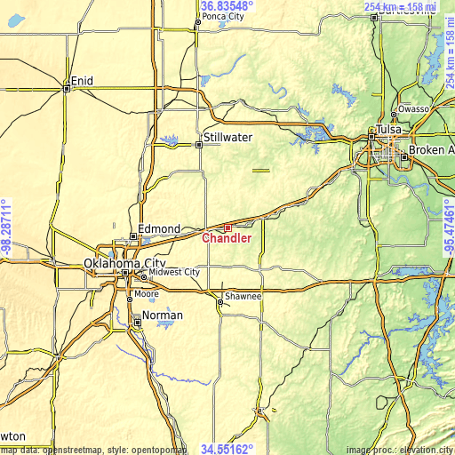
| \ | Map #1 | Topo.Map |
| Scale [m] | 249..317 m | × |
| Scale [ft] | 817..1040 ft | × |
| Average | 281 m = 922 ft | × |
| Width | 7.94 km = 4.9 mi | 253.9 km = 157.8 mi |
| Height | 7.94 km = 4.9 mi | 253.9 km = 157.8 mi |
| ↑Max Latitude | 35.737409° | 36.83548° |
| Latitude at center | 35.70173° | 35.70173° |
| ↓Min Latitude | 35.666036° | 34.55162° |
| ← Min Longitude | -96.924805° | -98.28711° |
| Longitude center | -96.88086° | -96.88086° |
| →Max Longitude | -96.836915° | -95.47461° |
Nearby cities:
Cities around Chandler sort by population:
• Shawnee elevation 326 m
41.8 km,  185°
185°
• Choctaw 353 m
41.8 km,  237°
237°
• Cushing 289 m
33.1 km,  18°
18°
• Harrah 340 m
34.8 km,  227°
227°
• McLoud 337 m
35.2 km,  212°
212°
• Jones 344 m
39.7 km,  247°
247°
• Drumright 263 m
40.6 km,  38°
38°
• Perkins 278 m
33.3 km,  335°
335°
• Stroud 270 m
20.8 km,  75°
75°
• Prague 311 m
29.7 km,  143°
143°
• Luther 286 m
28.8 km,  261°
261°
• Meeker 278 m
22.1 km, 185°
Multilingual:
 En español:
Chandler elevación 289 m.
 En France:
Chandler élévation 289 m.
 Auf Deutsch:
Chandler höhe über dem Meeresspiegel ist 289 m.

Sources and notes:
- [note 1] Map square and city borders are not equal. Map elevation data is calculated only from area inside that square.
- [src 1] Elevation data from geonames database provided with same terms of usage.
- [src 2] The elevation map of Chandler is generated using elevation data from NASA's 3 arcsec (90m) resolution SRTM data.
- [src 3] Base (background) map © OpenStreetMap contributors tiles are generated by Geofabrik and OpenTopoMap.
Copyright & License:
This Chandler Elevation Map is licensed under CC BY-SA. You may reuse any part from this page, if you give a proper credit by linking to this URL:
 More info on terms of use page.