Pauls Valley elevation
Pauls Valley (Oklahoma, Garvin County), United States elevation is 273 meters and Pauls Valley elevation in feet is 896 ft above sea level [src 1]. Pauls Valley is a seat of a second-order administrative division (feature code) with elevation that is 6 meters (20 ft) smaller than average city elevation in United States.
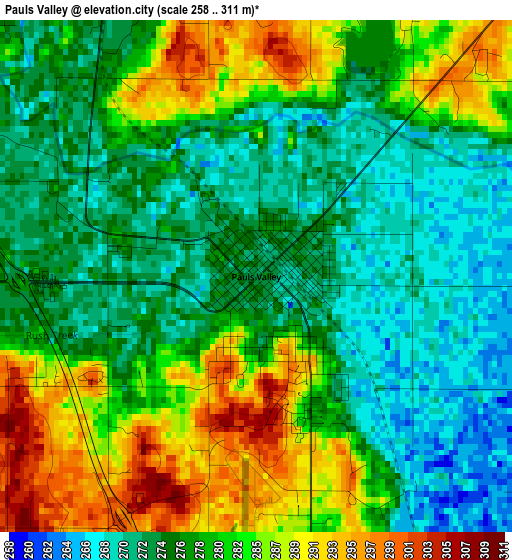
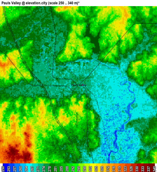
Below is the Elevation map of Pauls Valley, which displays elevation range with different colors. Scale of the first map is from 258 to 311 m (846 to 1020 ft) with average elevation of 279.1 meters (=916 ft) [note 1]
These maps also provides idea of topography and contour of this city, they are displayed at different zoom levels. More info about maps, scale and edge coordinates you can find below images.
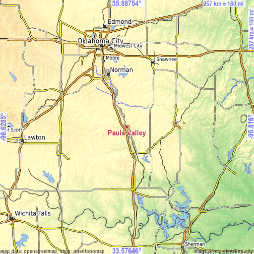
| \ | Map #1 | Map #2 | Topo.Map |
| Scale [m] | 258..311 m | 250..340 m | × |
| Scale [ft] | 846..1020 ft | 820..1115 ft | × |
| Average | 279.1 m = 916 ft | 283.7 m = 931 ft | × |
| Width | 8.03 km = 5 mi | 16.06 km = 10 mi | 257 km = 159.7 mi |
| Height | 8.03 km = 5 mi | 16.06 km = 10 mi | 257 km = 159.7 mi |
| ↑Max Latitude | 34.776184° | 34.812272° | 35.88754° |
| Latitude at center | 34.74008° | 34.74008° | 34.74008° |
| ↓Min Latitude | 34.70396° | 34.667825° | 33.57646° |
| ← Min Longitude | -97.266195° | -97.310141° | -98.6285° |
| Longitude center | -97.22225° | -97.22225° | -97.22225° |
| →Max Longitude | -97.178305° | -97.134359° | -95.816° |
Nearby cities:
Cities around Pauls Valley sort by population:
• Ada elevation 314 m
49.8 km,  85°
85°
• Noble 367 m
47.1 km,  340°
340°
• Purcell 341 m
33 km, 337°
• Sulphur 307 m
34.7 km,  138°
138°
• Slaughterville 344 m
40 km,  345°
345°
• Lindsay 302 m
36.3 km,  286°
286°
• Davis 263 m
27.8 km,  160°
160°
• Wynnewood 285 m
12 km,  153°
153°
• Lexington 319 m
32.2 km, 341°
• Stratford 346 m
24.8 km,  75°
75°
• Konawa 299 m
49.3 km,  60°
60°
• Maysville 291 m
18.8 km,  297°
297°
Multilingual:
 En español:
Pauls Valley elevación 273 m.
 En France:
Pauls Valley élévation 273 m.
 Auf Deutsch:
Pauls Valley höhe über dem Meeresspiegel ist 273 m.

Sources and notes:
- [note 1] Map square and city borders are not equal. Map elevation data is calculated only from area inside that square.
- [src 1] Elevation data from geonames database provided with same terms of usage.
- [src 2] The elevation map of Pauls Valley is generated using elevation data from NASA's 3 arcsec (90m) resolution SRTM data.
- [src 3] Base (background) map © OpenStreetMap contributors tiles are generated by Geofabrik and OpenTopoMap.
Copyright & License:
This Pauls Valley Elevation Map is licensed under CC BY-SA. You may reuse any part from this page, if you give a proper credit by linking to this URL:
 More info on terms of use page.