Owasso elevation
Owasso (Oklahoma, Tulsa County), United States elevation is 188 meters and Owasso elevation in feet is 617 ft above sea level [src 1]. Owasso is a populated place (feature code) with elevation that is 91 meters (299 ft) smaller than average city elevation in United States.
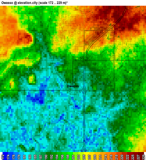
Below is the Elevation map of Owasso, which displays elevation range with different colors. Scale of the first map is from 172 to 229 m (564 to 751 ft) with average elevation of 195 meters (=640 ft) [note 1]
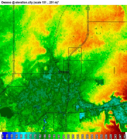
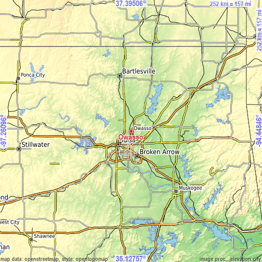
These maps also provides idea of topography and contour of this city, they are displayed at different zoom levels. More info about maps, scale and edge coordinates you can find below images.
| \ | Map #1 | Map #2 | Topo.Map |
| Scale [m] | 172..229 m | 151..251 m | × |
| Scale [ft] | 564..751 ft | 495..823 ft | × |
| Average | 195 m = 640 ft | 199.9 m = 656 ft | × |
| Width | 7.88 km = 4.9 mi | 15.76 km = 9.8 mi | 252.1 km = 156.6 mi |
| Height | 7.88 km = 4.9 mi | 15.76 km = 9.8 mi | 252.1 km = 156.6 mi |
| ↑Max Latitude | 36.304963° | 36.340369° | 37.39506° |
| Latitude at center | 36.26954° | 36.26954° | 36.26954° |
| ↓Min Latitude | 36.234101° | 36.198647° | 35.12757° |
| ← Min Longitude | -95.898655° | -95.942601° | -97.26096° |
| Longitude center | -95.85471° | -95.85471° | -95.85471° |
| →Max Longitude | -95.810765° | -95.766819° | -94.44846° |
Nearby cities:
Cities around Owasso sort by population:
• Tulsa elevation 226 m
17.8 km,  223°
223°
• Broken Arrow 234 m
24.8 km,  166°
166°
• Sand Springs 212 m
27 km,  237°
237°
• Claremore 187 m
21.9 km,  77°
77°
• Skiatook 198 m
17.1 km,  309°
309°
• Catoosa 193 m
13.3 km,  132°
132°
• Collinsville 198 m
10.7 km,  7°
7°
• Verdigris 192 m
15.2 km,  104°
104°
• Turley 198 m
11.3 km,  254°
254°
• Justice 208 m
26 km, 84°
• Sperry 193 m
12.6 km,  284°
284°
• Oologah 202 m
23.7 km,  33°
33°
Multilingual:
 En español:
Owasso elevación 188 m.
 En France:
Owasso élévation 188 m.


Sources and notes:
- [note 1] Map square and city borders are not equal. Map elevation data is calculated only from area inside that square.
- [src 1] Elevation data from geonames database provided with same terms of usage.
- [src 2] The elevation map of Owasso is generated using elevation data from NASA's 3 arcsec (90m) resolution SRTM data.
- [src 3] Base (background) map © OpenStreetMap contributors tiles are generated by Geofabrik and OpenTopoMap.
Copyright & License:
This Owasso Elevation Map is licensed under CC BY-SA. You may reuse any part from this page, if you give a proper credit by linking to this URL:
 More info on terms of use page.