Lone Grove elevation
Lone Grove (Oklahoma, Carter County), United States elevation is 295 meters and Lone Grove elevation in feet is 968 ft above sea level [src 1]. Lone Grove is a populated place (feature code) with elevation that is 16 meters (52 ft) bigger than average city elevation in United States.
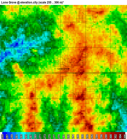
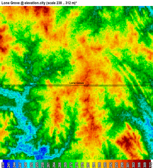
Below is the Elevation map of Lone Grove, which displays elevation range with different colors. Scale of the first map is from 255 to 306 m (837 to 1004 ft) with average elevation of 281.8 meters (=925 ft) [note 1]
These maps also provides idea of topography and contour of this city, they are displayed at different zoom levels. More info about maps, scale and edge coordinates you can find below images.
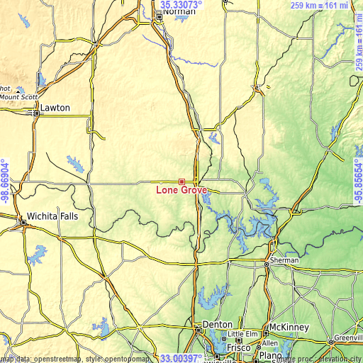
| \ | Map #1 | Map #2 | Topo.Map |
| Scale [m] | 255..306 m | 238..312 m | × |
| Scale [ft] | 837..1004 ft | 781..1024 ft | × |
| Average | 281.8 m = 925 ft | 275.5 m = 904 ft | × |
| Width | 8.08 km = 5 mi | 16.17 km = 10 mi | 258.7 km = 160.7 mi |
| Height | 8.09 km = 5 mi | 16.17 km = 10 mi | 258.7 km = 160.7 mi |
| ↑Max Latitude | 34.211719° | 34.248053° | 35.33073° |
| Latitude at center | 34.17537° | 34.17537° | 34.17537° |
| ↓Min Latitude | 34.139005° | 34.102625° | 33.00397° |
| ← Min Longitude | -97.306735° | -97.350681° | -98.66904° |
| Longitude center | -97.26279° | -97.26279° | -97.26279° |
| →Max Longitude | -97.218845° | -97.174899° | -95.85654° |
Nearby cities:
Cities around Lone Grove sort by population:
• Ardmore elevation 267 m
11 km,  90°
90°
• Sulphur 307 m
45.8 km,  36°
36°
• Madill 244 m
46.2 km,  101°
101°
• Davis 263 m
38.9 km,  19°
19°
• Healdton 299 m
21.7 km,  287°
287°
• Marietta 262 m
29.7 km,  153°
153°
• Wynnewood 285 m
52.8 km,  9°
9°
• Wilson 289 m
15.1 km,  264°
264°
• Kingston 246 m
53.7 km,  111°
111°
• Dickson 254 m
25.6 km, 87°
• Oakland 251 m
44 km, 100°
• Ringling 280 m
30.3 km,  270°
270°
Multilingual:
 En español:
Lone Grove elevación 295 m.
 En France:
Lone Grove élévation 295 m.
 Auf Deutsch:
Lone Grove höhe über dem Meeresspiegel ist 295 m.

Sources and notes:
- [note 1] Map square and city borders are not equal. Map elevation data is calculated only from area inside that square.
- [src 1] Elevation data from geonames database provided with same terms of usage.
- [src 2] The elevation map of Lone Grove is generated using elevation data from NASA's 3 arcsec (90m) resolution SRTM data.
- [src 3] Base (background) map © OpenStreetMap contributors tiles are generated by Geofabrik and OpenTopoMap.
Copyright & License:
This Lone Grove Elevation Map is licensed under CC BY-SA. You may reuse any part from this page, if you give a proper credit by linking to this URL:
 More info on terms of use page.