Madill elevation
Madill (Oklahoma, Marshall County), United States elevation is 244 meters and Madill elevation in feet is 801 ft above sea level [src 1]. Madill is a seat of a second-order administrative division (feature code) with elevation that is 35 meters (115 ft) smaller than average city elevation in United States.
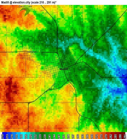
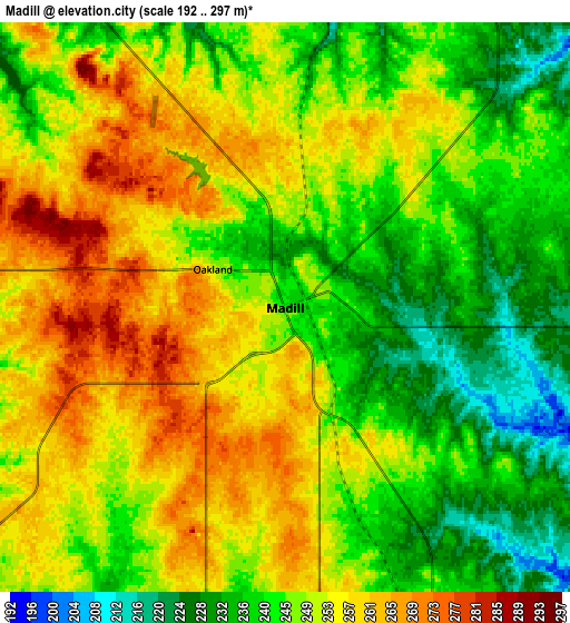
Below is the Elevation map of Madill, which displays elevation range with different colors. Scale of the first map is from 210 to 291 m (689 to 955 ft) with average elevation of 250.1 meters (=821 ft) [note 1]
These maps also provides idea of topography and contour of this city, they are displayed at different zoom levels. More info about maps, scale and edge coordinates you can find below images.
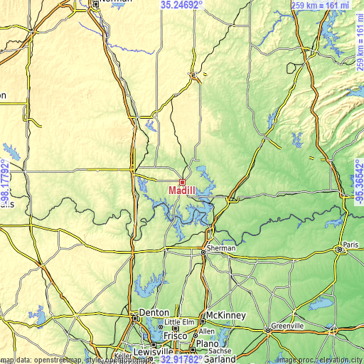
| \ | Map #1 | Map #2 | Topo.Map |
| Scale [m] | 210..291 m | 192..297 m | × |
| Scale [ft] | 689..955 ft | 630..974 ft | × |
| Average | 250.1 m = 821 ft | 248.1 m = 814 ft | × |
| Width | 8.09 km = 5 mi | 16.19 km = 10.1 mi | 259 km = 160.9 mi |
| Height | 8.09 km = 5 mi | 16.19 km = 10.1 mi | 259 km = 160.9 mi |
| ↑Max Latitude | 34.126766° | 34.163136° | 35.24692° |
| Latitude at center | 34.09038° | 34.09038° | 34.09038° |
| ↓Min Latitude | 34.053979° | 34.017562° | 32.91782° |
| ← Min Longitude | -96.815615° | -96.859561° | -98.17792° |
| Longitude center | -96.77167° | -96.77167° | -96.77167° |
| →Max Longitude | -96.727725° | -96.683779° | -95.36542° |
Nearby cities:
Cities around Madill sort by population:
• Ardmore elevation 267 m
35.5 km,  285°
285°
• Durant 199 m
38.5 km,  106°
106°
• Tishomingo 207 m
18.3 km,  27°
27°
• Marietta 262 m
36.1 km,  241°
241°
• Pottsboro 238 m
38 km,  165°
165°
• Calera 220 m
36.1 km,  118°
118°
• Preston 213 m
26.4 km,  151°
151°
• Kingston 246 m
11.3 km, 154°
• Dickson 254 m
22.4 km,  298°
298°
• Sherwood Shores 220 m
26.8 km,  189°
189°
• Colbert 205 m
36.2 km,  136°
136°
• Oakland 251 m
2.3 km, 297°
Multilingual:
 En español:
Madill elevación 244 m.
 En France:
Madill élévation 244 m.


Sources and notes:
- [note 1] Map square and city borders are not equal. Map elevation data is calculated only from area inside that square.
- [src 1] Elevation data from geonames database provided with same terms of usage.
- [src 2] The elevation map of Madill is generated using elevation data from NASA's 3 arcsec (90m) resolution SRTM data.
- [src 3] Base (background) map © OpenStreetMap contributors tiles are generated by Geofabrik and OpenTopoMap.
Copyright & License:
This Madill Elevation Map is licensed under CC BY-SA. You may reuse any part from this page, if you give a proper credit by linking to this URL:
 More info on terms of use page.