Hobart elevation
Hobart (Oklahoma, Kiowa County), United States elevation is 477 meters and Hobart elevation in feet is 1565 ft above sea level [src 1]. Hobart is a seat of a second-order administrative division (feature code) with elevation that is 198 meters (650 ft) bigger than average city elevation in United States.
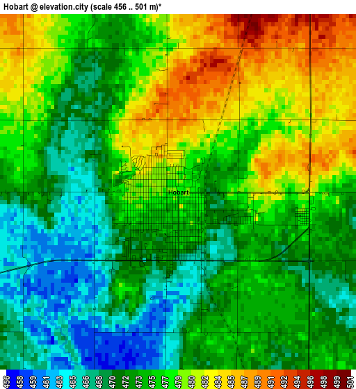
Below is the Elevation map of Hobart, which displays elevation range with different colors. Scale of the first map is from 456 to 501 m (1496 to 1644 ft) with average elevation of 475 meters (=1558 ft) [note 1]
These maps also provides idea of topography and contour of this city, they are displayed at different zoom levels. More info about maps, scale and edge coordinates you can find below images.
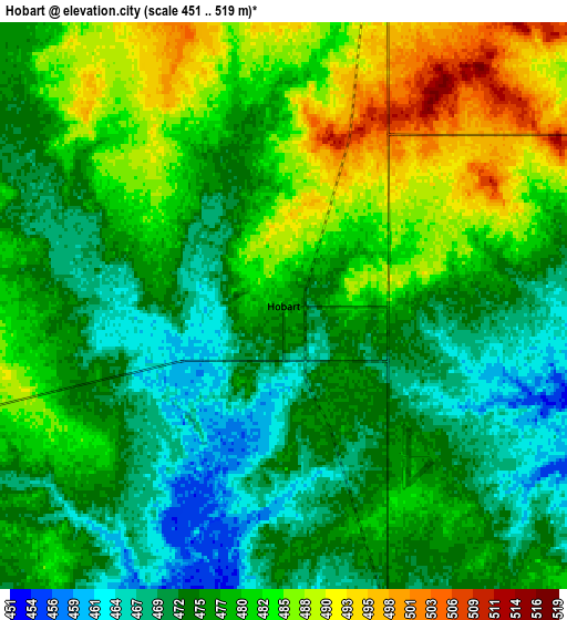
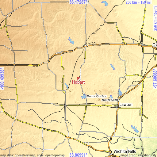
| \ | Map #1 | Map #2 | Topo.Map |
| Scale [m] | 456..501 m | 451..519 m | × |
| Scale [ft] | 1496..1644 ft | 1480..1703 ft | × |
| Average | 475 m = 1558 ft | 477.6 m = 1567 ft | × |
| Width | 8 km = 5 mi | 16 km = 9.9 mi | 256.1 km = 159.1 mi |
| Height | 8 km = 5 mi | 16 km = 9.9 mi | 256.1 km = 159.1 mi |
| ↑Max Latitude | 35.065477° | 35.101438° | 36.17287° |
| Latitude at center | 35.0295° | 35.0295° | 35.0295° |
| ↓Min Latitude | 34.993507° | 34.957499° | 33.86991° |
| ← Min Longitude | -99.137075° | -99.181021° | -100.49938° |
| Longitude center | -99.09313° | -99.09313° | -99.09313° |
| →Max Longitude | -99.049185° | -99.005239° | -97.68688° |
Nearby cities:
Cities around Hobart sort by population:
• Altus elevation 430 m
48.8 km,  206°
206°
• Elk City 590 m
51.1 km,  326°
326°
• Clinton 482 m
55.2 km,  11°
11°
• Sayre 554 m
57.6 km,  300°
300°
• Cache 392 m
61.4 km,  136°
136°
• Mangum 492 m
41.4 km,  244°
244°
• Cordell 481 m
30.6 km,  18°
18°
• Burns Flat 582 m
36.2 km,  348°
348°
• Granite 497 m
27.2 km,  254°
254°
• Carnegie 408 m
45.3 km,  79°
79°
• Snyder 417 m
43.2 km,  162°
162°
• Arapaho 509 m
62.1 km, 10°
Multilingual:
 En español:
Hobart elevación 477 m.
 En France:
Hobart élévation 477 m.


Sources and notes:
- [note 1] Map square and city borders are not equal. Map elevation data is calculated only from area inside that square.
- [src 1] Elevation data from geonames database provided with same terms of usage.
- [src 2] The elevation map of Hobart is generated using elevation data from NASA's 3 arcsec (90m) resolution SRTM data.
- [src 3] Base (background) map © OpenStreetMap contributors tiles are generated by Geofabrik and OpenTopoMap.
Copyright & License:
This Hobart Elevation Map is licensed under CC BY-SA. You may reuse any part from this page, if you give a proper credit by linking to this URL:
 More info on terms of use page.