West Jefferson elevation
West Jefferson (Ohio, Madison County), United States elevation is 279 meters and West Jefferson elevation in feet is 915 ft above sea level [src 1]. West Jefferson is a populated place (feature code) with elevation that is 0 meters (0 ft) bigger than average city elevation in United States.
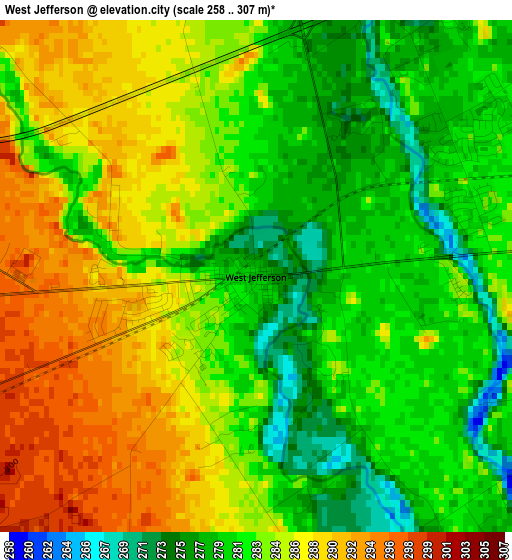
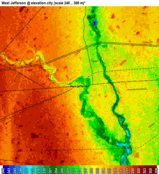
Below is the Elevation map of West Jefferson, which displays elevation range with different colors. Scale of the first map is from 258 to 307 m (846 to 1007 ft) with average elevation of 283.3 meters (=929 ft) [note 1]
These maps also provides idea of topography and contour of this city, they are displayed at different zoom levels. More info about maps, scale and edge coordinates you can find below images.
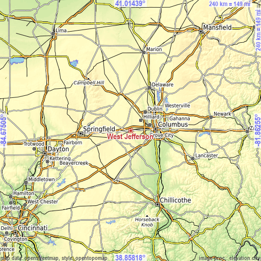
| \ | Map #1 | Map #2 | Topo.Map |
| Scale [m] | 258..307 m | 240..308 m | × |
| Scale [ft] | 846..1007 ft | 787..1010 ft | × |
| Average | 283.3 m = 929 ft | 285.8 m = 938 ft | × |
| Width | 7.49 km = 4.7 mi | 14.98 km = 9.3 mi | 239.7 km = 148.9 mi |
| Height | 7.49 km = 4.7 mi | 14.98 km = 9.3 mi | 239.7 km = 148.9 mi |
| ↑Max Latitude | 39.978463° | 40.012129° | 41.01439° |
| Latitude at center | 39.94478° | 39.94478° | 39.94478° |
| ↓Min Latitude | 39.91108° | 39.877364° | 38.85818° |
| ← Min Longitude | -83.312745° | -83.356691° | -84.67505° |
| Longitude center | -83.2688° | -83.2688° | -83.2688° |
| →Max Longitude | -83.224855° | -83.180909° | -81.86255° |
Nearby cities:
Cities around West Jefferson sort by population:
• Columbus elevation 242 m
23.1 km,  85°
85°
• Dublin 253 m
21.6 km,  37°
37°
• Grove City 258 m
16.6 km,  115°
115°
• Upper Arlington 249 m
18.4 km,  72°
72°
• Hilliard 284 m
13.6 km, 43°
• London 321 m
16.6 km,  247°
247°
• Lincoln Village 277 m
11.8 km,  84°
84°
• Grandview Heights 239 m
19.8 km, 78°
• Lake Darby 281 m
3.7 km, 67°
• Plain City 282 m
18.1 km,  0°
0°
• Choctaw Lake 320 m
18.5 km,  275°
275°
• Urbancrest 256 m
16.4 km,  108°
108°
Multilingual:
 En español:
West Jefferson elevación 279 m.
 En France:
West Jefferson élévation 279 m.
 Auf Deutsch:
West Jefferson höhe über dem Meeresspiegel ist 279 m.

Sources and notes:
- [note 1] Map square and city borders are not equal. Map elevation data is calculated only from area inside that square.
- [src 1] Elevation data from geonames database provided with same terms of usage.
- [src 2] The elevation map of West Jefferson is generated using elevation data from NASA's 3 arcsec (90m) resolution SRTM data.
- [src 3] Base (background) map © OpenStreetMap contributors tiles are generated by Geofabrik and OpenTopoMap.
Copyright & License:
This West Jefferson Elevation Map is licensed under CC BY-SA. You may reuse any part from this page, if you give a proper credit by linking to this URL:
 More info on terms of use page.