Roseville elevation
Roseville (Ohio, Muskingum County), United States elevation is 224 meters and Roseville elevation in feet is 735 ft above sea level [src 1]. Roseville is a populated place (feature code) with elevation that is 55 meters (180 ft) smaller than average city elevation in United States.
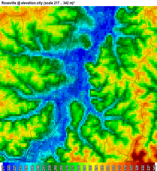
Below is the Elevation map of Roseville, which displays elevation range with different colors. Scale of the first map is from 217 to 342 m (712 to 1122 ft) with average elevation of 266.2 meters (=873 ft) [note 1]
These maps also provides idea of topography and contour of this city, they are displayed at different zoom levels. More info about maps, scale and edge coordinates you can find below images.
| \ | Map #1 | Topo.Map |
| Scale [m] | 217..342 m | × |
| Scale [ft] | 712..1122 ft | × |
| Average | 266.2 m = 873 ft | × |
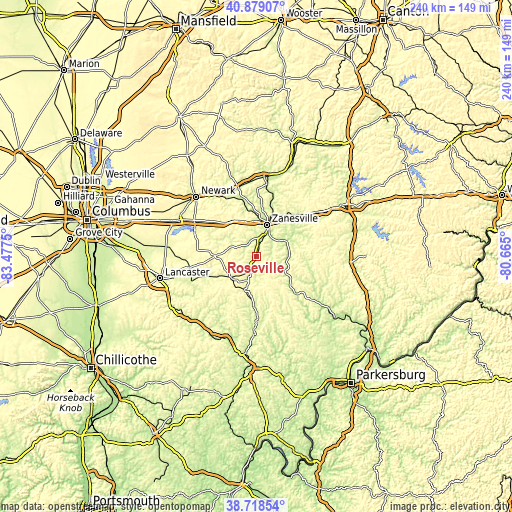
| Width | 7.51 km = 4.7 mi | 240.2 km = 149.3 mi |
| Height | 7.51 km = 4.7 mi | 240.2 km = 149.3 mi |
| ↑Max Latitude | 39.841041° | 40.87907° |
| Latitude at center | 39.80729° | 39.80729° |
| ↓Min Latitude | 39.773523° | 38.71854° |
| ← Min Longitude | -82.115195° | -83.4775° |
| Longitude center | -82.07125° | -82.07125° |
| →Max Longitude | -82.027305° | -80.665° |
Nearby cities:
Cities around Roseville sort by population:
• Zanesville elevation 207 m
15.6 km,  18°
18°
• New Lexington 293 m
15.7 km,  228°
228°
• North Zanesville 272 m
19.9 km, 16°
• Crooksville 239 m
4.6 km,  202°
202°
• South Zanesville 221 m
11.6 km,  28°
28°
• Glouster 221 m
33.8 km,  181°
181°
• McConnelsville 212 m
25.7 km,  133°
133°
• Pleasant Grove 288 m
18.7 km, 30°
• Harbor Hills 282 m
34.2 km,  294°
294°
• Somerset 330 m
19.3 km,  269°
269°
• Bremen 240 m
32.6 km,  248°
248°
• Thornport 270 m
31.3 km, 292°
Multilingual:
 En español:
Roseville elevación 224 m.
 En France:
Roseville élévation 224 m.
 Auf Deutsch:
Roseville höhe über dem Meeresspiegel ist 224 m.

Sources and notes:
- [note 1] Map square and city borders are not equal. Map elevation data is calculated only from area inside that square.
- [src 1] Elevation data from geonames database provided with same terms of usage.
- [src 2] The elevation map of Roseville is generated using elevation data from NASA's 3 arcsec (90m) resolution SRTM data.
- [src 3] Base (background) map © OpenStreetMap contributors tiles are generated by Geofabrik and OpenTopoMap.
Copyright & License:
This Roseville Elevation Map is licensed under CC BY-SA. You may reuse any part from this page, if you give a proper credit by linking to this URL:
 More info on terms of use page.