Milford elevation
Milford (Ohio, Clermont County), United States elevation is 179 meters and Milford elevation in feet is 587 ft above sea level [src 1]. Milford is a populated place (feature code) with elevation that is 100 meters (328 ft) smaller than average city elevation in United States.
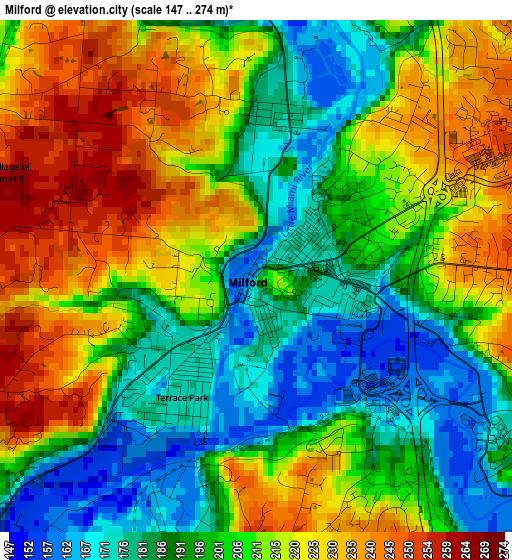
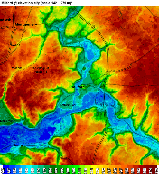
Below is the Elevation map of Milford, which displays elevation range with different colors. Scale of the first map is from 147 to 274 m (482 to 899 ft) with average elevation of 205.5 meters (=674 ft) [note 1]
These maps also provides idea of topography and contour of this city, they are displayed at different zoom levels. More info about maps, scale and edge coordinates you can find below images.
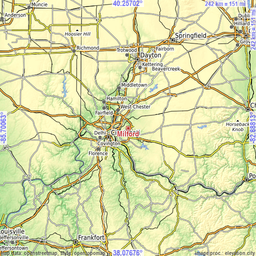
| \ | Map #1 | Map #2 | Topo.Map |
| Scale [m] | 147..274 m | 142..279 m | × |
| Scale [ft] | 482..899 ft | 466..915 ft | × |
| Average | 205.5 m = 674 ft | 224.2 m = 736 ft | × |
| Width | 7.58 km = 4.7 mi | 15.15 km = 9.4 mi | 242.4 km = 150.6 mi |
| Height | 7.58 km = 4.7 mi | 15.15 km = 9.4 mi | 242.4 km = 150.6 mi |
| ↑Max Latitude | 39.209399° | 39.243441° | 40.25702° |
| Latitude at center | 39.17534° | 39.17534° | 39.17534° |
| ↓Min Latitude | 39.141265° | 39.107173° | 38.07676° |
| ← Min Longitude | -84.338325° | -84.382271° | -85.70063° |
| Longitude center | -84.29438° | -84.29438° | -84.29438° |
| →Max Longitude | -84.250435° | -84.206489° | -82.88813° |
Nearby cities:
Cities around Milford sort by population:
• Montgomery elevation 243 m
7.8 km,  318°
318°
• Madeira 234 m
6.2 km,  286°
286°
• Kenwood 247 m
7.4 km,  302°
302°
• The Village of Indian Hill 250 m
3.5 km,  277°
277°
• Summerside 268 m
7.9 km,  176°
176°
• Mount Carmel 269 m
7.8 km,  186°
186°
• Mount Repose 263 m
6.7 km,  65°
65°
• Mariemont 181 m
7.7 km,  243°
243°
• Mulberry 257 m
4.9 km, 65°
• Newtown 154 m
8.1 km,  225°
225°
• Day Heights 267 m
5.9 km,  91°
91°
• Terrace Park 176 m
2.1 km,  211°
211°
Multilingual:
 En español:
Milford elevación 179 m.
 En France:
Milford élévation 179 m.


Sources and notes:
- [note 1] Map square and city borders are not equal. Map elevation data is calculated only from area inside that square.
- [src 1] Elevation data from geonames database provided with same terms of usage.
- [src 2] The elevation map of Milford is generated using elevation data from NASA's 3 arcsec (90m) resolution SRTM data.
- [src 3] Base (background) map © OpenStreetMap contributors tiles are generated by Geofabrik and OpenTopoMap.
Copyright & License:
This Milford Elevation Map is licensed under CC BY-SA. You may reuse any part from this page, if you give a proper credit by linking to this URL:
 More info on terms of use page.