Montgomery elevation
Montgomery (Ohio, Hamilton County), United States elevation is 243 meters and Montgomery elevation in feet is 797 ft above sea level [src 1]. Montgomery is a populated place (feature code) with elevation that is 36 meters (118 ft) smaller than average city elevation in United States.
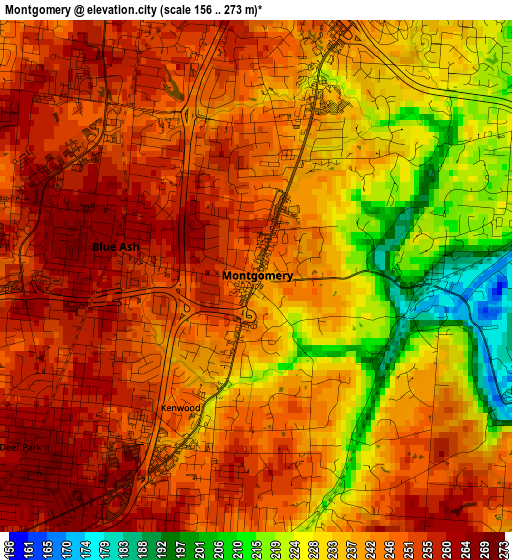
Below is the Elevation map of Montgomery, which displays elevation range with different colors. Scale of the first map is from 156 to 273 m (512 to 896 ft) with average elevation of 241 meters (=791 ft) [note 1]
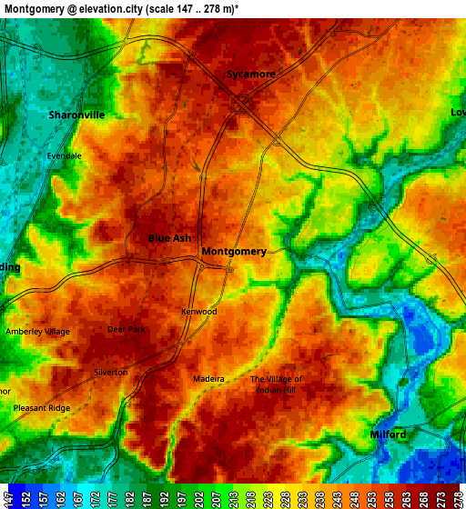
These maps also provides idea of topography and contour of this city, they are displayed at different zoom levels. More info about maps, scale and edge coordinates you can find below images.
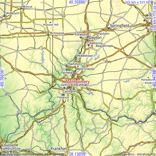
| \ | Map #1 | Map #2 | Topo.Map |
| Scale [m] | 156..273 m | 147..278 m | × |
| Scale [ft] | 512..896 ft | 482..912 ft | × |
| Average | 241 m = 791 ft | 228.1 m = 748 ft | × |
| Width | 7.57 km = 4.7 mi | 15.14 km = 9.4 mi | 242.2 km = 150.5 mi |
| Height | 7.57 km = 4.7 mi | 15.14 km = 9.4 mi | 242.2 km = 150.5 mi |
| ↑Max Latitude | 39.262143° | 39.29616° | 40.30896° |
| Latitude at center | 39.22811° | 39.22811° | 39.22811° |
| ↓Min Latitude | 39.19406° | 39.159994° | 38.13035° |
| ← Min Longitude | -84.398055° | -84.442001° | -85.76036° |
| Longitude center | -84.35411° | -84.35411° | -84.35411° |
| →Max Longitude | -84.310165° | -84.266219° | -82.94786° |
Nearby cities:
Cities around Montgomery sort by population:
• Sharonville elevation 178 m
6.8 km,  311°
311°
• Blue Ash 260 m
2.1 km,  281°
281°
• Madeira 234 m
4.2 km,  191°
191°
• Kenwood 247 m
2.2 km,  210°
210°
• The Village of Indian Hill 250 m
5.6 km,  163°
163°
• Deer Park 266 m
4.3 km,  234°
234°
• Silverton 260 m
5.6 km, 225°
• Dillonvale 245 m
4.3 km,  254°
254°
• Sixteen Mile Stand 246 m
5.5 km,  24°
24°
• Evendale 179 m
6.3 km,  299°
299°
• Rossmoyne 257 m
3.2 km,  240°
240°
• Highpoint 268 m
6.7 km,  2°
2°
Multilingual:
 En español:
Montgomery elevación 243 m.
 En France:
Montgomery élévation 243 m.
 Auf Deutsch:
Montgomery höhe über dem Meeresspiegel ist 243 m.

Sources and notes:
- [note 1] Map square and city borders are not equal. Map elevation data is calculated only from area inside that square.
- [src 1] Elevation data from geonames database provided with same terms of usage.
- [src 2] The elevation map of Montgomery is generated using elevation data from NASA's 3 arcsec (90m) resolution SRTM data.
- [src 3] Base (background) map © OpenStreetMap contributors tiles are generated by Geofabrik and OpenTopoMap.
Copyright & License:
This Montgomery Elevation Map is licensed under CC BY-SA. You may reuse any part from this page, if you give a proper credit by linking to this URL:
 More info on terms of use page.