Eaton elevation
Eaton (Ohio, Preble County), United States elevation is 318 meters and Eaton elevation in feet is 1043 ft above sea level [src 1]. Eaton is a seat of a second-order administrative division (feature code) with elevation that is 39 meters (128 ft) bigger than average city elevation in United States.
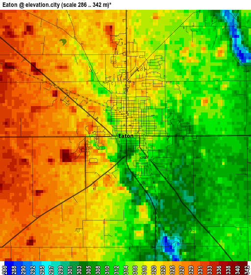
Below is the Elevation map of Eaton, which displays elevation range with different colors. Scale of the first map is from 286 to 342 m (938 to 1122 ft) with average elevation of 318.2 meters (=1044 ft) [note 1]
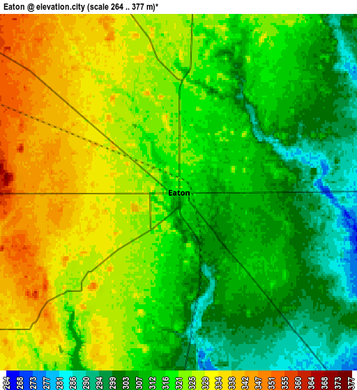
These maps also provides idea of topography and contour of this city, they are displayed at different zoom levels. More info about maps, scale and edge coordinates you can find below images.
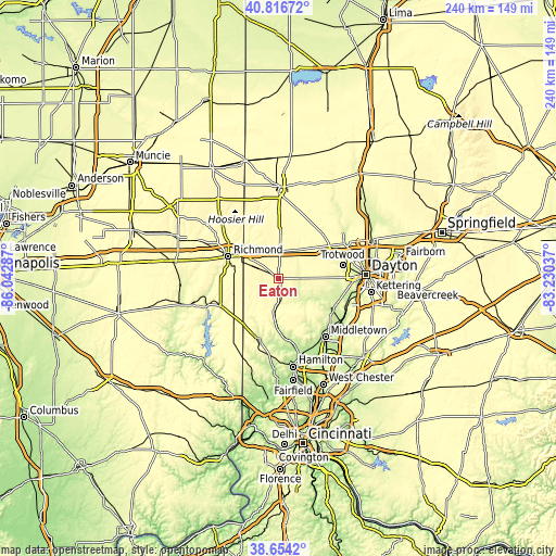
| \ | Map #1 | Map #2 | Topo.Map |
| Scale [m] | 286..342 m | 264..377 m | × |
| Scale [ft] | 938..1122 ft | 866..1237 ft | × |
| Average | 318.2 m = 1044 ft | 317.8 m = 1043 ft | × |
| Width | 7.51 km = 4.7 mi | 15.03 km = 9.3 mi | 240.4 km = 149.4 mi |
| Height | 7.51 km = 4.7 mi | 15.03 km = 9.3 mi | 240.4 km = 149.4 mi |
| ↑Max Latitude | 39.777722° | 39.811487° | 40.81672° |
| Latitude at center | 39.74394° | 39.74394° | 39.74394° |
| ↓Min Latitude | 39.710142° | 39.676327° | 38.6542° |
| ← Min Longitude | -84.680565° | -84.724511° | -86.04287° |
| Longitude center | -84.63662° | -84.63662° | -84.63662° |
| →Max Longitude | -84.592675° | -84.548729° | -83.23037° |
Nearby cities:
Cities around Eaton sort by population:
• Richmond elevation 300 m
23.6 km,  293°
293°
• Oxford 280 m
27.9 km,  199°
199°
• Clayton 305 m
27.1 km,  60°
60°
• Brookville 313 m
21.8 km, 61°
• Germantown 220 m
26.4 km,  119°
119°
• New Lebanon 276 m
21.5 km,  89°
89°
• Lake Lakengren 331 m
7.9 km,  218°
218°
• Camden 256 m
12.8 km,  184°
184°
• Lewisburg 302 m
14.1 km,  36°
36°
• New Paris 315 m
18.4 km,  313°
313°
• West Alexandria 274 m
8.9 km, 89°
• Farmersville 266 m
19.1 km,  111°
111°
Multilingual:
 En español:
Eaton elevación 318 m.
 En France:
Eaton élévation 318 m.


Sources and notes:
- [note 1] Map square and city borders are not equal. Map elevation data is calculated only from area inside that square.
- [src 1] Elevation data from geonames database provided with same terms of usage.
- [src 2] The elevation map of Eaton is generated using elevation data from NASA's 3 arcsec (90m) resolution SRTM data.
- [src 3] Base (background) map © OpenStreetMap contributors tiles are generated by Geofabrik and OpenTopoMap.
Copyright & License:
This Eaton Elevation Map is licensed under CC BY-SA. You may reuse any part from this page, if you give a proper credit by linking to this URL:
 More info on terms of use page.