Farmersville elevation
Farmersville (Ohio, Montgomery County), United States elevation is 266 meters and Farmersville elevation in feet is 873 ft above sea level [src 1]. Farmersville is a populated place (feature code) with elevation that is 13 meters (43 ft) smaller than average city elevation in United States.
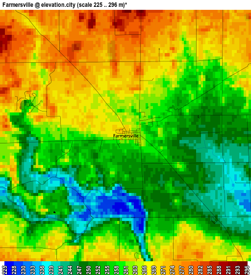
Below is the Elevation map of Farmersville, which displays elevation range with different colors. Scale of the first map is from 225 to 296 m (738 to 971 ft) with average elevation of 260.4 meters (=854 ft) [note 1]
These maps also provides idea of topography and contour of this city, they are displayed at different zoom levels. More info about maps, scale and edge coordinates you can find below images.
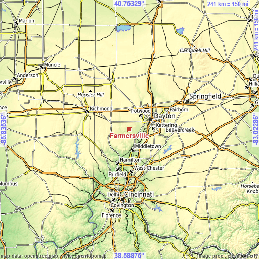
| \ | Map #1 | Topo.Map |
| Scale [m] | 225..296 m | × |
| Scale [ft] | 738..971 ft | × |
| Average | 260.4 m = 854 ft | × |
| Width | 7.52 km = 4.7 mi | 240.7 km = 149.6 mi |
| Height | 7.52 km = 4.7 mi | 240.7 km = 149.6 mi |
| ↑Max Latitude | 39.713313° | 40.75329° |
| Latitude at center | 39.6795° | 39.6795° |
| ↓Min Latitude | 39.64567° | 38.58875° |
| ← Min Longitude | -84.473055° | -85.83536° |
| Longitude center | -84.42911° | -84.42911° |
| →Max Longitude | -84.385165° | -83.02286° |
Nearby cities:
Cities around Farmersville sort by population:
• Middletown elevation 200 m
18.5 km,  171°
171°
• Trotwood 255 m
16.5 km,  37°
37°
• Miamisburg 215 m
12.9 km,  108°
108°
• West Carrollton City 219 m
15.2 km,  93°
93°
• Franklin 208 m
17.2 km,  141°
141°
• Moraine 226 m
18.2 km,  80°
80°
• Brookville 313 m
17.5 km,  4°
4°
• Germantown 220 m
7.8 km, 139°
• Carlisle 211 m
14.3 km, 139°
• New Lebanon 276 m
8.2 km,  27°
27°
• Drexel 289 m
14.3 km,  58°
58°
• West Alexandria 274 m
11.4 km,  309°
309°
Multilingual:
 En español:
Farmersville elevación 266 m.
 En France:
Farmersville élévation 266 m.
 Auf Deutsch:
Farmersville höhe über dem Meeresspiegel ist 266 m.

Sources and notes:
- [note 1] Map square and city borders are not equal. Map elevation data is calculated only from area inside that square.
- [src 1] Elevation data from geonames database provided with same terms of usage.
- [src 2] The elevation map of Farmersville is generated using elevation data from NASA's 3 arcsec (90m) resolution SRTM data.
- [src 3] Base (background) map © OpenStreetMap contributors tiles are generated by Geofabrik and OpenTopoMap.
Copyright & License:
This Farmersville Elevation Map is licensed under CC BY-SA. You may reuse any part from this page, if you give a proper credit by linking to this URL:
 More info on terms of use page.