Tyro elevation
Tyro (North Carolina, Davidson County), United States elevation is 254 meters and Tyro elevation in feet is 833 ft above sea level [src 1]. Tyro is a populated place (feature code) with elevation that is 25 meters (82 ft) smaller than average city elevation in United States.
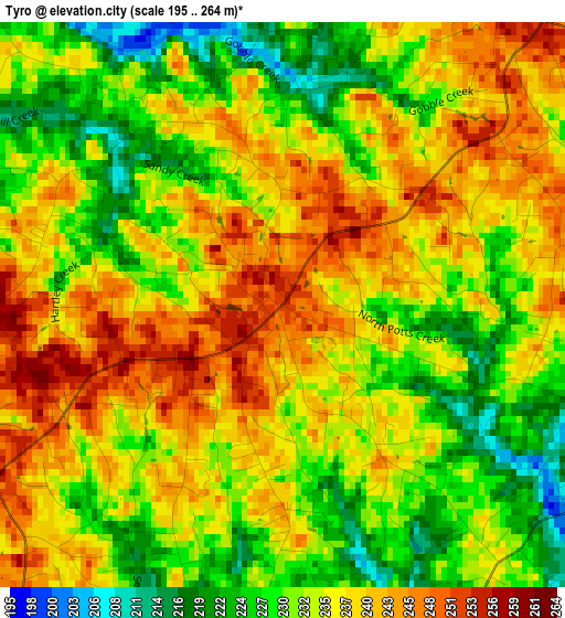
Below is the Elevation map of Tyro, which displays elevation range with different colors. Scale of the first map is from 195 to 264 m (640 to 866 ft) with average elevation of 234.8 meters (=770 ft) [note 1]
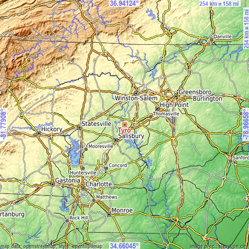
These maps also provides idea of topography and contour of this city, they are displayed at different zoom levels. More info about maps, scale and edge coordinates you can find below images.
| \ | Map #1 | Map #2 | Topo.Map |
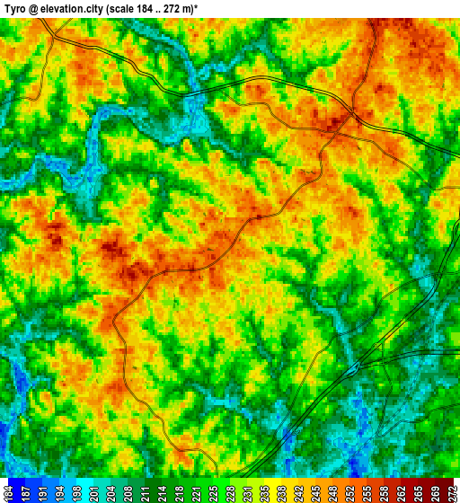
| Scale [m] | 195..264 m | 184..272 m | × |
| Scale [ft] | 640..866 ft | 604..892 ft | × |
| Average | 234.8 m = 770 ft | 227.8 m = 747 ft | × |
| Width | 7.93 km = 4.9 mi | 15.85 km = 9.8 mi | 253.6 km = 157.6 mi |
| Height | 7.93 km = 4.9 mi | 15.85 km = 9.8 mi | 253.6 km = 157.6 mi |
| ↑Max Latitude | 35.84466° | 35.880275° | 36.94124° |
| Latitude at center | 35.80903° | 35.80903° | 35.80903° |
| ↓Min Latitude | 35.773384° | 35.737721° | 34.66045° |
| ← Min Longitude | -80.416775° | -80.460721° | -81.77908° |
| Longitude center | -80.37283° | -80.37283° | -80.37283° |
| →Max Longitude | -80.328885° | -80.284939° | -78.96658° |
Nearby cities:
Cities around Tyro sort by population:
• Salisbury elevation 236 m
17.9 km,  210°
210°
• Lexington 247 m
10.9 km,  81°
81°
• Mocksville 262 m
19.4 km,  299°
299°
• Midway 271 m
21.3 km,  40°
40°
• Welcome 262 m
14.8 km, 44°
• Franklin 240 m
15 km,  229°
229°
• Spencer 218 m
14.1 km,  203°
203°
• Granite Quarry 243 m
22.9 km, 196°
• Bermuda Run 244 m
22.1 km,  348°
348°
• East Spencer 218 m
15.1 km, 200°
• Southmont 210 m
18.4 km,  148°
148°
• Advance 252 m
15.1 km, 347°
Multilingual:
 En español:
Tyro elevación 254 m.
 En France:
Tyro élévation 254 m.


Sources and notes:
- [note 1] Map square and city borders are not equal. Map elevation data is calculated only from area inside that square.
- [src 1] Elevation data from geonames database provided with same terms of usage.
- [src 2] The elevation map of Tyro is generated using elevation data from NASA's 3 arcsec (90m) resolution SRTM data.
- [src 3] Base (background) map © OpenStreetMap contributors tiles are generated by Geofabrik and OpenTopoMap.
Copyright & License:
This Tyro Elevation Map is licensed under CC BY-SA. You may reuse any part from this page, if you give a proper credit by linking to this URL:
 More info on terms of use page.