Franklin elevation
Franklin (North Carolina, Rowan County), United States elevation is 240 meters and Franklin elevation in feet is 787 ft above sea level [src 1]. Franklin is a populated place (feature code) with elevation that is 39 meters (128 ft) smaller than average city elevation in United States.
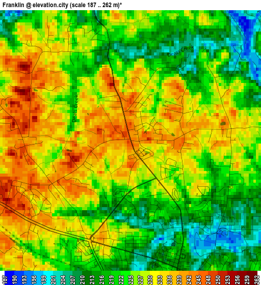
Below is the Elevation map of Franklin, which displays elevation range with different colors. Scale of the first map is from 187 to 262 m (614 to 860 ft) with average elevation of 226 meters (=741 ft) [note 1]
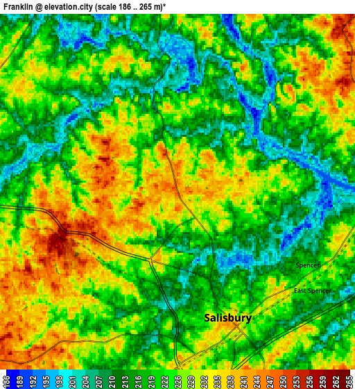
These maps also provides idea of topography and contour of this city, they are displayed at different zoom levels. More info about maps, scale and edge coordinates you can find below images.
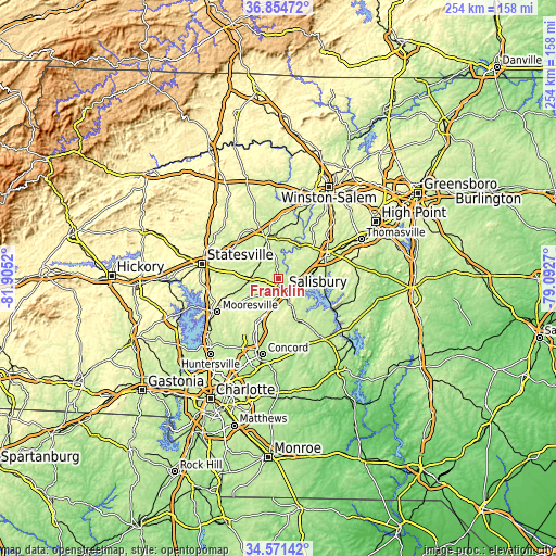
| \ | Map #1 | Map #2 | Topo.Map |
| Scale [m] | 187..262 m | 186..265 m | × |
| Scale [ft] | 614..860 ft | 610..869 ft | × |
| Average | 226 m = 741 ft | 222.9 m = 731 ft | × |
| Width | 7.93 km = 4.9 mi | 15.87 km = 9.9 mi | 253.9 km = 157.8 mi |
| Height | 7.93 km = 4.9 mi | 15.87 km = 9.9 mi | 253.9 km = 157.8 mi |
| ↑Max Latitude | 35.75692° | 35.792574° | 36.85472° |
| Latitude at center | 35.72125° | 35.72125° | 35.72125° |
| ↓Min Latitude | 35.685564° | 35.649863° | 34.57142° |
| ← Min Longitude | -80.542895° | -80.586841° | -81.9052° |
| Longitude center | -80.49895° | -80.49895° | -80.49895° |
| →Max Longitude | -80.455005° | -80.411059° | -79.0927° |
Nearby cities:
Cities around Franklin sort by population:
• Salisbury elevation 236 m
6 km,  158°
158°
• Lexington 247 m
24.9 km,  62°
62°
• Mocksville 262 m
20 km,  343°
343°
• China Grove 251 m
18.5 km,  203°
203°
• Tyro 254 m
15 km,  49°
49°
• Spencer 218 m
6.6 km,  119°
119°
• Landis 266 m
22 km,  207°
207°
• Granite Quarry 243 m
13 km, 158°
• Rockwell 238 m
20.7 km, 156°
• East Spencer 218 m
7.4 km,  126°
126°
• Southmont 210 m
21.8 km,  105°
105°
• Advance 252 m
25.8 km,  18°
18°
Multilingual:
 En español:
Franklin elevación 240 m.
 En France:
Franklin élévation 240 m.
 Auf Deutsch:
Franklin höhe über dem Meeresspiegel ist 240 m.

Sources and notes:
- [note 1] Map square and city borders are not equal. Map elevation data is calculated only from area inside that square.
- [src 1] Elevation data from geonames database provided with same terms of usage.
- [src 2] The elevation map of Franklin is generated using elevation data from NASA's 3 arcsec (90m) resolution SRTM data.
- [src 3] Base (background) map © OpenStreetMap contributors tiles are generated by Geofabrik and OpenTopoMap.
Copyright & License:
This Franklin Elevation Map is licensed under CC BY-SA. You may reuse any part from this page, if you give a proper credit by linking to this URL:
 More info on terms of use page.