Lexington elevation
Lexington (North Carolina, Davidson County), United States elevation is 247 meters and Lexington elevation in feet is 810 ft above sea level [src 1]. Lexington is a seat of a second-order administrative division (feature code) with elevation that is 32 meters (105 ft) smaller than average city elevation in United States.
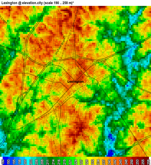
Below is the Elevation map of Lexington, which displays elevation range with different colors. Scale of the first map is from 190 to 258 m (623 to 846 ft) with average elevation of 227.8 meters (=747 ft) [note 1]
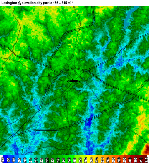
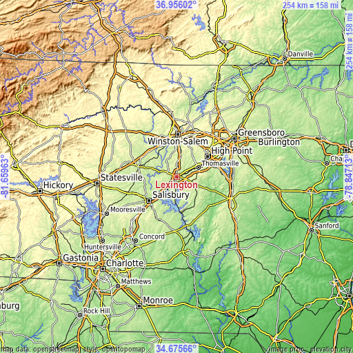
These maps also provides idea of topography and contour of this city, they are displayed at different zoom levels. More info about maps, scale and edge coordinates you can find below images.
| \ | Map #1 | Map #2 | Topo.Map |
| Scale [m] | 190..258 m | 186..315 m | × |
| Scale [ft] | 623..846 ft | 610..1033 ft | × |
| Average | 227.8 m = 747 ft | 230.7 m = 757 ft | × |
| Width | 7.92 km = 4.9 mi | 15.85 km = 9.8 mi | 253.6 km = 157.6 mi |
| Height | 7.92 km = 4.9 mi | 15.85 km = 9.8 mi | 253.6 km = 157.6 mi |
| ↑Max Latitude | 35.859654° | 35.895261° | 36.95602° |
| Latitude at center | 35.82403° | 35.82403° | 35.82403° |
| ↓Min Latitude | 35.78839° | 35.752735° | 34.67566° |
| ← Min Longitude | -80.297325° | -80.341271° | -81.65963° |
| Longitude center | -80.25338° | -80.25338° | -80.25338° |
| →Max Longitude | -80.209435° | -80.165489° | -78.84713° |
Nearby cities:
Cities around Lexington sort by population:
• Thomasville elevation 260 m
16.8 km,  67°
67°
• Clemmons 255 m
24.8 km,  332°
332°
• Trinity 244 m
24.9 km, 71°
• Midway 271 m
14.7 km,  12°
12°
• Welcome 262 m
8.8 km,  357°
357°
• Tyro 254 m
10.9 km,  261°
261°
• Spencer 218 m
22 km,  228°
228°
• Wallburg 283 m
23.1 km,  26°
26°
• Denton 211 m
24.6 km,  149°
149°
• East Spencer 218 m
22.6 km, 225°
• Southmont 210 m
17.4 km,  184°
184°
• Advance 252 m
19.2 km,  312°
312°
Multilingual:
 En español:
Lexington elevación 247 m.
 En France:
Lexington élévation 247 m.
 Auf Deutsch:
Lexington höhe über dem Meeresspiegel ist 247 m.

Sources and notes:
- [note 1] Map square and city borders are not equal. Map elevation data is calculated only from area inside that square.
- [src 1] Elevation data from geonames database provided with same terms of usage.
- [src 2] The elevation map of Lexington is generated using elevation data from NASA's 3 arcsec (90m) resolution SRTM data.
- [src 3] Base (background) map © OpenStreetMap contributors tiles are generated by Geofabrik and OpenTopoMap.
Copyright & License:
This Lexington Elevation Map is licensed under CC BY-SA. You may reuse any part from this page, if you give a proper credit by linking to this URL:
 More info on terms of use page.