High Point elevation
High Point (North Carolina, Guilford County), United States elevation is 289 meters and High Point elevation in feet is 948 ft above sea level [src 1]. High Point is a populated place (feature code) with elevation that is 10 meters (33 ft) bigger than average city elevation in United States.
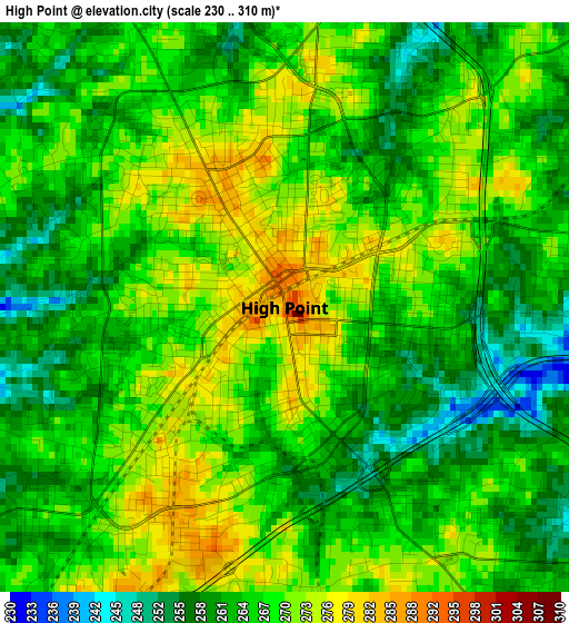
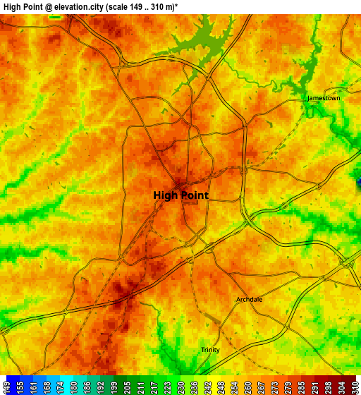
Below is the Elevation map of High Point, which displays elevation range with different colors. Scale of the first map is from 230 to 310 m (755 to 1017 ft) with average elevation of 266 meters (=873 ft) [note 1]
These maps also provides idea of topography and contour of this city, they are displayed at different zoom levels. More info about maps, scale and edge coordinates you can find below images.
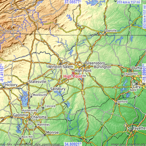
| \ | Map #1 | Map #2 | Topo.Map |
| Scale [m] | 230..310 m | 149..310 m | × |
| Scale [ft] | 755..1017 ft | 489..1017 ft | × |
| Average | 266 m = 873 ft | 256.5 m = 842 ft | × |
| Width | 7.91 km = 4.9 mi | 15.82 km = 9.8 mi | 253.1 km = 157.3 mi |
| Height | 7.91 km = 4.9 mi | 15.82 km = 9.8 mi | 253.1 km = 157.3 mi |
| ↑Max Latitude | 35.991254° | 36.026803° | 37.08577° |
| Latitude at center | 35.95569° | 35.95569° | 35.95569° |
| ↓Min Latitude | 35.92011° | 35.884513° | 34.80921° |
| ← Min Longitude | -80.049265° | -80.093211° | -81.41157° |
| Longitude center | -80.00532° | -80.00532° | -80.00532° |
| →Max Longitude | -79.961375° | -79.917429° | -78.59907° |
Nearby cities:
Cities around High Point sort by population:
• Greensboro elevation 260 m
23.2 km,  55°
55°
• Thomasville 260 m
10.7 km,  220°
220°
• Kernersville 307 m
19.3 km,  341°
341°
• Archdale 265 m
5.5 km,  146°
146°
• Oak Ridge 284 m
24.3 km,  3°
3°
• Trinity 244 m
6.9 km,  169°
169°
• Midway 271 m
19.2 km,  269°
269°
• Pleasant Garden 261 m
21.9 km,  88°
88°
• Welcome 262 m
23.4 km,  255°
255°
• Randleman 209 m
23.8 km,  130°
130°
• Jamestown 239 m
7.6 km, 55°
• Wallburg 283 m
13.5 km,  296°
296°
Multilingual:
 En español:
High Point elevación 289 m.
 En France:
High Point élévation 289 m.
 Auf Deutsch:
High Point höhe über dem Meeresspiegel ist 289 m.

Sources and notes:
- [note 1] Map square and city borders are not equal. Map elevation data is calculated only from area inside that square.
- [src 1] Elevation data from geonames database provided with same terms of usage.
- [src 2] The elevation map of High Point is generated using elevation data from NASA's 3 arcsec (90m) resolution SRTM data.
- [src 3] Base (background) map © OpenStreetMap contributors tiles are generated by Geofabrik and OpenTopoMap.
Copyright & License:
This High Point Elevation Map is licensed under CC BY-SA. You may reuse any part from this page, if you give a proper credit by linking to this URL:
 More info on terms of use page.