Calhoun City elevation
Calhoun City (Mississippi, Calhoun County), United States elevation is 87 meters and Calhoun City elevation in feet is 285 ft above sea level [src 1]. Calhoun City is a populated place (feature code) with elevation that is 192 meters (630 ft) smaller than average city elevation in United States.
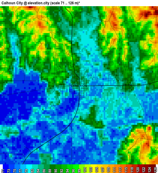
Below is the Elevation map of Calhoun City, which displays elevation range with different colors. Scale of the first map is from 71 to 126 m (233 to 413 ft) with average elevation of 86.5 meters (=284 ft) [note 1]
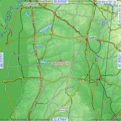
These maps also provides idea of topography and contour of this city, they are displayed at different zoom levels. More info about maps, scale and edge coordinates you can find below images.
| \ | Map #1 | Topo.Map |
| Scale [m] | 71..126 m | × |
| Scale [ft] | 233..413 ft | × |
| Average | 86.5 m = 284 ft | × |
| Width | 8.12 km = 5 mi | 259.7 km = 161.4 mi |
| Height | 8.12 km = 5 mi | 259.7 km = 161.4 mi |
| ↑Max Latitude | 33.891876° | 35.01518° |
| Latitude at center | 33.85539° | 33.85539° |
| ↓Min Latitude | 33.818888° | 32.67964° |
| ← Min Longitude | -89.355405° | -90.71771° |
| Longitude center | -89.31146° | -89.31146° |
| →Max Longitude | -89.267515° | -87.90521° |
Nearby cities:
Cities around Calhoun City sort by population:
• Grenada elevation 67 m
46.9 km,  258°
258°
• Pontotoc 154 m
52.3 km,  33°
33°
• Houston 109 m
29.2 km,  80°
80°
• Water Valley 90 m
44.2 km,  318°
318°
• Okolona 104 m
53.8 km,  72°
72°
• Eupora 119 m
35.2 km,  173°
173°
• Bruce 85 m
15.6 km,  347°
347°
• Vardaman 85 m
12.6 km, 79°
• Duck Hill 75 m
44.5 km,  236°
236°
• Derma 91 m
2.5 km,  89°
89°
• Pittsboro 120 m
9.8 km, 345°
• Walthall 145 m
27.8 km, 173°
Multilingual:
 En español:
Calhoun City elevación 87 m.
 En France:
Calhoun City élévation 87 m.
 Auf Deutsch:
Calhoun City höhe über dem Meeresspiegel ist 87 m.

Sources and notes:
- [note 1] Map square and city borders are not equal. Map elevation data is calculated only from area inside that square.
- [src 1] Elevation data from geonames database provided with same terms of usage.
- [src 2] The elevation map of Calhoun City is generated using elevation data from NASA's 3 arcsec (90m) resolution SRTM data.
- [src 3] Base (background) map © OpenStreetMap contributors tiles are generated by Geofabrik and OpenTopoMap.
Copyright & License:
This Calhoun City Elevation Map is licensed under CC BY-SA. You may reuse any part from this page, if you give a proper credit by linking to this URL:
 More info on terms of use page.