Slater elevation
Slater (Missouri, Saline County), United States elevation is 266 meters and Slater elevation in feet is 873 ft above sea level [src 1]. Slater is a populated place (feature code) with elevation that is 13 meters (43 ft) smaller than average city elevation in United States.
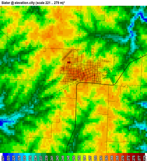
Below is the Elevation map of Slater, which displays elevation range with different colors. Scale of the first map is from 221 to 279 m (725 to 915 ft) with average elevation of 250 meters (=820 ft) [note 1]
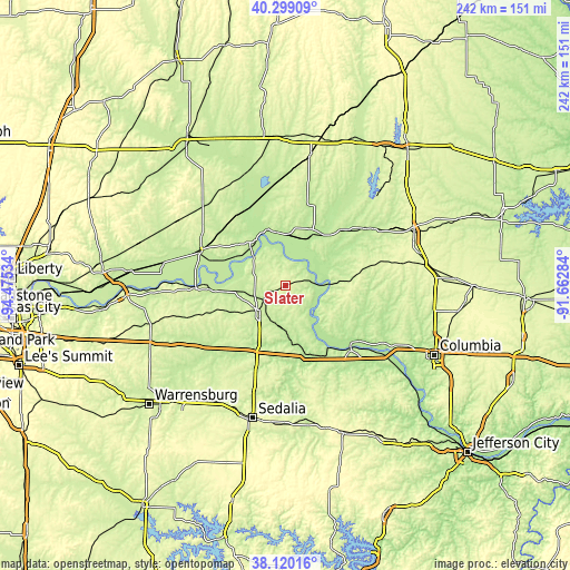
These maps also provides idea of topography and contour of this city, they are displayed at different zoom levels. More info about maps, scale and edge coordinates you can find below images.
| \ | Map #1 | Topo.Map |
| Scale [m] | 221..279 m | × |
| Scale [ft] | 725..915 ft | × |
| Average | 250 m = 820 ft | × |
| Width | 7.57 km = 4.7 mi | 242.3 km = 150.6 mi |
| Height | 7.57 km = 4.7 mi | 242.3 km = 150.6 mi |
| ↑Max Latitude | 39.252118° | 40.29909° |
| Latitude at center | 39.21808° | 39.21808° |
| ↓Min Latitude | 39.184025° | 38.12016° |
| ← Min Longitude | -93.113035° | -94.47534° |
| Longitude center | -93.06909° | -93.06909° |
| →Max Longitude | -93.025145° | -91.66284° |
Nearby cities:
Cities around Slater sort by population:
• Marshall elevation 239 m
15.3 km,  226°
226°
• Boonville 210 m
39.1 km,  134°
134°
• Carrollton 232 m
39.9 km,  293°
293°
• Fayette 217 m
34.2 km,  103°
103°
• Concordia 243 m
50.4 km,  238°
238°
• Marceline 266 m
55.9 km,  10°
10°
• Salisbury 229 m
32.5 km,  45°
45°
• Huntsville 245 m
51.4 km,  61°
61°
• Sweet Springs 223 m
41.1 km, 226°
• Glasgow 203 m
19.2 km,  86°
86°
• New Franklin 202 m
36.3 km, 127°
• Keytesville 221 m
26.6 km,  25°
25°
Multilingual:
 En español:
Slater elevación 266 m.
 En France:
Slater élévation 266 m.


Sources and notes:
- [note 1] Map square and city borders are not equal. Map elevation data is calculated only from area inside that square.
- [src 1] Elevation data from geonames database provided with same terms of usage.
- [src 2] The elevation map of Slater is generated using elevation data from NASA's 3 arcsec (90m) resolution SRTM data.
- [src 3] Base (background) map © OpenStreetMap contributors tiles are generated by Geofabrik and OpenTopoMap.
Copyright & License:
This Slater Elevation Map is licensed under CC BY-SA. You may reuse any part from this page, if you give a proper credit by linking to this URL:
 More info on terms of use page.