Lexington elevation
Lexington (Missouri, Lafayette County), United States elevation is 262 meters and Lexington elevation in feet is 860 ft above sea level [src 1]. Lexington is a seat of a second-order administrative division (feature code) with elevation that is 17 meters (56 ft) smaller than average city elevation in United States.
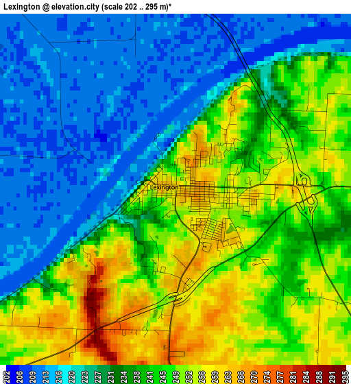
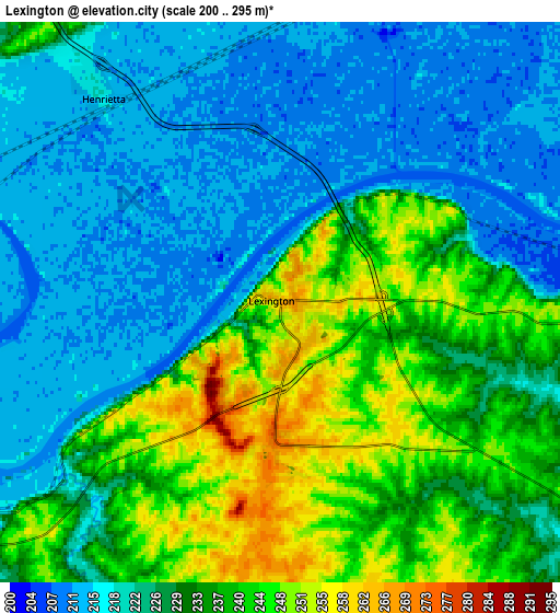
Below is the Elevation map of Lexington, which displays elevation range with different colors. Scale of the first map is from 202 to 295 m (663 to 968 ft) with average elevation of 236.7 meters (=777 ft) [note 1]
These maps also provides idea of topography and contour of this city, they are displayed at different zoom levels. More info about maps, scale and edge coordinates you can find below images.
| \ | Map #1 | Map #2 | Topo.Map |
| Scale [m] | 202..295 m | 200..295 m | × |
| Scale [ft] | 663..968 ft | 656..968 ft | × |
| Average | 236.7 m = 777 ft | 228.7 m = 750 ft | × |
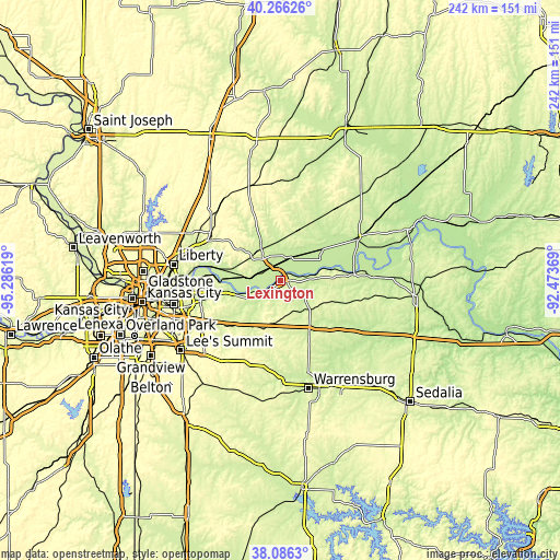
| Width | 7.57 km = 4.7 mi | 15.15 km = 9.4 mi | 242.4 km = 150.6 mi |
| Height | 7.57 km = 4.7 mi | 15.15 km = 9.4 mi | 242.4 km = 150.6 mi |
| ↑Max Latitude | 39.218784° | 39.252822° | 40.26626° |
| Latitude at center | 39.18473° | 39.18473° | 39.18473° |
| ↓Min Latitude | 39.150659° | 39.116572° | 38.0863° |
| ← Min Longitude | -93.923885° | -93.967831° | -95.28619° |
| Longitude center | -93.87994° | -93.87994° | -93.87994° |
| →Max Longitude | -93.835995° | -93.792049° | -92.47369° |
Nearby cities:
Cities around Lexington sort by population:
• Blue Springs elevation 300 m
39.4 km,  241°
241°
• Grain Valley 242 m
33.3 km, 235°
• Excelsior Springs 242 m
34.4 km,  299°
299°
• Oak Grove 271 m
29.4 km,  227°
227°
• Richmond 253 m
13.4 km,  321°
321°
• Odessa 288 m
21.6 km,  197°
197°
• Higginsville 252 m
18.8 km,  131°
131°
• Carrollton 232 m
38.3 km,  59°
59°
• Buckner 231 m
28.1 km,  258°
258°
• Lawson 328 m
39.7 km, 315°
• Concordia 243 m
35 km, 129°
• Albany 228 m
20.6 km,  282°
282°
Multilingual:
 En español:
Lexington elevación 262 m.
 En France:
Lexington élévation 262 m.
 Auf Deutsch:
Lexington höhe über dem Meeresspiegel ist 262 m.

Sources and notes:
- [note 1] Map square and city borders are not equal. Map elevation data is calculated only from area inside that square.
- [src 1] Elevation data from geonames database provided with same terms of usage.
- [src 2] The elevation map of Lexington is generated using elevation data from NASA's 3 arcsec (90m) resolution SRTM data.
- [src 3] Base (background) map © OpenStreetMap contributors tiles are generated by Geofabrik and OpenTopoMap.
Copyright & License:
This Lexington Elevation Map is licensed under CC BY-SA. You may reuse any part from this page, if you give a proper credit by linking to this URL:
 More info on terms of use page.