Caruthersville elevation
Caruthersville (Missouri, Pemiscot County), United States elevation is 85 meters and Caruthersville elevation in feet is 279 ft above sea level [src 1]. Caruthersville is a seat of a second-order administrative division (feature code) with elevation that is 194 meters (636 ft) smaller than average city elevation in United States.
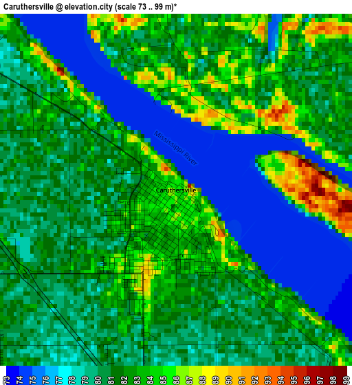
Below is the Elevation map of Caruthersville, which displays elevation range with different colors. Scale of the first map is from 73 to 99 m (240 to 325 ft) with average elevation of 80.7 meters (=265 ft) [note 1]
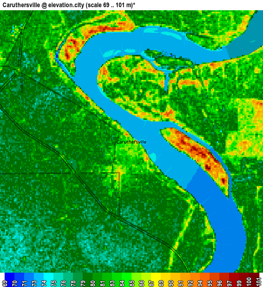
These maps also provides idea of topography and contour of this city, they are displayed at different zoom levels. More info about maps, scale and edge coordinates you can find below images.
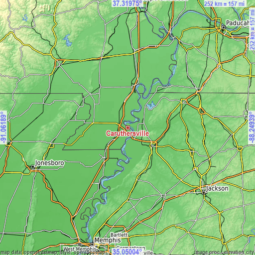
| \ | Map #1 | Map #2 | Topo.Map |
| Scale [m] | 73..99 m | 69..101 m | × |
| Scale [ft] | 240..325 ft | 226..331 ft | × |
| Average | 80.7 m = 265 ft | 80.1 m = 263 ft | × |
| Width | 7.89 km = 4.9 mi | 15.77 km = 9.8 mi | 252.4 km = 156.8 mi |
| Height | 7.89 km = 4.9 mi | 15.77 km = 9.8 mi | 252.4 km = 156.8 mi |
| ↑Max Latitude | 36.228577° | 36.264018° | 37.31975° |
| Latitude at center | 36.19312° | 36.19312° | 36.19312° |
| ↓Min Latitude | 36.157647° | 36.122157° | 35.05004° |
| ← Min Longitude | -89.699585° | -89.743531° | -91.06189° |
| Longitude center | -89.65564° | -89.65564° | -89.65564° |
| →Max Longitude | -89.611695° | -89.567749° | -88.24939° |
Nearby cities:
Cities around Caruthersville sort by population:
• Dyersburg elevation 96 m
30 km,  126°
126°
• Blytheville 77 m
37.9 km,  218°
218°
• Kennett 82 m
36.2 km,  277°
277°
• Tiptonville 93 m
26.4 km,  38°
38°
• Newbern 116 m
36.5 km,  104°
104°
• Gosnell 75 m
38.5 km,  227°
227°
• Portageville 84 m
26.1 km,  351°
351°
• Hayti 82 m
9.6 km,  298°
298°
• Steele 79 m
19.8 km, 232°
• Ridgely 84 m
17 km,  62°
62°
• Clarkton 91 m
40.1 km,  315°
315°
• Gideon 82 m
37.2 km, 320°
Multilingual:
 En español:
Caruthersville elevación 85 m.
 En France:
Caruthersville élévation 85 m.
 Auf Deutsch:
Caruthersville höhe über dem Meeresspiegel ist 85 m.

Sources and notes:
- [note 1] Map square and city borders are not equal. Map elevation data is calculated only from area inside that square.
- [src 1] Elevation data from geonames database provided with same terms of usage.
- [src 2] The elevation map of Caruthersville is generated using elevation data from NASA's 3 arcsec (90m) resolution SRTM data.
- [src 3] Base (background) map © OpenStreetMap contributors tiles are generated by Geofabrik and OpenTopoMap.
Copyright & License:
This Caruthersville Elevation Map is licensed under CC BY-SA. You may reuse any part from this page, if you give a proper credit by linking to this URL:
 More info on terms of use page.