Gosnell elevation
Gosnell (Arkansas, Mississippi County), United States elevation is 75 meters and Gosnell elevation in feet is 246 ft above sea level [src 1]. Gosnell is a populated place (feature code) with elevation that is 204 meters (669 ft) smaller than average city elevation in United States.
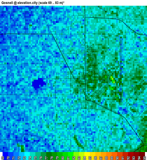
Below is the Elevation map of Gosnell, which displays elevation range with different colors. Scale of the first map is from 69 to 83 m (226 to 272 ft) with average elevation of 73 meters (=240 ft) [note 1]
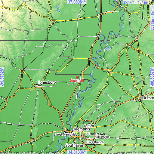
These maps also provides idea of topography and contour of this city, they are displayed at different zoom levels. More info about maps, scale and edge coordinates you can find below images.
| \ | Map #1 | Topo.Map |
| Scale [m] | 69..83 m | × |
| Scale [ft] | 226..272 ft | × |
| Average | 73 m = 240 ft | × |
| Width | 7.91 km = 4.9 mi | 253.1 km = 157.3 mi |
| Height | 7.91 km = 4.9 mi | 253.1 km = 157.3 mi |
| ↑Max Latitude | 35.995353° | 37.08981° |
| Latitude at center | 35.95979° | 35.95979° |
| ↓Min Latitude | 35.924211° | 34.81336° |
| ← Min Longitude | -90.015975° | -91.37828° |
| Longitude center | -89.97203° | -89.97203° |
| →Max Longitude | -89.928085° | -88.56578° |
Nearby cities:
Cities around Gosnell sort by population:
• Blytheville elevation 77 m
6 km,  127°
127°
• Kennett 82 m
31.6 km,  346°
346°
• Osceola 75 m
28.3 km,  179°
179°
• Caruthersville 85 m
38.5 km,  47°
47°
• Manila 73 m
19.7 km,  243°
243°
• Hayti 82 m
36.4 km,  33°
33°
• Steele 79 m
18.9 km,  42°
42°
• Leachville 73 m
25.9 km,  264°
264°
• Senath 77 m
25.7 km,  318°
318°
• Monette 73 m
34.4 km, 257°
• Caraway 69 m
38.7 km,  234°
234°
• Luxora 74 m
23 km,  170°
170°
Multilingual:
 En español:
Gosnell elevación 75 m.
 En France:
Gosnell élévation 75 m.


Sources and notes:
- [note 1] Map square and city borders are not equal. Map elevation data is calculated only from area inside that square.
- [src 1] Elevation data from geonames database provided with same terms of usage.
- [src 2] The elevation map of Gosnell is generated using elevation data from NASA's 3 arcsec (90m) resolution SRTM data.
- [src 3] Base (background) map © OpenStreetMap contributors tiles are generated by Geofabrik and OpenTopoMap.
Copyright & License:
This Gosnell Elevation Map is licensed under CC BY-SA. You may reuse any part from this page, if you give a proper credit by linking to this URL:
 More info on terms of use page.