Camdenton elevation
Camdenton (Missouri, Camden County), United States elevation is 319 meters and Camdenton elevation in feet is 1047 ft above sea level [src 1]. Camdenton is a seat of a second-order administrative division (feature code) with elevation that is 40 meters (131 ft) bigger than average city elevation in United States.
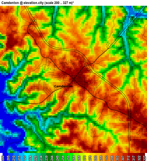
Below is the Elevation map of Camdenton, which displays elevation range with different colors. Scale of the first map is from 200 to 327 m (656 to 1073 ft) with average elevation of 274.3 meters (=900 ft) [note 1]
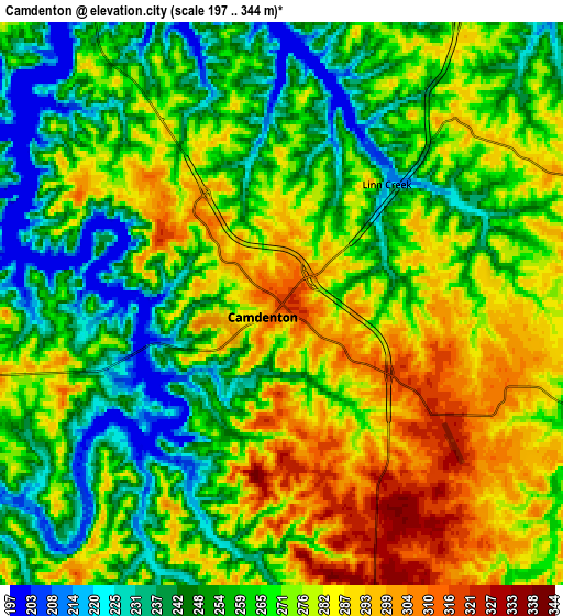
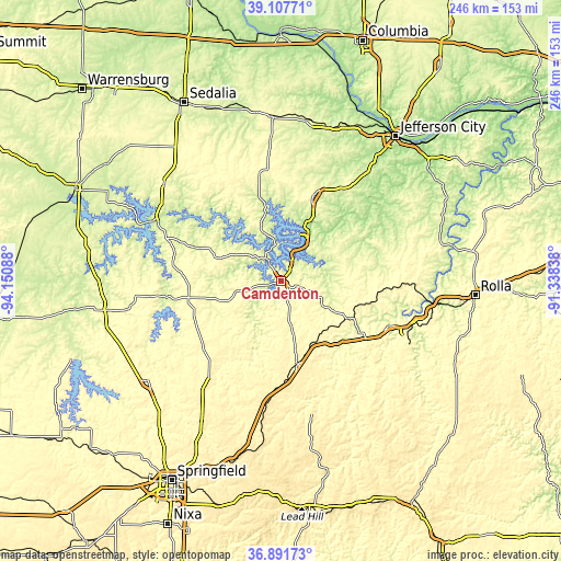
These maps also provides idea of topography and contour of this city, they are displayed at different zoom levels. More info about maps, scale and edge coordinates you can find below images.
| \ | Map #1 | Map #2 | Topo.Map |
| Scale [m] | 200..327 m | 197..344 m | × |
| Scale [ft] | 656..1073 ft | 646..1129 ft | × |
| Average | 274.3 m = 900 ft | 267.2 m = 877 ft | × |
| Width | 7.7 km = 4.8 mi | 15.4 km = 9.6 mi | 246.4 km = 153.1 mi |
| Height | 7.7 km = 4.8 mi | 15.4 km = 9.6 mi | 246.4 km = 153.1 mi |
| ↑Max Latitude | 38.042707° | 38.077308° | 39.10771° |
| Latitude at center | 38.00809° | 38.00809° | 38.00809° |
| ↓Min Latitude | 37.973456° | 37.938806° | 36.89173° |
| ← Min Longitude | -92.788575° | -92.832521° | -94.15088° |
| Longitude center | -92.74463° | -92.74463° | -92.74463° |
| →Max Longitude | -92.700685° | -92.656739° | -91.33838° |
Nearby cities:
Cities around Camdenton sort by population:
• Lebanon elevation 386 m
37.1 km,  168°
168°
• Eldon 286 m
40.4 km,  20°
20°
• Osage Beach 236 m
15.7 km,  30°
30°
• Buffalo 365 m
50.7 km,  217°
217°
• Riverview 256 m
41.2 km,  316°
316°
• Versailles 320 m
47.8 km,  349°
349°
• Four Seasons 234 m
21.3 km,  7°
7°
• Richland 345 m
34.2 km,  119°
119°
• Lake Ozark 230 m
23.1 km, 23°
• Crocker 344 m
42.7 km,  98°
98°
• Hermitage 251 m
50.7 km,  261°
261°
• Tuscumbia 184 m
35.4 km,  45°
45°
Multilingual:
 En español:
Camdenton elevación 319 m.
 En France:
Camdenton élévation 319 m.
 Auf Deutsch:
Camdenton höhe über dem Meeresspiegel ist 319 m.

Sources and notes:
- [note 1] Map square and city borders are not equal. Map elevation data is calculated only from area inside that square.
- [src 1] Elevation data from geonames database provided with same terms of usage.
- [src 2] The elevation map of Camdenton is generated using elevation data from NASA's 3 arcsec (90m) resolution SRTM data.
- [src 3] Base (background) map © OpenStreetMap contributors tiles are generated by Geofabrik and OpenTopoMap.
Copyright & License:
This Camdenton Elevation Map is licensed under CC BY-SA. You may reuse any part from this page, if you give a proper credit by linking to this URL:
 More info on terms of use page.