Butler elevation
Butler (Missouri, Bates County), United States elevation is 269 meters and Butler elevation in feet is 883 ft above sea level [src 1]. Butler is a seat of a second-order administrative division (feature code) with elevation that is 10 meters (33 ft) smaller than average city elevation in United States.
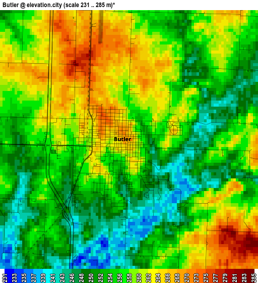
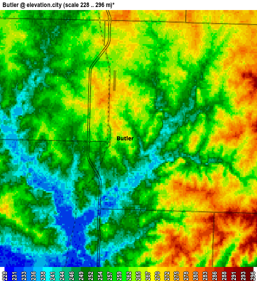
Below is the Elevation map of Butler, which displays elevation range with different colors. Scale of the first map is from 231 to 285 m (758 to 935 ft) with average elevation of 256.5 meters (=842 ft) [note 1]
These maps also provides idea of topography and contour of this city, they are displayed at different zoom levels. More info about maps, scale and edge coordinates you can find below images.
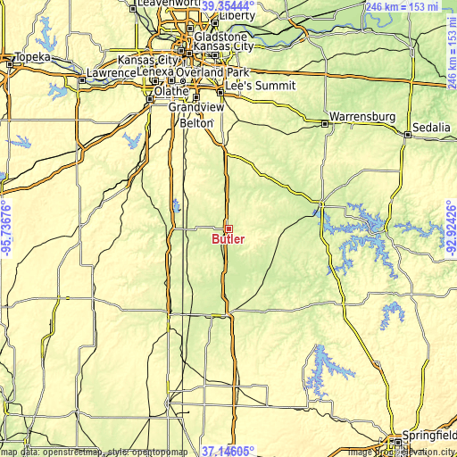
| \ | Map #1 | Map #2 | Topo.Map |
| Scale [m] | 231..285 m | 228..296 m | × |
| Scale [ft] | 758..935 ft | 748..971 ft | × |
| Average | 256.5 m = 842 ft | 258.6 m = 848 ft | × |
| Width | 7.67 km = 4.8 mi | 15.35 km = 9.5 mi | 245.5 km = 152.5 mi |
| Height | 7.67 km = 4.8 mi | 15.35 km = 9.5 mi | 245.5 km = 152.5 mi |
| ↑Max Latitude | 38.293129° | 38.327611° | 39.35444° |
| Latitude at center | 38.25863° | 38.25863° | 38.25863° |
| ↓Min Latitude | 38.224115° | 38.189583° | 37.14605° |
| ← Min Longitude | -94.374455° | -94.418401° | -95.73676° |
| Longitude center | -94.33051° | -94.33051° | -94.33051° |
| →Max Longitude | -94.286565° | -94.242619° | -92.92426° |
Nearby cities:
Cities around Butler sort by population:
• Harrisonville elevation 295 m
43.9 km,  357°
357°
• Clinton 247 m
49.7 km,  75°
75°
• Nevada 272 m
46.7 km,  182°
182°
• El Dorado Springs 261 m
50.3 km,  147°
147°
• Garden City 285 m
35.8 km,  19°
19°
• Adrian 268 m
15.6 km,  353°
353°
• Rich Hill 244 m
18.2 km,  188°
188°
• Archie 257 m
24.9 km, 355°
• Pleasanton 266 m
34.5 km,  254°
254°
• La Cygne 260 m
38.9 km,  285°
285°
• Appleton City 267 m
27.4 km,  106°
106°
• Mound City 270 m
44.1 km, 253°
Multilingual:
 En español:
Butler elevación 269 m.
 En France:
Butler élévation 269 m.


Sources and notes:
- [note 1] Map square and city borders are not equal. Map elevation data is calculated only from area inside that square.
- [src 1] Elevation data from geonames database provided with same terms of usage.
- [src 2] The elevation map of Butler is generated using elevation data from NASA's 3 arcsec (90m) resolution SRTM data.
- [src 3] Base (background) map © OpenStreetMap contributors tiles are generated by Geofabrik and OpenTopoMap.
Copyright & License:
This Butler Elevation Map is licensed under CC BY-SA. You may reuse any part from this page, if you give a proper credit by linking to this URL:
 More info on terms of use page.