Ballwin elevation
Ballwin (Missouri, Saint Louis County), United States elevation is 194 meters and Ballwin elevation in feet is 636 ft above sea level [src 1]. Ballwin is a populated place (feature code) with elevation that is 85 meters (279 ft) smaller than average city elevation in United States.
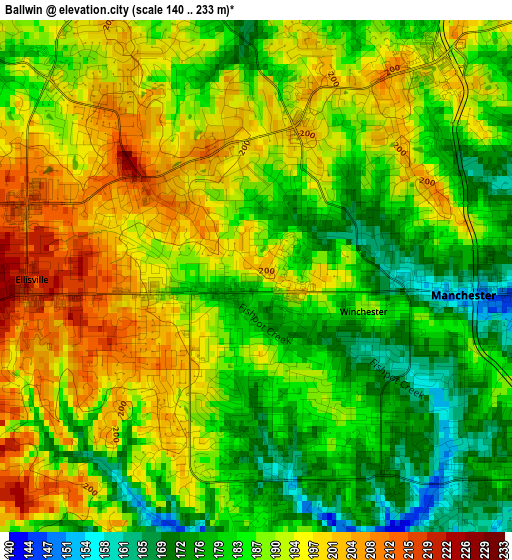
Below is the Elevation map of Ballwin, which displays elevation range with different colors. Scale of the first map is from 140 to 233 m (459 to 764 ft) with average elevation of 188.1 meters (=617 ft) [note 1]
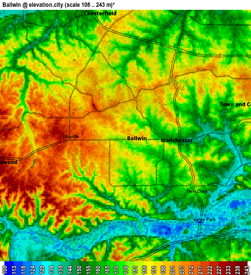
These maps also provides idea of topography and contour of this city, they are displayed at different zoom levels. More info about maps, scale and edge coordinates you can find below images.
| \ | Map #1 | Map #2 | Topo.Map |
| Scale [m] | 140..233 m | 108..243 m | × |
| Scale [ft] | 459..764 ft | 354..797 ft | × |
| Average | 188.1 m = 617 ft | 176.3 m = 578 ft | × |
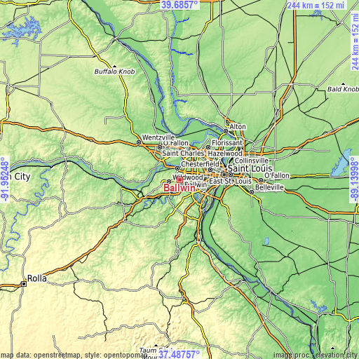
| Width | 7.64 km = 4.7 mi | 15.28 km = 9.5 mi | 244.4 km = 151.9 mi |
| Height | 7.64 km = 4.7 mi | 15.28 km = 9.5 mi | 244.4 km = 151.9 mi |
| ↑Max Latitude | 38.629388° | 38.66371° | 39.6857° |
| Latitude at center | 38.59505° | 38.59505° | 38.59505° |
| ↓Min Latitude | 38.560695° | 38.526324° | 37.48757° |
| ← Min Longitude | -90.590175° | -90.634121° | -91.95248° |
| Longitude center | -90.54623° | -90.54623° | -90.54623° |
| →Max Longitude | -90.502285° | -90.458339° | -89.13998° |
Nearby cities:
Cities around Ballwin sort by population:
• Chesterfield elevation 140 m
8 km,  340°
340°
• Wildwood 235 m
10.2 km,  262°
262°
• Kirkwood 204 m
12.2 km,  96°
96°
• Manchester 174 m
3.2 km,  86°
86°
• Town and Country 186 m
7.4 km,  75°
75°
• Eureka 140 m
12.5 km,  214°
214°
• Ellisville 218 m
3.6 km,  265°
265°
• Des Peres 183 m
9.9 km, 86°
• Valley Park 131 m
6.9 km,  137°
137°
• Frontenac 175 m
12.3 km,  68°
68°
• Clarkson Valley 186 m
4.6 km,  304°
304°
• Winchester 187 m
1.7 km,  108°
108°
Multilingual:
 En español:
Ballwin elevación 194 m.
 En France:
Ballwin élévation 194 m.


Sources and notes:
- [note 1] Map square and city borders are not equal. Map elevation data is calculated only from area inside that square.
- [src 1] Elevation data from geonames database provided with same terms of usage.
- [src 2] The elevation map of Ballwin is generated using elevation data from NASA's 3 arcsec (90m) resolution SRTM data.
- [src 3] Base (background) map © OpenStreetMap contributors tiles are generated by Geofabrik and OpenTopoMap.
Copyright & License:
This Ballwin Elevation Map is licensed under CC BY-SA. You may reuse any part from this page, if you give a proper credit by linking to this URL:
 More info on terms of use page.