Frontenac elevation
Frontenac (Missouri, Saint Louis County), United States elevation is 175 meters and Frontenac elevation in feet is 574 ft above sea level [src 1]. Frontenac is a populated place (feature code) with elevation that is 104 meters (341 ft) smaller than average city elevation in United States.
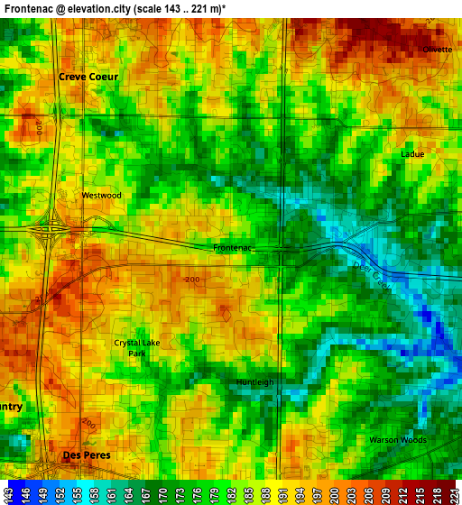
Below is the Elevation map of Frontenac, which displays elevation range with different colors. Scale of the first map is from 143 to 221 m (469 to 725 ft) with average elevation of 183.3 meters (=601 ft) [note 1]
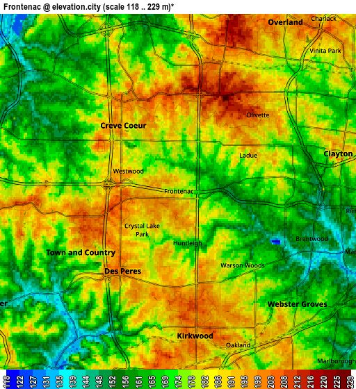
These maps also provides idea of topography and contour of this city, they are displayed at different zoom levels. More info about maps, scale and edge coordinates you can find below images.
| \ | Map #1 | Map #2 | Topo.Map |
| Scale [m] | 143..221 m | 118..229 m | × |
| Scale [ft] | 469..725 ft | 387..751 ft | × |
| Average | 183.3 m = 601 ft | 176.7 m = 580 ft | × |
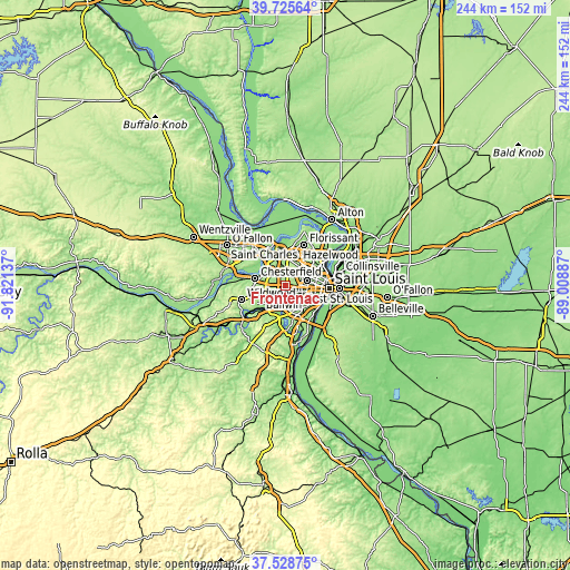
| Width | 7.63 km = 4.7 mi | 15.27 km = 9.5 mi | 244.3 km = 151.8 mi |
| Height | 7.63 km = 4.7 mi | 15.27 km = 9.5 mi | 244.3 km = 151.8 mi |
| ↑Max Latitude | 38.669929° | 38.704231° | 39.72564° |
| Latitude at center | 38.63561° | 38.63561° | 38.63561° |
| ↓Min Latitude | 38.601275° | 38.566923° | 37.52875° |
| ← Min Longitude | -90.459065° | -90.503011° | -91.82137° |
| Longitude center | -90.41512° | -90.41512° | -90.41512° |
| →Max Longitude | -90.371175° | -90.327229° | -89.00887° |
Nearby cities:
Cities around Frontenac sort by population:
• Kirkwood elevation 204 m
5.9 km,  172°
172°
• Webster Groves 173 m
6.9 km,  133°
133°
• Creve Coeur 189 m
2.9 km,  346°
346°
• Town and Country 186 m
4.9 km,  238°
238°
• Ladue 189 m
3.4 km,  62°
62°
• Des Peres 183 m
4.2 km,  201°
201°
• Brentwood 149 m
6.1 km,  109°
109°
• Olivette 207 m
4.7 km,  45°
45°
• Glendale 182 m
5.5 km,  143°
143°
• Rock Hill 170 m
4.5 km, 134°
• Warson Woods 166 m
4.2 km, 138°
• Oakland 186 m
7.1 km,  158°
158°
Multilingual:
 En español:
Frontenac elevación 175 m.
 En France:
Frontenac élévation 175 m.
 Auf Deutsch:
Frontenac höhe über dem Meeresspiegel ist 175 m.

Sources and notes:
- [note 1] Map square and city borders are not equal. Map elevation data is calculated only from area inside that square.
- [src 1] Elevation data from geonames database provided with same terms of usage.
- [src 2] The elevation map of Frontenac is generated using elevation data from NASA's 3 arcsec (90m) resolution SRTM data.
- [src 3] Base (background) map © OpenStreetMap contributors tiles are generated by Geofabrik and OpenTopoMap.
Copyright & License:
This Frontenac Elevation Map is licensed under CC BY-SA. You may reuse any part from this page, if you give a proper credit by linking to this URL:
 More info on terms of use page.