Westminster elevation
Westminster (Maryland, Carroll County), United States elevation is 223 meters and Westminster elevation in feet is 732 ft above sea level [src 1]. Westminster is a seat of a second-order administrative division (feature code) with elevation that is 56 meters (184 ft) smaller than average city elevation in United States.
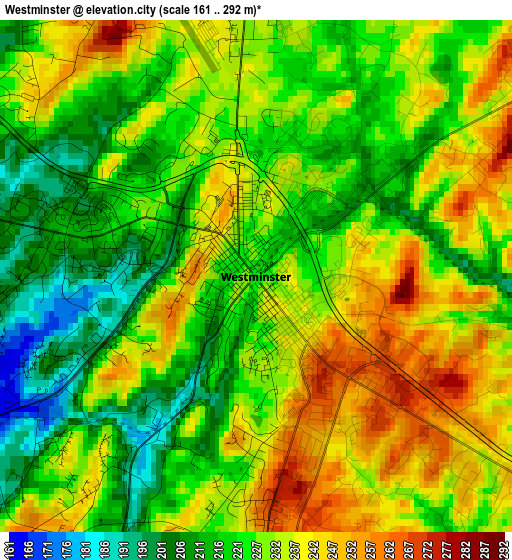
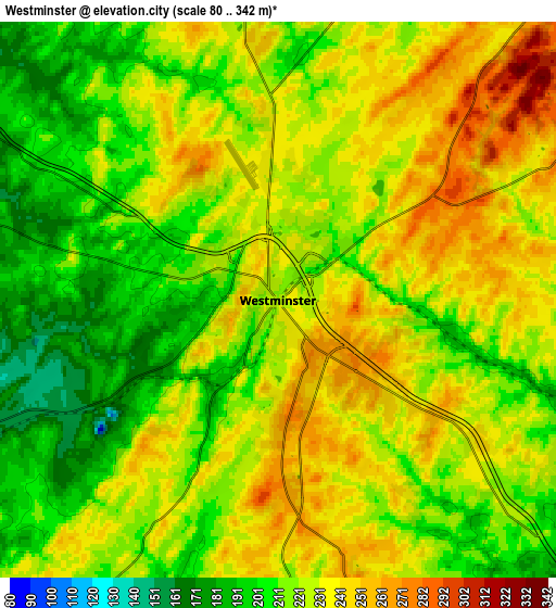
Below is the Elevation map of Westminster, which displays elevation range with different colors. Scale of the first map is from 161 to 292 m (528 to 958 ft) with average elevation of 228.1 meters (=748 ft) [note 1]
These maps also provides idea of topography and contour of this city, they are displayed at different zoom levels. More info about maps, scale and edge coordinates you can find below images.
| \ | Map #1 | Map #2 | Topo.Map |
| Scale [m] | 161..292 m | 80..342 m | × |
| Scale [ft] | 528..958 ft | 262..1122 ft | × |
| Average | 228.1 m = 748 ft | 223.6 m = 734 ft | × |
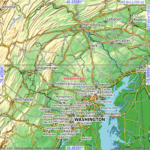
| Width | 7.53 km = 4.7 mi | 15.07 km = 9.4 mi | 241 km = 149.8 mi |
| Height | 7.53 km = 4.7 mi | 15.07 km = 9.4 mi | 241 km = 149.8 mi |
| ↑Max Latitude | 39.609244° | 39.643092° | 40.65081° |
| Latitude at center | 39.57538° | 39.57538° | 39.57538° |
| ↓Min Latitude | 39.541499° | 39.507602° | 38.48301° |
| ← Min Longitude | -77.039755° | -77.083701° | -78.40206° |
| Longitude center | -76.99581° | -76.99581° | -76.99581° |
| →Max Longitude | -76.951865° | -76.907919° | -75.58956° |
Nearby cities:
Cities around Westminster sort by population:
• Eldersburg elevation 197 m
19.5 km,  168°
168°
• Reisterstown 220 m
18.3 km,  129°
129°
• Linganore 126 m
23.6 km,  230°
230°
• Taneytown 155 m
17.8 km,  300°
300°
• Parkville 235 m
23.1 km,  6°
6°
• Hampstead 278 m
12.9 km,  75°
75°
• Manchester 303 m
13.5 km,  44°
44°
• Mount Pleasant 205 m
18.9 km,  338°
338°
• Littlestown 194 m
20.4 km, 337°
• Sykesville 164 m
22.6 km, 173°
• Pennville 171 m
23.8 km,  359°
359°
• New Windsor 143 m
10.3 km,  248°
248°
Multilingual:
 En español:
Westminster elevación 223 m.
 En France:
Westminster élévation 223 m.
 Auf Deutsch:
Westminster höhe über dem Meeresspiegel ist 223 m.

Sources and notes:
- [note 1] Map square and city borders are not equal. Map elevation data is calculated only from area inside that square.
- [src 1] Elevation data from geonames database provided with same terms of usage.
- [src 2] The elevation map of Westminster is generated using elevation data from NASA's 3 arcsec (90m) resolution SRTM data.
- [src 3] Base (background) map © OpenStreetMap contributors tiles are generated by Geofabrik and OpenTopoMap.
Copyright & License:
This Westminster Elevation Map is licensed under CC BY-SA. You may reuse any part from this page, if you give a proper credit by linking to this URL:
 More info on terms of use page.