La Plata elevation
La Plata (Maryland, Charles County), United States elevation is 55 meters and La Plata elevation in feet is 180 ft above sea level [src 1]. La Plata is a seat of a second-order administrative division (feature code) with elevation that is 224 meters (735 ft) smaller than average city elevation in United States.
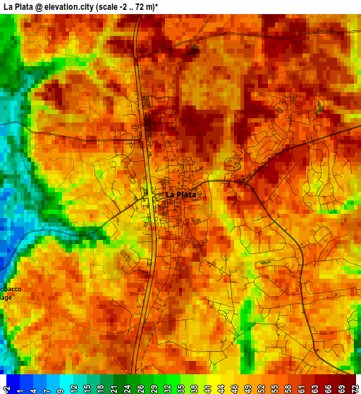
Below is the Elevation map of La Plata, which displays elevation range with different colors. Scale of the first map is from -2 to 72 m (-7 to 236 ft) with average elevation of 50 meters (=164 ft) [note 1]
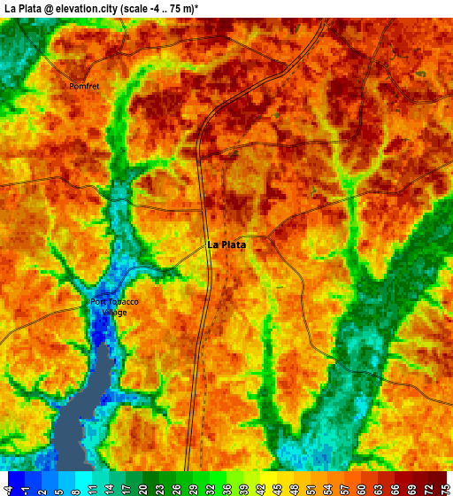
These maps also provides idea of topography and contour of this city, they are displayed at different zoom levels. More info about maps, scale and edge coordinates you can find below images.
| \ | Map #1 | Map #2 | Topo.Map |
| Scale [m] | -2..72 m | -4..75 m | × |
| Scale [ft] | -7..236 ft | -13..246 ft | × |
| Average | 50 m = 164 ft | 47.8 m = 157 ft | × |
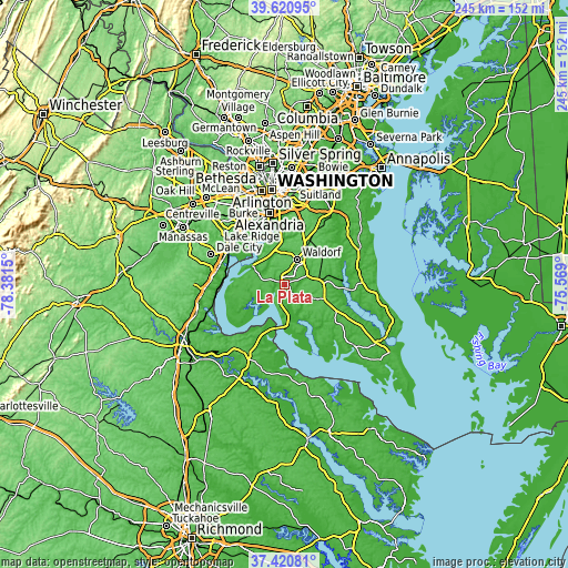
| Width | 7.64 km = 4.7 mi | 15.29 km = 9.5 mi | 244.6 km = 152 mi |
| Height | 7.64 km = 4.7 mi | 15.29 km = 9.5 mi | 244.6 km = 152 mi |
| ↑Max Latitude | 38.56366° | 38.598013° | 39.62095° |
| Latitude at center | 38.52929° | 38.52929° | 38.52929° |
| ↓Min Latitude | 38.494904° | 38.460501° | 37.42081° |
| ← Min Longitude | -77.019195° | -77.063141° | -78.3815° |
| Longitude center | -76.97525° | -76.97525° | -76.97525° |
| →Max Longitude | -76.931305° | -76.887359° | -75.569° |
Nearby cities:
Cities around La Plata sort by population:
• Waldorf elevation 65 m
11 km,  16°
16°
• Saint Charles 69 m
8.8 km, 21°
• St. Charles 65 m
9.7 km,  26°
26°
• Fort Washington 41 m
20.2 km,  348°
348°
• Bennsville 57 m
9.5 km,  340°
340°
• Accokeek 67 m
16.1 km, 343°
• Bryans Road 50 m
13.8 km,  321°
321°
• Brandywine 72 m
21.7 km, 30°
• Indian Head 35 m
18.1 km,  295°
295°
• Hughesville 53 m
16.7 km,  88°
88°
• Charlotte Hall 54 m
18 km,  107°
107°
• Potomac Heights 25 m
16.9 km, 301°
Multilingual:
 En español:
La Plata elevación 55 m.
 En France:
La Plata élévation 55 m.


Sources and notes:
- [note 1] Map square and city borders are not equal. Map elevation data is calculated only from area inside that square.
- [src 1] Elevation data from geonames database provided with same terms of usage.
- [src 2] The elevation map of La Plata is generated using elevation data from NASA's 3 arcsec (90m) resolution SRTM data.
- [src 3] Base (background) map © OpenStreetMap contributors tiles are generated by Geofabrik and OpenTopoMap.
Copyright & License:
This La Plata Elevation Map is licensed under CC BY-SA. You may reuse any part from this page, if you give a proper credit by linking to this URL:
 More info on terms of use page.