Brandywine elevation
Brandywine (Maryland, Prince George's County), United States elevation is 72 meters and Brandywine elevation in feet is 236 ft above sea level [src 1]. Brandywine is a populated place (feature code) with elevation that is 207 meters (679 ft) smaller than average city elevation in United States.
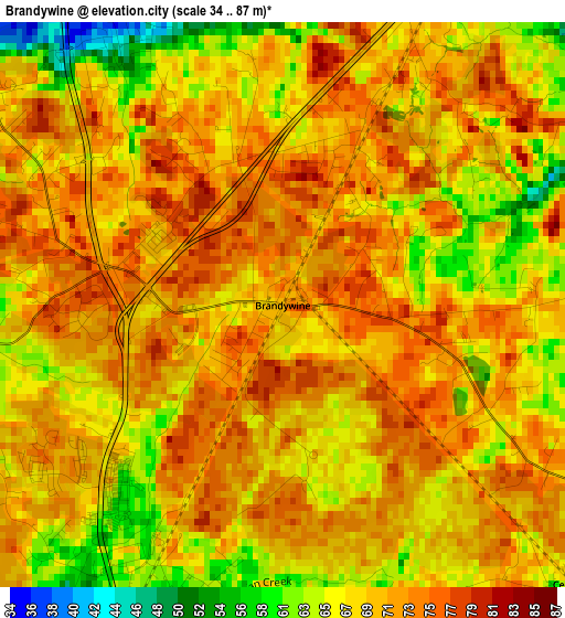
Below is the Elevation map of Brandywine, which displays elevation range with different colors. Scale of the first map is from 34 to 87 m (112 to 285 ft) with average elevation of 69.1 meters (=227 ft) [note 1]
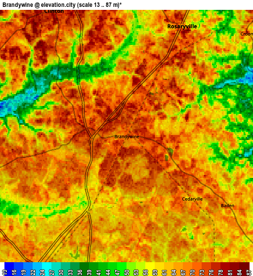
These maps also provides idea of topography and contour of this city, they are displayed at different zoom levels. More info about maps, scale and edge coordinates you can find below images.
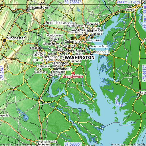
| \ | Map #1 | Map #2 | Topo.Map |
| Scale [m] | 34..87 m | 13..87 m | × |
| Scale [ft] | 112..285 ft | 43..285 ft | × |
| Average | 69.1 m = 227 ft | 63.5 m = 208 ft | × |
| Width | 7.63 km = 4.7 mi | 15.25 km = 9.5 mi | 244.1 km = 151.7 mi |
| Height | 7.63 km = 4.7 mi | 15.25 km = 9.5 mi | 244.1 km = 151.7 mi |
| ↑Max Latitude | 38.73107° | 38.765343° | 39.78587° |
| Latitude at center | 38.69678° | 38.69678° | 38.69678° |
| ↓Min Latitude | 38.662474° | 38.628152° | 37.59085° |
| ← Min Longitude | -76.891695° | -76.935641° | -78.254° |
| Longitude center | -76.84775° | -76.84775° | -76.84775° |
| →Max Longitude | -76.803805° | -76.759859° | -75.4415° |
Nearby cities:
Cities around Brandywine sort by population:
• Waldorf elevation 65 m
11.3 km,  224°
224°
• Clinton 76 m
8.8 km,  330°
330°
• St. Charles 65 m
12 km,  213°
213°
• Camp Springs 80 m
13 km,  336°
336°
• Rosaryville 67 m
7.4 km,  26°
26°
• Friendly 72 m
12.9 km,  298°
298°
• Marlton 60 m
9.9 km, 30°
• Mellwood 64 m
12.8 km,  9°
9°
• Andrews AFB 81 m
12.3 km,  349°
349°
• Croom 80 m
9.6 km,  49°
49°
• Baden 64 m
7.4 km,  124°
124°
• Queenland 54 m
13 km,  22°
22°
Multilingual:
 En español:
Brandywine elevación 72 m.
 En France:
Brandywine élévation 72 m.
 Auf Deutsch:
Brandywine höhe über dem Meeresspiegel ist 72 m.

Sources and notes:
- [note 1] Map square and city borders are not equal. Map elevation data is calculated only from area inside that square.
- [src 1] Elevation data from geonames database provided with same terms of usage.
- [src 2] The elevation map of Brandywine is generated using elevation data from NASA's 3 arcsec (90m) resolution SRTM data.
- [src 3] Base (background) map © OpenStreetMap contributors tiles are generated by Geofabrik and OpenTopoMap.
Copyright & License:
This Brandywine Elevation Map is licensed under CC BY-SA. You may reuse any part from this page, if you give a proper credit by linking to this URL:
 More info on terms of use page.