Camp Springs elevation
Camp Springs (Maryland, Prince George's County), United States elevation is 80 meters and Camp Springs elevation in feet is 262 ft above sea level [src 1]. Camp Springs is a populated place (feature code) with elevation that is 199 meters (653 ft) smaller than average city elevation in United States.
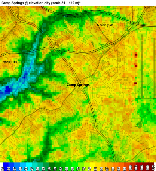
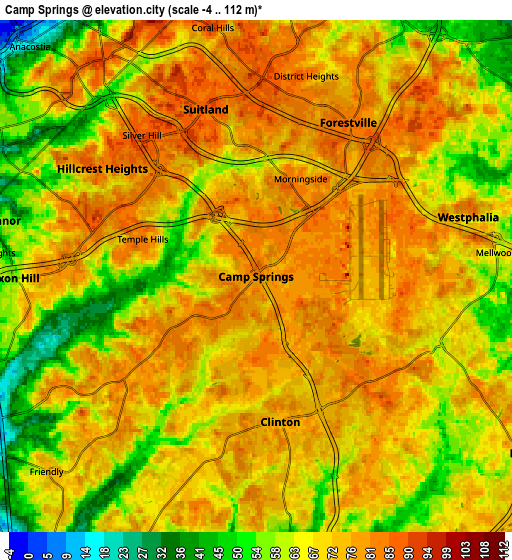
Below is the Elevation map of Camp Springs, which displays elevation range with different colors. Scale of the first map is from 31 to 112 m (102 to 367 ft) with average elevation of 75.6 meters (=248 ft) [note 1]
These maps also provides idea of topography and contour of this city, they are displayed at different zoom levels. More info about maps, scale and edge coordinates you can find below images.
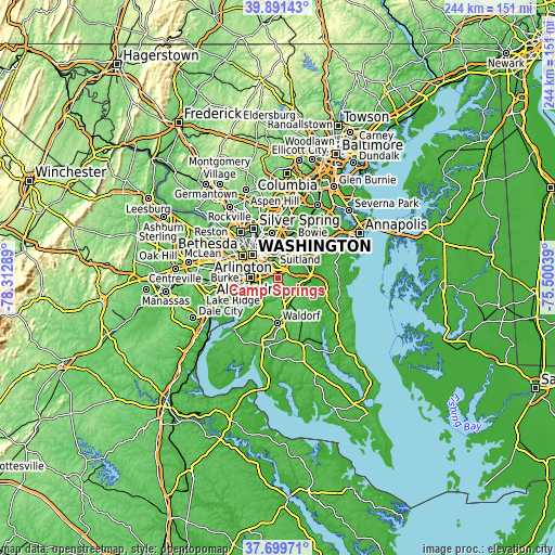
| \ | Map #1 | Map #2 | Topo.Map |
| Scale [m] | 31..112 m | -4..112 m | × |
| Scale [ft] | 102..367 ft | -13..367 ft | × |
| Average | 75.6 m = 248 ft | 69.1 m = 227 ft | × |
| Width | 7.62 km = 4.7 mi | 15.23 km = 9.5 mi | 243.7 km = 151.4 mi |
| Height | 7.62 km = 4.7 mi | 15.23 km = 9.5 mi | 243.7 km = 151.4 mi |
| ↑Max Latitude | 38.838238° | 38.87246° | 39.89143° |
| Latitude at center | 38.804° | 38.804° | 38.804° |
| ↓Min Latitude | 38.769745° | 38.735474° | 37.69971° |
| ← Min Longitude | -76.950585° | -76.994531° | -78.31289° |
| Longitude center | -76.90664° | -76.90664° | -76.90664° |
| →Max Longitude | -76.862695° | -76.818749° | -75.50039° |
Nearby cities:
Cities around Camp Springs sort by population:
• Clinton elevation 76 m
4.4 km,  170°
170°
• Oxon Hill-Glassmanor 51 m
6 km,  261°
261°
• Suitland-Silver Hill 86 m
5 km,  340°
340°
• Suitland 86 m
5.2 km, 343°
• Hillcrest Heights 81 m
5.6 km,  305°
305°
• Forestville 85 m
5.3 km,  30°
30°
• Temple Hills 83 m
3.5 km,  288°
288°
• District Heights 84 m
6.1 km,  14°
14°
• Silver Hill 87 m
5.4 km,  321°
321°
• Marlow Heights 81 m
5.1 km, 310°
• Andrews AFB 81 m
2.8 km,  86°
86°
• Morningside 80 m
3.2 km,  24°
24°
Multilingual:
 En español:
Camp Springs elevación 80 m.
 En France:
Camp Springs élévation 80 m.
 Auf Deutsch:
Camp Springs höhe über dem Meeresspiegel ist 80 m.

Sources and notes:
- [note 1] Map square and city borders are not equal. Map elevation data is calculated only from area inside that square.
- [src 1] Elevation data from geonames database provided with same terms of usage.
- [src 2] The elevation map of Camp Springs is generated using elevation data from NASA's 3 arcsec (90m) resolution SRTM data.
- [src 3] Base (background) map © OpenStreetMap contributors tiles are generated by Geofabrik and OpenTopoMap.
Copyright & License:
This Camp Springs Elevation Map is licensed under CC BY-SA. You may reuse any part from this page, if you give a proper credit by linking to this URL:
 More info on terms of use page.