District Heights elevation
District Heights (Maryland, Prince George's County), United States elevation is 84 meters and District Heights elevation in feet is 276 ft above sea level [src 1]. District Heights is a populated place (feature code) with elevation that is 195 meters (640 ft) smaller than average city elevation in United States.
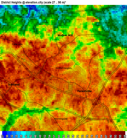
Below is the Elevation map of District Heights, which displays elevation range with different colors. Scale of the first map is from 27 to 98 m (89 to 322 ft) with average elevation of 72 meters (=236 ft) [note 1]
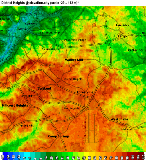
These maps also provides idea of topography and contour of this city, they are displayed at different zoom levels. More info about maps, scale and edge coordinates you can find below images.
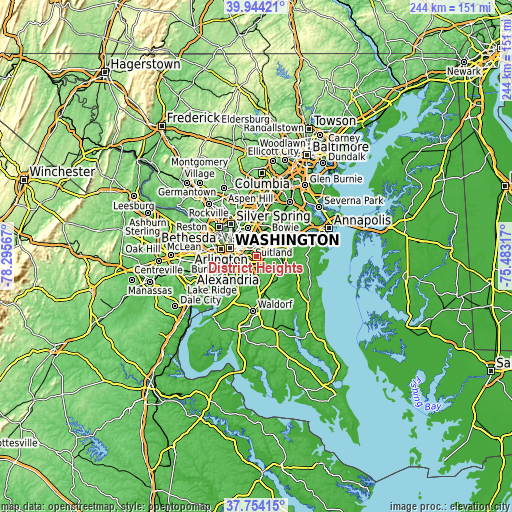
| \ | Map #1 | Map #2 | Topo.Map |
| Scale [m] | 27..98 m | -29..112 m | × |
| Scale [ft] | 89..322 ft | -95..367 ft | × |
| Average | 72 m = 236 ft | 58.2 m = 191 ft | × |
| Width | 7.61 km = 4.7 mi | 15.22 km = 9.5 mi | 243.5 km = 151.3 mi |
| Height | 7.61 km = 4.7 mi | 15.22 km = 9.5 mi | 243.5 km = 151.3 mi |
| ↑Max Latitude | 38.891822° | 38.926018° | 39.94421° |
| Latitude at center | 38.85761° | 38.85761° | 38.85761° |
| ↓Min Latitude | 38.823381° | 38.789136° | 37.75415° |
| ← Min Longitude | -76.933365° | -76.977311° | -78.29567° |
| Longitude center | -76.88942° | -76.88942° | -76.88942° |
| →Max Longitude | -76.845475° | -76.801529° | -75.48317° |
Nearby cities:
Cities around District Heights sort by population:
• Suitland-Silver Hill elevation 86 m
3.4 km,  249°
249°
• Suitland 86 m
3.1 km, 251°
• Forestville 85 m
1.9 km,  138°
138°
• Walker Mill 61 m
2 km,  2°
2°
• Summerfield 64 m
5.5 km,  19°
19°
• Coral Hills 91 m
3.1 km,  297°
297°
• Silver Hill 87 m
5.2 km, 250°
• Peppermill Village 60 m
4.1 km, 3°
• Seat Pleasant 34 m
4.5 km,  340°
340°
• Capitol Heights 37 m
3.8 km,  323°
323°
• Morningside 80 m
3.1 km,  183°
183°
• Fairmount Heights 33 m
5.3 km,  334°
334°
Multilingual:
 En español:
District Heights elevación 84 m.
 En France:
District Heights élévation 84 m.
 Auf Deutsch:
District Heights höhe über dem Meeresspiegel ist 84 m.

Sources and notes:
- [note 1] Map square and city borders are not equal. Map elevation data is calculated only from area inside that square.
- [src 1] Elevation data from geonames database provided with same terms of usage.
- [src 2] The elevation map of District Heights is generated using elevation data from NASA's 3 arcsec (90m) resolution SRTM data.
- [src 3] Base (background) map © OpenStreetMap contributors tiles are generated by Geofabrik and OpenTopoMap.
Copyright & License:
This District Heights Elevation Map is licensed under CC BY-SA. You may reuse any part from this page, if you give a proper credit by linking to this URL:
 More info on terms of use page.