Olive Hill elevation
Olive Hill (Kentucky, Carter County), United States elevation is 231 meters and Olive Hill elevation in feet is 758 ft above sea level [src 1]. Olive Hill is a populated place (feature code) with elevation that is 48 meters (157 ft) smaller than average city elevation in United States.
Below is the Elevation map of Olive Hill, which displays elevation range with different colors. Scale of the first map is from 226 to 342 m (741 to 1122 ft) with average elevation of 287.1 meters (=942 ft) [note 1]
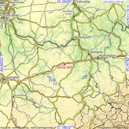
These maps also provides idea of topography and contour of this city, they are displayed at different zoom levels. More info about maps, scale and edge coordinates you can find below images.
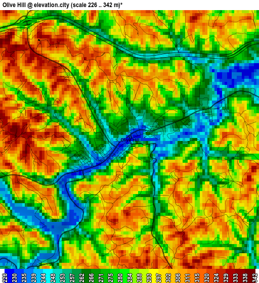
| \ | Map #1 | Topo.Map |
| Scale [m] | 226..342 m | × |
| Scale [ft] | 741..1122 ft | × |
| Average | 287.1 m = 942 ft | × |
| Width | 7.67 km = 4.8 mi | 245.4 km = 152.5 mi |
| Height | 7.67 km = 4.8 mi | 245.4 km = 152.5 mi |
| ↑Max Latitude | 38.334559° | 39.39525° |
| Latitude at center | 38.30008° | 38.30008° |
| ↓Min Latitude | 38.265585° | 37.18812° |
| ← Min Longitude | -83.218015° | -84.58032° |
| Longitude center | -83.17407° | -83.17407° |
| →Max Longitude | -83.130125° | -81.76782° |
Nearby cities:
Cities around Olive Hill sort by population:
• Ironville elevation 221 m
45.4 km,  67°
67°
• Meads 188 m
42.4 km, 72°
• Flatwoods 210 m
46.9 km,  58°
58°
• Morehead 226 m
26 km,  240°
240°
• Grayson 193 m
20 km,  79°
79°
• West Liberty 247 m
42.8 km,  190°
190°
• Raceland 169 m
47.1 km, 55°
• Elkfork 263 m
37.5 km,  174°
174°
• Vanceburg 161 m
35.6 km,  339°
339°
• Greenup 163 m
42.6 km,  44°
44°
• Wurtland 167 m
44.3 km,  51°
51°
• Sandy Hook 232 m
24.1 km, 170°
Multilingual:
 En español:
Olive Hill elevación 231 m.
 En France:
Olive Hill élévation 231 m.
 Auf Deutsch:
Olive Hill höhe über dem Meeresspiegel ist 231 m.

Sources and notes:
- [note 1] Map square and city borders are not equal. Map elevation data is calculated only from area inside that square.
- [src 1] Elevation data from geonames database provided with same terms of usage.
- [src 2] The elevation map of Olive Hill is generated using elevation data from NASA's 3 arcsec (90m) resolution SRTM data.
- [src 3] Base (background) map © OpenStreetMap contributors tiles are generated by Geofabrik and OpenTopoMap.
Copyright & License:
This Olive Hill Elevation Map is licensed under CC BY-SA. You may reuse any part from this page, if you give a proper credit by linking to this URL:
 More info on terms of use page.