Danville elevation
Danville (Kentucky, Boyle County), United States elevation is 305 meters and Danville elevation in feet is 1001 ft above sea level [src 1]. Danville is a seat of a second-order administrative division (feature code) with elevation that is 26 meters (85 ft) bigger than average city elevation in United States.
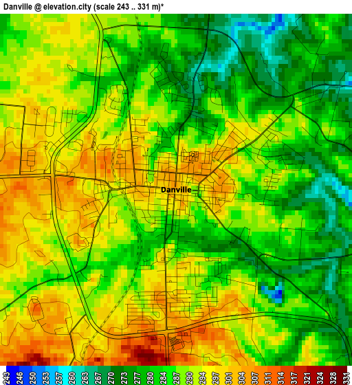
Below is the Elevation map of Danville, which displays elevation range with different colors. Scale of the first map is from 243 to 331 m (797 to 1086 ft) with average elevation of 288.3 meters (=946 ft) [note 1]
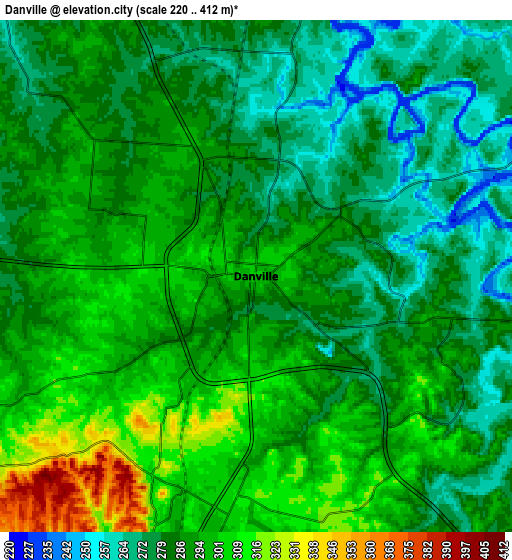
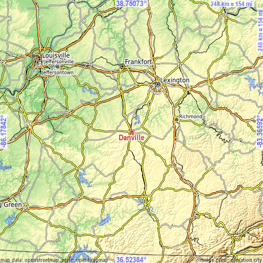
These maps also provides idea of topography and contour of this city, they are displayed at different zoom levels. More info about maps, scale and edge coordinates you can find below images.
| \ | Map #1 | Map #2 | Topo.Map |
| Scale [m] | 243..331 m | 220..412 m | × |
| Scale [ft] | 797..1086 ft | 722..1352 ft | × |
| Average | 288.3 m = 946 ft | 288.6 m = 947 ft | × |
| Width | 7.74 km = 4.8 mi | 15.48 km = 9.6 mi | 247.6 km = 153.9 mi |
| Height | 7.74 km = 4.8 mi | 15.48 km = 9.6 mi | 247.6 km = 153.9 mi |
| ↑Max Latitude | 37.680418° | 37.715189° | 38.75073° |
| Latitude at center | 37.64563° | 37.64563° | 37.64563° |
| ↓Min Latitude | 37.610826° | 37.576005° | 36.52384° |
| ← Min Longitude | -84.816115° | -84.860061° | -86.17842° |
| Longitude center | -84.77217° | -84.77217° | -84.77217° |
| →Max Longitude | -84.728225° | -84.684279° | -83.36592° |
Nearby cities:
Cities around Danville sort by population:
• Nicholasville elevation 291 m
31.5 km,  33°
33°
• Berea 314 m
42.8 km,  101°
101°
• Harrodsburg 260 m
14.4 km,  334°
334°
• Wilmore 274 m
25.9 km,  21°
21°
• Monticello 306 m
43.2 km, 26°
• Lancaster 316 m
17.3 km, 99°
• Stanford 289 m
16 km,  142°
142°
• Springfield 233 m
39.9 km,  276°
276°
• Jackson 262 m
21.8 km,  336°
336°
• Junction City 302 m
6.8 km,  196°
196°
• Liberty 248 m
39.3 km, 202°
• Brodhead 289 m
41.5 km,  130°
130°
Multilingual:
 En español:
Danville elevación 305 m.
 En France:
Danville élévation 305 m.
 Auf Deutsch:
Danville höhe über dem Meeresspiegel ist 305 m.

Sources and notes:
- [note 1] Map square and city borders are not equal. Map elevation data is calculated only from area inside that square.
- [src 1] Elevation data from geonames database provided with same terms of usage.
- [src 2] The elevation map of Danville is generated using elevation data from NASA's 3 arcsec (90m) resolution SRTM data.
- [src 3] Base (background) map © OpenStreetMap contributors tiles are generated by Geofabrik and OpenTopoMap.
Copyright & License:
This Danville Elevation Map is licensed under CC BY-SA. You may reuse any part from this page, if you give a proper credit by linking to this URL:
 More info on terms of use page.