Berea elevation
Berea (Kentucky, Madison County), United States elevation is 314 meters and Berea elevation in feet is 1030 ft above sea level [src 1]. Berea is a populated place (feature code) with elevation that is 35 meters (115 ft) bigger than average city elevation in United States.
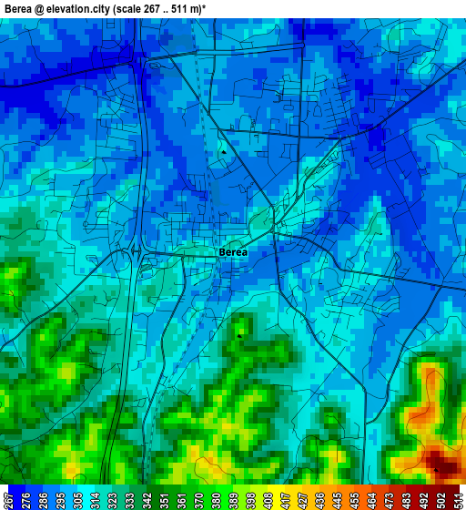
Below is the Elevation map of Berea, which displays elevation range with different colors. Scale of the first map is from 267 to 511 m (876 to 1677 ft) with average elevation of 314.5 meters (=1032 ft) [note 1]
These maps also provides idea of topography and contour of this city, they are displayed at different zoom levels. More info about maps, scale and edge coordinates you can find below images.
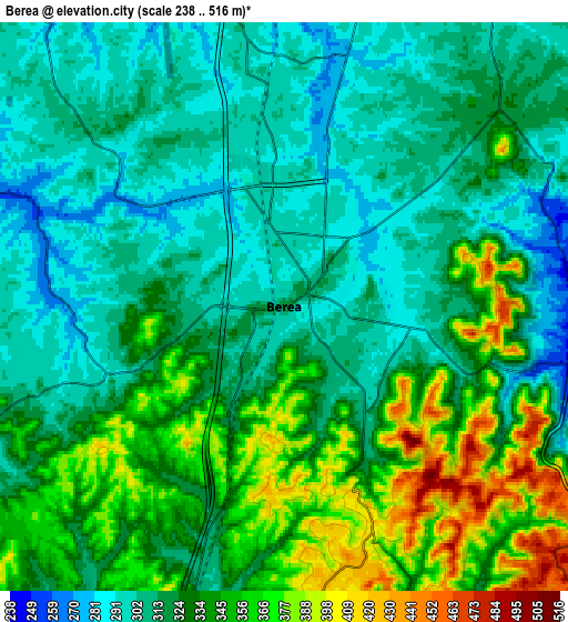
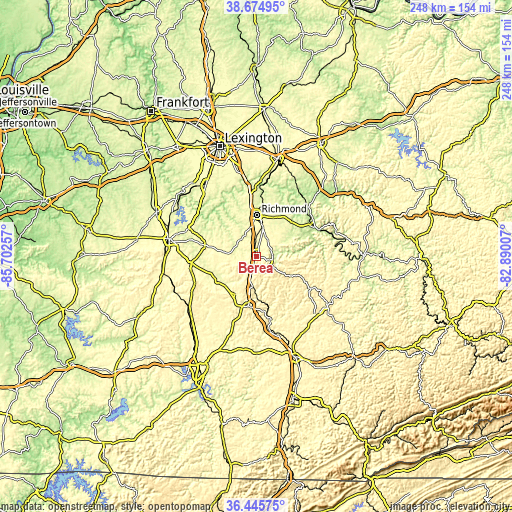
| \ | Map #1 | Map #2 | Topo.Map |
| Scale [m] | 267..511 m | 238..516 m | × |
| Scale [ft] | 876..1677 ft | 781..1693 ft | × |
| Average | 314.5 m = 1032 ft | 326.1 m = 1070 ft | × |
| Width | 7.75 km = 4.8 mi | 15.49 km = 9.6 mi | 247.9 km = 154 mi |
| Height | 7.75 km = 4.8 mi | 15.49 km = 9.6 mi | 247.9 km = 154 mi |
| ↑Max Latitude | 37.603514° | 37.638322° | 38.67495° |
| Latitude at center | 37.56869° | 37.56869° | 37.56869° |
| ↓Min Latitude | 37.53385° | 37.498993° | 36.44575° |
| ← Min Longitude | -84.340265° | -84.384211° | -85.70257° |
| Longitude center | -84.29632° | -84.29632° | -84.29632° |
| →Max Longitude | -84.252375° | -84.208429° | -82.89007° |
Nearby cities:
Cities around Berea sort by population:
• Richmond elevation 293 m
19.9 km,  0°
0°
• Nicholasville 291 m
42.4 km,  324°
324°
• Danville 305 m
42.8 km,  281°
281°
• Wilmore 274 m
45.8 km, 315°
• Lancaster 316 m
25.5 km, 282°
• Stanford 289 m
32.5 km,  262°
262°
• Mount Vernon 368 m
24.3 km,  189°
189°
• Irvine 208 m
32 km,  62°
62°
• Junction City 302 m
43.9 km,  272°
272°
• Brodhead 289 m
21 km,  209°
209°
• Annville 339 m
40 km,  133°
133°
• McKee 315 m
30.5 km,  120°
120°
Multilingual:
 En español:
Berea elevación 314 m.
 En France:
Berea élévation 314 m.


Sources and notes:
- [note 1] Map square and city borders are not equal. Map elevation data is calculated only from area inside that square.
- [src 1] Elevation data from geonames database provided with same terms of usage.
- [src 2] The elevation map of Berea is generated using elevation data from NASA's 3 arcsec (90m) resolution SRTM data.
- [src 3] Base (background) map © OpenStreetMap contributors tiles are generated by Geofabrik and OpenTopoMap.
Copyright & License:
This Berea Elevation Map is licensed under CC BY-SA. You may reuse any part from this page, if you give a proper credit by linking to this URL:
 More info on terms of use page.