Parsons elevation
Parsons (Kansas, Labette County), United States elevation is 281 meters and Parsons elevation in feet is 922 ft above sea level [src 1]. Parsons is a populated place (feature code) with elevation that is 2 meters (7 ft) bigger than average city elevation in United States.
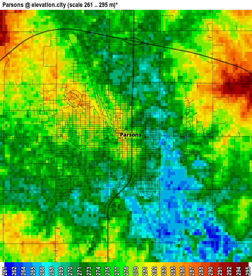
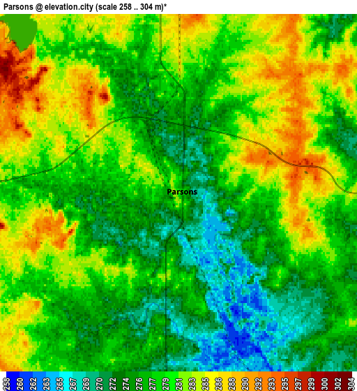
Below is the Elevation map of Parsons, which displays elevation range with different colors. Scale of the first map is from 261 to 295 m (856 to 968 ft) with average elevation of 275.5 meters (=904 ft) [note 1]
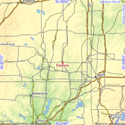
These maps also provides idea of topography and contour of this city, they are displayed at different zoom levels. More info about maps, scale and edge coordinates you can find below images.
| \ | Map #1 | Map #2 | Topo.Map |
| Scale [m] | 261..295 m | 258..304 m | × |
| Scale [ft] | 856..968 ft | 846..997 ft | × |
| Average | 275.5 m = 904 ft | 278.6 m = 914 ft | × |
| Width | 7.77 km = 4.8 mi | 15.54 km = 9.7 mi | 248.6 km = 154.5 mi |
| Height | 7.77 km = 4.8 mi | 15.54 km = 9.7 mi | 248.6 km = 154.5 mi |
| ↑Max Latitude | 37.37527° | 37.410185° | 38.45002° |
| Latitude at center | 37.34034° | 37.34034° | 37.34034° |
| ↓Min Latitude | 37.305393° | 37.27043° | 36.21401° |
| ← Min Longitude | -95.305025° | -95.348971° | -96.66733° |
| Longitude center | -95.26108° | -95.26108° | -95.26108° |
| →Max Longitude | -95.217135° | -95.173189° | -93.85483° |
Nearby cities:
Cities around Parsons sort by population:
• Pittsburg elevation 288 m
49.8 km,  80°
80°
• Coffeyville 227 m
46.1 km,  223°
223°
• Chanute 297 m
41.5 km,  335°
335°
• Independence 247 m
41.6 km,  251°
251°
• Columbus 279 m
41.5 km,  117°
117°
• Girard 303 m
41.9 km,  63°
63°
• Neodesha 251 m
38 km,  283°
283°
• Cherryvale 258 m
26.9 km, 253°
• Oswego 282 m
23.4 km,  145°
145°
• Erie 277 m
25.4 km,  3°
3°
• Chetopa 254 m
36.9 km,  155°
155°
• Altamont 279 m
17 km,  190°
190°
Multilingual:
 En español:
Parsons elevación 281 m.
 En France:
Parsons élévation 281 m.


Sources and notes:
- [note 1] Map square and city borders are not equal. Map elevation data is calculated only from area inside that square.
- [src 1] Elevation data from geonames database provided with same terms of usage.
- [src 2] The elevation map of Parsons is generated using elevation data from NASA's 3 arcsec (90m) resolution SRTM data.
- [src 3] Base (background) map © OpenStreetMap contributors tiles are generated by Geofabrik and OpenTopoMap.
Copyright & License:
This Parsons Elevation Map is licensed under CC BY-SA. You may reuse any part from this page, if you give a proper credit by linking to this URL:
 More info on terms of use page.