Shoals elevation
Shoals (Indiana, Martin County), United States elevation is 155 meters and Shoals elevation in feet is 509 ft above sea level [src 1]. Shoals is a seat of a second-order administrative division (feature code) with elevation that is 124 meters (407 ft) smaller than average city elevation in United States.
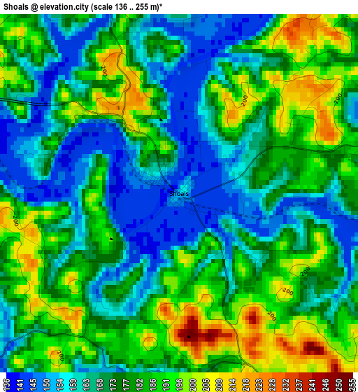
Below is the Elevation map of Shoals, which displays elevation range with different colors. Scale of the first map is from 136 to 255 m (446 to 837 ft) with average elevation of 175.8 meters (=577 ft) [note 1]
These maps also provides idea of topography and contour of this city, they are displayed at different zoom levels. More info about maps, scale and edge coordinates you can find below images.
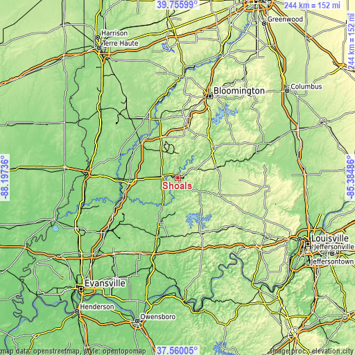
| \ | Map #1 | Topo.Map |
| Scale [m] | 136..255 m | × |
| Scale [ft] | 446..837 ft | × |
| Average | 175.8 m = 577 ft | × |
| Width | 7.63 km = 4.7 mi | 244.2 km = 151.7 mi |
| Height | 7.63 km = 4.7 mi | 244.2 km = 151.7 mi |
| ↑Max Latitude | 38.700744° | 39.75599° |
| Latitude at center | 38.66644° | 38.66644° |
| ↓Min Latitude | 38.632119° | 37.56005° |
| ← Min Longitude | -86.835055° | -88.19736° |
| Longitude center | -86.79111° | -86.79111° |
| →Max Longitude | -86.747165° | -85.38486° |
Nearby cities:
Cities around Shoals sort by population:
• Jasper elevation 146 m
32.9 km,  201°
201°
• Bedford 211 m
34.1 km,  50°
50°
• Washington 156 m
33.1 km,  268°
268°
• Huntingburg 150 m
43.3 km, 199°
• Mitchell 209 m
28.5 km,  75°
75°
• Paoli 192 m
30.6 km,  113°
113°
• Loogootee 165 m
10.7 km,  276°
276°
• Bloomfield 184 m
42 km,  342°
342°
• Orleans 193 m
29.5 km,  91°
91°
• French Lick 154 m
19.8 km,  131°
131°
• Odon 165 m
26.2 km,  318°
318°
• Oolitic 173 m
34.8 km,  41°
41°
Multilingual:
 En español:
Shoals elevación 155 m.
 En France:
Shoals élévation 155 m.


Sources and notes:
- [note 1] Map square and city borders are not equal. Map elevation data is calculated only from area inside that square.
- [src 1] Elevation data from geonames database provided with same terms of usage.
- [src 2] The elevation map of Shoals is generated using elevation data from NASA's 3 arcsec (90m) resolution SRTM data.
- [src 3] Base (background) map © OpenStreetMap contributors tiles are generated by Geofabrik and OpenTopoMap.
Copyright & License:
This Shoals Elevation Map is licensed under CC BY-SA. You may reuse any part from this page, if you give a proper credit by linking to this URL:
 More info on terms of use page.