Farmersburg elevation
Farmersburg (Indiana, Sullivan County), United States elevation is 171 meters and Farmersburg elevation in feet is 561 ft above sea level [src 1]. Farmersburg is a populated place (feature code) with elevation that is 108 meters (354 ft) smaller than average city elevation in United States.
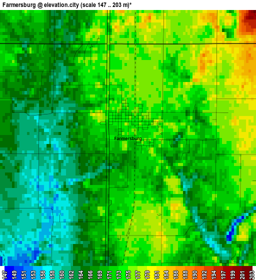
Below is the Elevation map of Farmersburg, which displays elevation range with different colors. Scale of the first map is from 147 to 203 m (482 to 666 ft) with average elevation of 170 meters (=558 ft) [note 1]
These maps also provides idea of topography and contour of this city, they are displayed at different zoom levels. More info about maps, scale and edge coordinates you can find below images.
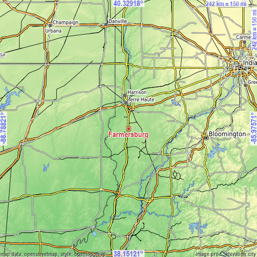
| \ | Map #1 | Topo.Map |
| Scale [m] | 147..203 m | × |
| Scale [ft] | 482..666 ft | × |
| Average | 170 m = 558 ft | × |
| Width | 7.57 km = 4.7 mi | 242.2 km = 150.5 mi |
| Height | 7.57 km = 4.7 mi | 242.2 km = 150.5 mi |
| ↑Max Latitude | 39.282673° | 40.32918° |
| Latitude at center | 39.24865° | 39.24865° |
| ↓Min Latitude | 39.21461° | 38.15121° |
| ← Min Longitude | -87.425905° | -88.78821° |
| Longitude center | -87.38196° | -87.38196° |
| →Max Longitude | -87.338015° | -85.97571° |
Nearby cities:
Cities around Farmersburg sort by population:
• Terre Haute elevation 152 m
24.4 km,  353°
353°
• Linton 165 m
30.2 km,  141°
141°
• North Terre Haute 151 m
31.1 km,  3°
3°
• Sullivan 163 m
17.2 km,  186°
186°
• Marshall 193 m
31.2 km,  300°
300°
• Middlebury 204 m
22.7 km,  85°
85°
• West Terre Haute 143 m
24.8 km, 346°
• Jasonville 192 m
18.4 km,  121°
121°
• Worthington 156 m
37.3 km,  111°
111°
• Palestine 141 m
33.7 km,  216°
216°
• Shelburn 164 m
7.9 km, 187°
• Seelyville 180 m
28.8 km,  20°
20°
Multilingual:
 En español:
Farmersburg elevación 171 m.
 En France:
Farmersburg élévation 171 m.
 Auf Deutsch:
Farmersburg höhe über dem Meeresspiegel ist 171 m.

Sources and notes:
- [note 1] Map square and city borders are not equal. Map elevation data is calculated only from area inside that square.
- [src 1] Elevation data from geonames database provided with same terms of usage.
- [src 2] The elevation map of Farmersburg is generated using elevation data from NASA's 3 arcsec (90m) resolution SRTM data.
- [src 3] Base (background) map © OpenStreetMap contributors tiles are generated by Geofabrik and OpenTopoMap.
Copyright & License:
This Farmersburg Elevation Map is licensed under CC BY-SA. You may reuse any part from this page, if you give a proper credit by linking to this URL:
 More info on terms of use page.