English elevation
English (Indiana, Crawford County), United States elevation is 154 meters and English elevation in feet is 505 ft above sea level [src 1]. English is a seat of a second-order administrative division (feature code) with elevation that is 125 meters (410 ft) smaller than average city elevation in United States.
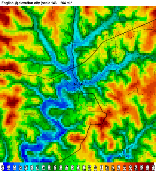
Below is the Elevation map of English, which displays elevation range with different colors. Scale of the first map is from 143 to 264 m (469 to 866 ft) with average elevation of 201.4 meters (=661 ft) [note 1]
These maps also provides idea of topography and contour of this city, they are displayed at different zoom levels. More info about maps, scale and edge coordinates you can find below images.
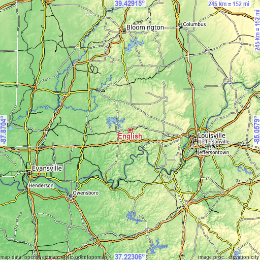
| \ | Map #1 | Topo.Map |
| Scale [m] | 143..264 m | × |
| Scale [ft] | 469..866 ft | × |
| Average | 201.4 m = 661 ft | × |
| Width | 7.67 km = 4.8 mi | 245.3 km = 152.4 mi |
| Height | 7.67 km = 4.8 mi | 245.3 km = 152.4 mi |
| ↑Max Latitude | 38.368963° | 39.42915° |
| Latitude at center | 38.3345° | 38.3345° |
| ↓Min Latitude | 38.300021° | 37.22306° |
| ← Min Longitude | -86.508095° | -87.8704° |
| Longitude center | -86.46415° | -86.46415° |
| →Max Longitude | -86.420205° | -85.0579° |
Nearby cities:
Cities around English sort by population:
• Jasper elevation 146 m
41.2 km,  278°
278°
• Salem 231 m
43.7 km,  46°
46°
• Huntingburg 150 m
43 km,  264°
264°
• Mitchell 209 m
44.3 km,  358°
358°
• Paoli 192 m
24.7 km, 359°
• Georgetown 219 m
42.9 km,  95°
95°
• Corydon 178 m
32.8 km,  114°
114°
• Brandenburg 171 m
45.3 km,  145°
145°
• Ferdinand 162 m
36.9 km,  250°
250°
• Orleans 193 m
36.4 km,  1°
1°
• French Lick 154 m
27.4 km,  330°
330°
• New Pekin 219 m
43.3 km,  64°
64°
Multilingual:
 En español:
English elevación 154 m.
 En France:
English élévation 154 m.


Sources and notes:
- [note 1] Map square and city borders are not equal. Map elevation data is calculated only from area inside that square.
- [src 1] Elevation data from geonames database provided with same terms of usage.
- [src 2] The elevation map of English is generated using elevation data from NASA's 3 arcsec (90m) resolution SRTM data.
- [src 3] Base (background) map © OpenStreetMap contributors tiles are generated by Geofabrik and OpenTopoMap.
Copyright & License:
This English Elevation Map is licensed under CC BY-SA. You may reuse any part from this page, if you give a proper credit by linking to this URL:
 More info on terms of use page.