Taylorville elevation
Taylorville (Illinois, Christian County), United States elevation is 191 meters and Taylorville elevation in feet is 627 ft above sea level [src 1]. Taylorville is a seat of a second-order administrative division (feature code) with elevation that is 88 meters (289 ft) smaller than average city elevation in United States.
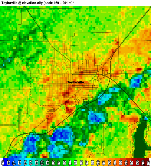
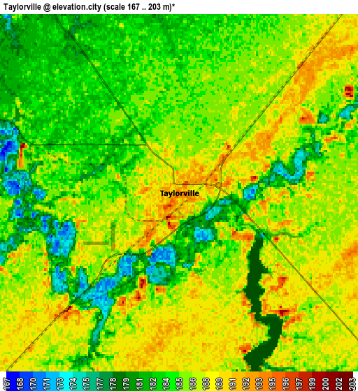
Below is the Elevation map of Taylorville, which displays elevation range with different colors. Scale of the first map is from 169 to 201 m (554 to 659 ft) with average elevation of 185.5 meters (=609 ft) [note 1]
These maps also provides idea of topography and contour of this city, they are displayed at different zoom levels. More info about maps, scale and edge coordinates you can find below images.
| \ | Map #1 | Map #2 | Topo.Map |
| Scale [m] | 169..201 m | 167..203 m | × |
| Scale [ft] | 554..659 ft | 548..666 ft | × |
| Average | 185.5 m = 609 ft | 185.4 m = 608 ft | × |
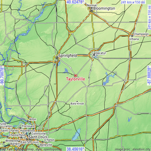
| Width | 7.54 km = 4.7 mi | 15.07 km = 9.4 mi | 241.1 km = 149.8 mi |
| Height | 7.54 km = 4.7 mi | 15.07 km = 9.4 mi | 241.1 km = 149.8 mi |
| ↑Max Latitude | 39.582817° | 39.616678° | 40.62478° |
| Latitude at center | 39.54894° | 39.54894° | 39.54894° |
| ↓Min Latitude | 39.515046° | 39.481136° | 38.45616° |
| ← Min Longitude | -89.338475° | -89.382421° | -90.70078° |
| Longitude center | -89.29453° | -89.29453° | -89.29453° |
| →Max Longitude | -89.250585° | -89.206639° | -87.88828° |
Nearby cities:
Cities around Taylorville sort by population:
• Pana elevation 212 m
25.6 km,  134°
134°
• Rochester 172 m
30.2 km,  317°
317°
• Pawnee 186 m
25 km,  280°
280°
• Nokomis 206 m
27.6 km,  178°
178°
• Moweaqua 195 m
25.1 km,  70°
70°
• Kincaid 185 m
11.2 km,  293°
293°
• Divernon 187 m
31.2 km,  273°
273°
• Macon 215 m
31.3 km,  54°
54°
• Assumption 196 m
21.3 km,  98°
98°
• Blue Mound 193 m
22.4 km,  40°
40°
• Edinburg 180 m
14.5 km,  325°
325°
• Morrisonville 193 m
19.9 km,  223°
223°
Multilingual:
 En español:
Taylorville elevación 191 m.
 En France:
Taylorville élévation 191 m.
 Auf Deutsch:
Taylorville höhe über dem Meeresspiegel ist 191 m.

Sources and notes:
- [note 1] Map square and city borders are not equal. Map elevation data is calculated only from area inside that square.
- [src 1] Elevation data from geonames database provided with same terms of usage.
- [src 2] The elevation map of Taylorville is generated using elevation data from NASA's 3 arcsec (90m) resolution SRTM data.
- [src 3] Base (background) map © OpenStreetMap contributors tiles are generated by Geofabrik and OpenTopoMap.
Copyright & License:
This Taylorville Elevation Map is licensed under CC BY-SA. You may reuse any part from this page, if you give a proper credit by linking to this URL:
 More info on terms of use page.