Jacksonville elevation
Jacksonville (Illinois, Morgan County), United States elevation is 190 meters and Jacksonville elevation in feet is 623 ft above sea level [src 1]. Jacksonville is a seat of a second-order administrative division (feature code) with elevation that is 89 meters (292 ft) smaller than average city elevation in United States.
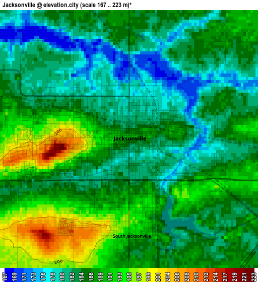
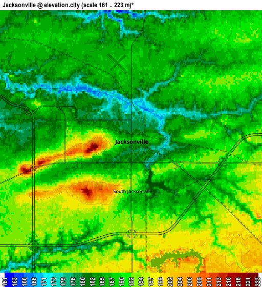
Below is the Elevation map of Jacksonville, which displays elevation range with different colors. Scale of the first map is from 167 to 223 m (548 to 732 ft) with average elevation of 185.9 meters (=610 ft) [note 1]
These maps also provides idea of topography and contour of this city, they are displayed at different zoom levels. More info about maps, scale and edge coordinates you can find below images.
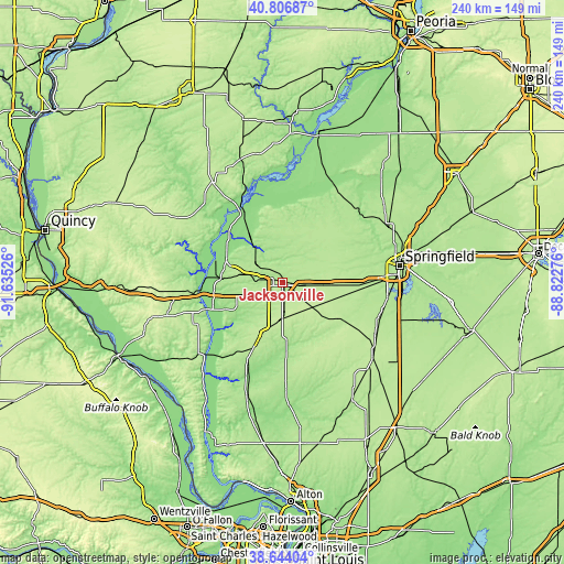
| \ | Map #1 | Map #2 | Topo.Map |
| Scale [m] | 167..223 m | 161..223 m | × |
| Scale [ft] | 548..732 ft | 528..732 ft | × |
| Average | 185.9 m = 610 ft | 188.3 m = 618 ft | × |
| Width | 7.52 km = 4.7 mi | 15.03 km = 9.3 mi | 240.5 km = 149.4 mi |
| Height | 7.52 km = 4.7 mi | 15.03 km = 9.3 mi | 240.5 km = 149.4 mi |
| ↑Max Latitude | 39.767727° | 39.801497° | 40.80687° |
| Latitude at center | 39.73394° | 39.73394° | 39.73394° |
| ↓Min Latitude | 39.700137° | 39.666317° | 38.64404° |
| ← Min Longitude | -90.272955° | -90.316901° | -91.63526° |
| Longitude center | -90.22901° | -90.22901° | -90.22901° |
| →Max Longitude | -90.185065° | -90.141119° | -88.82276° |
Nearby cities:
Cities around Jacksonville sort by population:
• Beardstown elevation 140 m
35.7 km,  332°
332°
• South Jacksonville 191 m
2.8 km,  178°
178°
• White Hall 176 m
36.2 km,  204°
204°
• Roodhouse 202 m
30.4 km, 203°
• Virginia 189 m
24.2 km,  3°
3°
• Winchester 168 m
22.6 km,  239°
239°
• New Berlin 199 m
27.2 km,  92°
92°
• Waverly 210 m
28.4 km,  123°
123°
• Ashland 194 m
25.5 km,  47°
47°
• Griggsville 215 m
42.5 km,  266°
266°
• Greenfield 179 m
43.4 km, 178°
• Meredosia 136 m
30.2 km,  290°
290°
Multilingual:
 En español:
Jacksonville elevación 190 m.
 En France:
Jacksonville élévation 190 m.
 Auf Deutsch:
Jacksonville höhe über dem Meeresspiegel ist 190 m.

Sources and notes:
- [note 1] Map square and city borders are not equal. Map elevation data is calculated only from area inside that square.
- [src 1] Elevation data from geonames database provided with same terms of usage.
- [src 2] The elevation map of Jacksonville is generated using elevation data from NASA's 3 arcsec (90m) resolution SRTM data.
- [src 3] Base (background) map © OpenStreetMap contributors tiles are generated by Geofabrik and OpenTopoMap.
Copyright & License:
This Jacksonville Elevation Map is licensed under CC BY-SA. You may reuse any part from this page, if you give a proper credit by linking to this URL:
 More info on terms of use page.